

Could We See More Beneficial Rain Over The Weekend From A Tropical System?
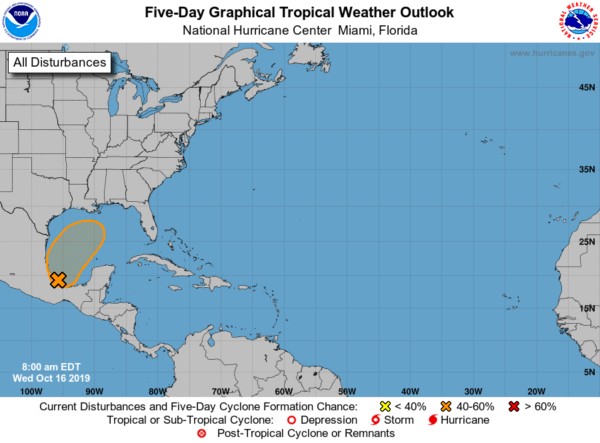
A broad area of low pressure located in the Bay of Campeche has a medium chance of becoming a tropical or subtropical cyclone over the western or central Gulf of Mexico later this week. Models still continue to show the potential for a tropical system moving up over the Gulf of Mexico from the Bay of Campeche and making landfall over the southeastern states, including Alabama.
Impacts and Safety Issues Long The Gulf Coast:
Heavy rain will be the primary threat, but higher tides and gusty winds will also be possible depending on the eventual track of this system.
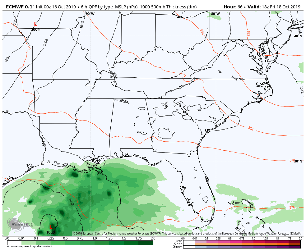
The latest run of the European model shows the tropical low centered over the northwestern Gulf of Mexico nearly due south of Lake Charles, Louisiana at 1:00 pm on Friday afternoon. As you continue in the animation, the low moves northeast and looks to make landfall just a little over 24 hours later on the Mississippi Gulf Coast. As you will notice, tropical moisture has already moved into a good bit of Central Alabama, and that will only increase as the low continues moving northeast. By 1:00 am Sunday, the low will be centered around Andalusia in South Alabama, but tropical moisture nearly covers the entire state. By 7:00 am on Sunday, the low will be crossing the Alabama/Georgia state line very close to Phenix City and Columbus.
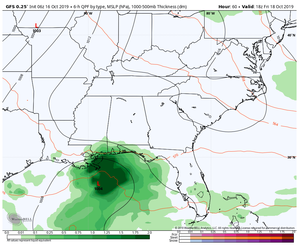
The GFS is a little further south and a little quicker with its solution on the tropical system, having the low centered over the northern Gulf of Mexico at 1:00 pm Friday due south of Gulfport, Mississippi. Its track is more on an east-northeast direction and shows a possible landfall just 24 hours later near Port St. Joe, Florida. This run keeps the tropical moisture over the southern parts of the state until after midnight on Friday night and that is when it starts working up into Central Alabama. Any rainfall with this solution won’t last long as the moisture quickly moves off to the east, leaving us dry as early as midnight Saturday night. By the end of the animation (Sunday 7:00 pm), the low will be off the Atlantic coast of the Carolinas and headed out to sea.
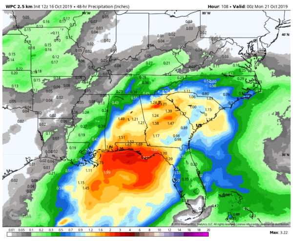
The latest QPF chart from the WPC shows rainfall potentials of 0.50 inches to 1.50 inches over much of Central Alabama, with amounts along the coast nearing or topping 2.00 inches. So as you can see, if this pans out over the weekend, this will help bring the drought severity down a little.
Category: Alabama's Weather, ALL POSTS, Tropical
About the Author (Author Profile)
Scott Martin is an operational meteorologist, professional graphic artist, musician, husband, and father. Not only is Scott a member of the National Weather Association, but he is also the Central Alabama Chapter of the NWA president. Scott is also the co-founder of Racecast Weather, which provides forecasts for many racing series across the USA. He also supplies forecasts for the BassMaster Elite Series events including the BassMaster Classic.Subscribe
If you enjoyed this article, subscribe to receive more just like it.


