

Tropical Storm Warnings Issued for Portions of the Northern Gulf Coast in Advance of Newly Designated Potential Tropical Cyclone Sixteen
The area of low pressure over the southwestern Gulf of Mexico that had been designated Invest 96-L by the National Hurricane Center is now known at Potential Tropical Cyclone Number 16.
A Tropical Storm Warning is in effect for…
* Mississippi/Alabama border to the Ochlockonee River, Florida
* Grand Isle, Louisiana to the Mouth of the Pearl River
A Tropical Storm Watch is in effect for…
* East of the Ochlockonee River to Yankeetown, Florida
A Storm Surge Watch is in effect for…
* Indian Pass to Clearwater, Florida
The shower and thunderstorm activity associated with Invest 96-L is steadily becoming better organized and it is likely that it will become a tropical storm as soon as this afternoon. It will be named Nestor when it does.
The system is expected to become better organized and strengthen as it moves across the Gulf. It will make landfall on Saturday between the Florida Panhandle and the Big Bend area of northwest Florida.
There is a chance that the system could take more east northeasterly course toward Tampa and Cedar Key.
Most of the track model guidance shows a path that takes the system to the Florida Panhandle between Fort Walton Beach and Panama City late Friday night or Saturday morning. Most of the track guidance forecasts that PTC #16 will be about a 50-60 mph tropical storm when it comes onshore.
The GFS model forecasts a mid-range tropical storm to come ashore somewhere between Apalachicola and Cedar Key on Saturday morning.
The European model forecasts an upper-end tropical storm to come ashore between Pensacola and Panama City on Saturday morning.
Some of the hurricane models are suggesting that the system could be near hurricane strength at landfall. That is possible if wind shear lessens a bit. I think that the system will peak at between 55 and 70 mph on Saturday morning as it’s making landfall.
COASTAL IMPACTS
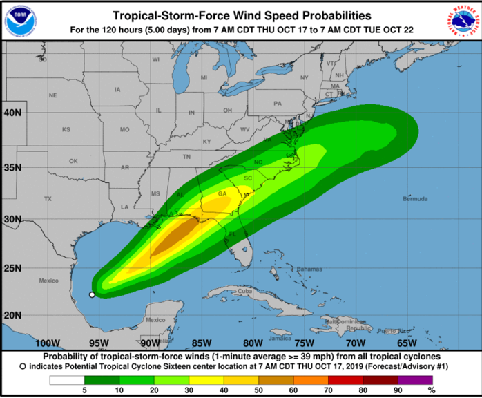
Because of the expected rapid forward speed, excessive rainfall should not be a big problem. Rainfall amounts of 2-4 inches are expected along the northern Gulf Coast including the Mississippi coast, coastal Alabama, and the Panhandle from Pensacola to Cedar Key in the Big Bend.
Most of the heavy rain and strong winds will occur on the eastern side of the storm and little or no weather will occur on the western side. Because of this, tropical-storm-force winds with wind gusts of up to 50 to 70 mph are expected on Friday night and Saturday across the eastern Florida Panhandle including Panama City, Mexico Beach, and Appalachicola, and the Big Bend area of northwest Florida. Areas from Destin to Panama City could see tropical storm force as well. In addition, tropical-storm-force winds are also expected on Friday night and Saturday across parts of the west coast of Florida, especially from Tampa to the north.
We will be able to be more specific with wind forecasts for the Florida Panhandle as the system evolves.
Storm surge will be 2-5 feet east of Indian Pass, Florida, which will include coastal areas from near Appalachicola around to Clearwater Beach, Florida. Along the Alabama and Northwest Florida Coast from Dauphin Island to Destin, surge should be 1 foot or less. East of Destin to Indian Pass, it will be 1-2 feet.
IMPACTS FOR US IN CENTRAL ALABAMA
Once the storm forms, we will have a better idea of specific impacts, but for Alabama, you will notice slightly breezier than normal conditions Friday afternoon, fairly calm conditions until midnight Friday night, then breezy conditions during the pre-dawn hours and morning, with winds gusting to 20-25 mph at times. Those gusty winds will continue over East Alabama Saturday afternoon, lessening Saturday evening as the center lifts into southern Georgia.
There will be a few showers over Southeast Alabama, but our state will miss much of the rain, which will be on the wetter eastern side of the storm.
Category: Alabama's Weather, ALL POSTS, Tropical
About the Author (Author Profile)
Bill Murray is the President of The Weather Factory. He is the site's official weather historian and a weekend forecaster. He also anchors the site's severe weather coverage. Bill Murray is the proud holder of National Weather Association Digital Seal #0001 @wxhistorianSubscribe
If you enjoyed this article, subscribe to receive more just like it.


