

Brief Check On Our Weather Situation At 8:30 AM
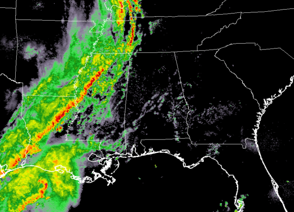
As of 8:30 this morning, the line of storms on our southeastern US map stretches from the western portions of Kentucky, down through western Tennessee and eastern Arkansas, and through northern and western Mississippi and into Louisiana, with it tailing off over the Texas Gulf Coast. Storms are already pretty active as there is a Tornado Warning in effect until 9:00 am for portions of Holmes, Leflore, and Humphreys counties in Mississippi, as a severe thunderstorm capable of producing a tornado was located near Belzoni and moving east at 40 MPH. Only a few spotty showers have creeped into the northwest corner of Alabama at this point.
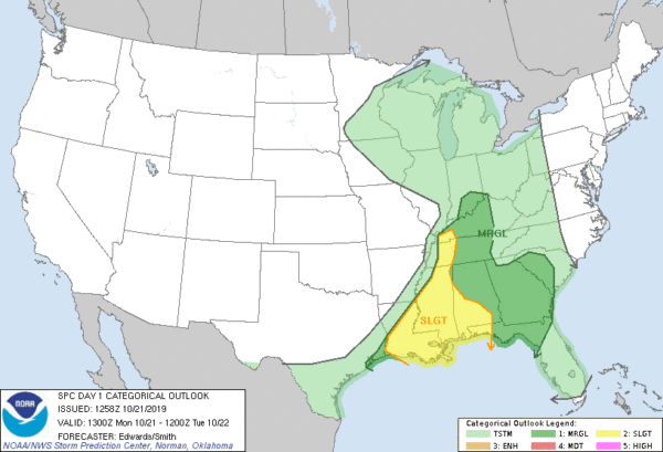
As you can see, the Storm Prediction Center has much of the southeastern United States in some sort of risk for severe storms throughout the day today through the pre-dawn hours on Tuesday morning. A Slight Risk is up for portions of west and south Alabama, the western parts of the Florida panhandle, nearly all of Mississippi, a small sliver of western Tennessee, much of Louisiana, and just the extreme southeastern corner of Arkansas. A Marginal Risk is up for the rest of Alabama, nearly all of Georgia, the rest of the Florida panhandle, western parts of South Carolina, Central Tennessee, and west and central parts of Kentucky.
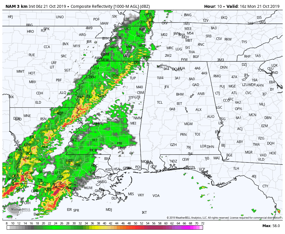
The main line of rain and thunderstorms will begin to move into the northwest corner of Alabama later this morning and slowly progress through the state until just after sunrise on Tuesday. The good news is that the line will be weakening as it moves through, so the higher potential for severe storms will be over the western and southern parts of the state.
The main window for strong to severe storms across Central Alabama will be from noon today through midnight tonight. We still see a threat of isolated damaging winds up to 60 MPH and the potential of a brief tornado or two. We’ll have some decent shear with decent instability, but those values will be higher over the west and southern parts in the Slight Risk area.
While this is not going to be a significant severe weather outbreak, we still do not need to take this system for granted. Go ahead and have your severe weather safety kits and your place of safety ready to go just in case your location goes under a warning. Have your batteries charged on your smart phone and fresh batteries in your flashlights and in your NOAA WeatherRadio. We’ll update throughout the day on the blog.
Category: Alabama's Weather, ALL POSTS, Severe Weather
About the Author (Author Profile)
Scott Martin is an operational meteorologist, professional graphic artist, musician, husband, and father. Not only is Scott a member of the National Weather Association, but he is also the Central Alabama Chapter of the NWA president. Scott is also the co-founder of Racecast Weather, which provides forecasts for many racing series across the USA. He also supplies forecasts for the BassMaster Elite Series events including the BassMaster Classic.Subscribe
If you enjoyed this article, subscribe to receive more just like it.


