

Strong Storm Affecting Parts Of Madison & Limestone Counties
SIGNIFICANT WEATHER ADVISORY FOR NORTHERN MADISON AND SOUTHEASTERN LIMESTONE COUNTIES UNTIL 230 PM CDT
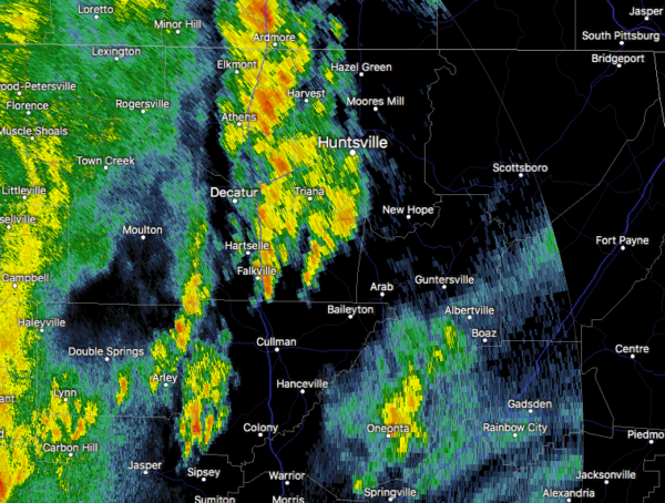
At 159 PM CDT, Doppler radar was tracking a strong thunderstorm near Huntsville International Airport, or near Madison, moving northeast at 50 mph. Winds in excess of 30 mph will be possible with this storm.
Locations impacted include…
Huntsville, Madison, Athens, Moores Mill, Redstone Arsenal, Meridianville, Hazel Green, Triana, Alabama A And M University and Marshall Space Flight Center.
Category: Alabama's Weather, ALL POSTS, Severe Weather
About the Author (Author Profile)
Scott Martin is an operational meteorologist, professional graphic artist, musician, husband, and father. Not only is Scott a member of the National Weather Association, but he is also the Central Alabama Chapter of the NWA president. Scott is also the co-founder of Racecast Weather, which provides forecasts for many racing series across the USA. He also supplies forecasts for the BassMaster Elite Series events including the BassMaster Classic.Subscribe
If you enjoyed this article, subscribe to receive more just like it.


