

Rain Tonight; Sunny Tomorrow
WET: A large mass of rain covers much of North/Central Alabama this afternoon. Not seeing any lightning over the northern half of the state; the best instability is over South Alabama, where SPC maintains a “slight risk” (level 2/5) of severe storms for tonight. The risk of severe thunderstorm activity for North Alabama is very low, although a “marginal risk” is still in play.
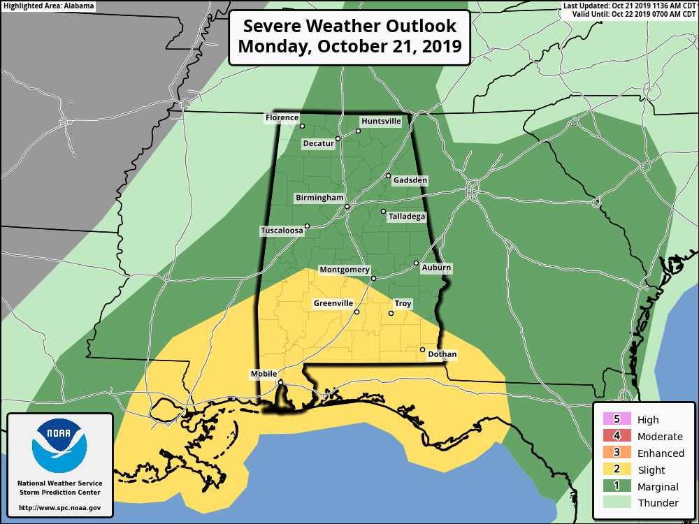
A few storms over South Alabama could produce a brief tornado along with gusty winds tonight. Rain totals will be around 1/2″ for most places, with isolated heavier amounts.
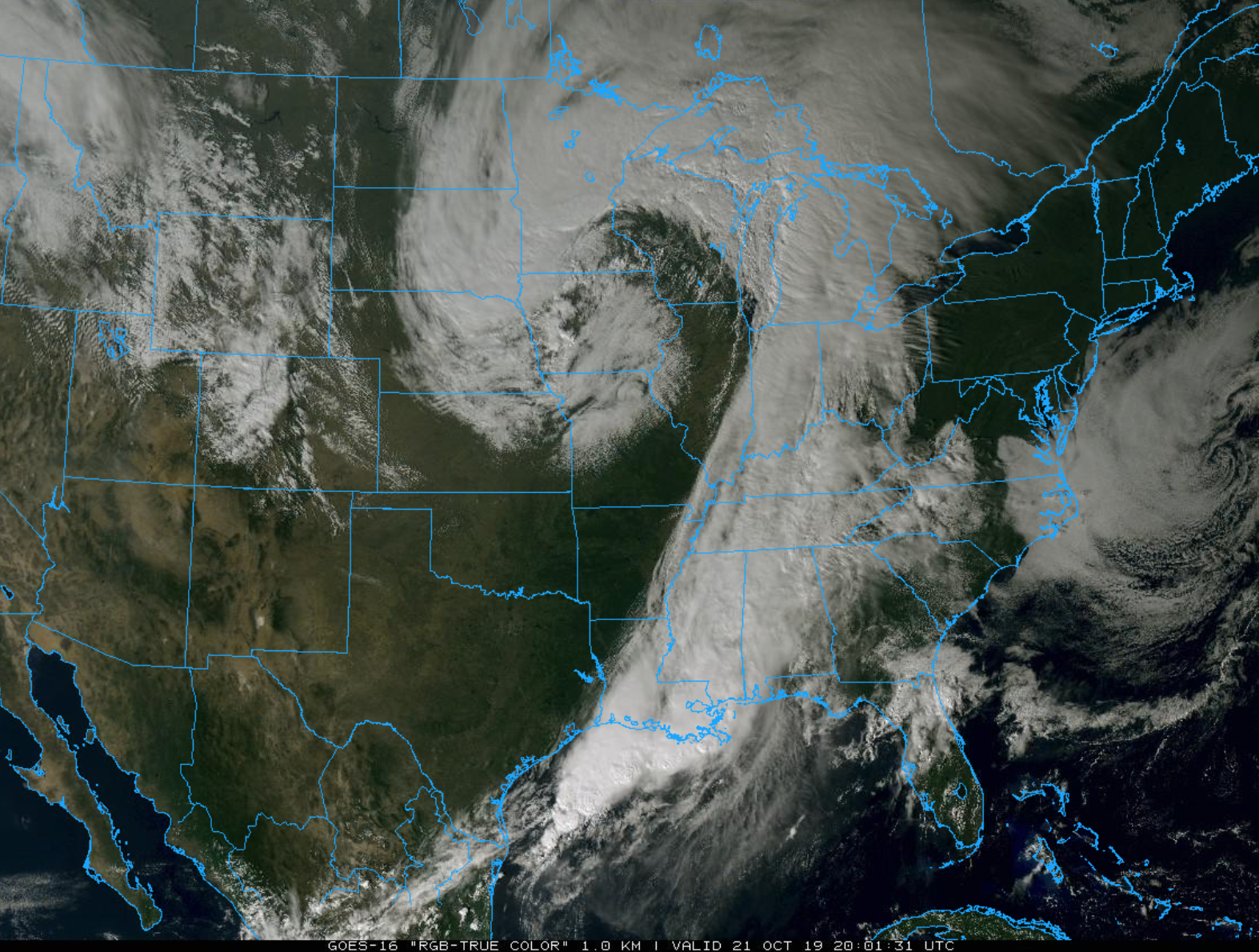
MID-WEEK: The sky will clear from west to east after midnight, and the weather will be dry and very pleasant tomorrow through Thursday. Sunny days, fair nights, highs in the low 70s, lows mostly in the low to mid 40s. Perfect autumn weather.
FRIDAY AND THE WEEKEND: The weather picture for Alabama remains about as clear as mud on these three days due to large model differences and inconsistencies. Models differ on how to handle an upper wave west of the state, but both do suggest periods of rain are likely Friday, possibly Friday night. Then, the divergence begins. The American global model (GFS) shows dry and pleasant weather Saturday and Sunday, while the European global model (ECMWF) suggests occasional rain and a few thunderstorms need to be in the forecast both days.
As we often point out here, the European model tends to perform better in the medium range (3-7 days out), and we will lean toward the wetter solution for now and maintain some risk of rain for Saturday and Sunday in our forecast package. But, I would not change plans or be too worried if you have something planned outdoors right now since this forecast can, and probably will change. Keep an eye on the blog as we get better clarity through the week.
NEXT WEEK: For now Monday and Tuesday look dry, but a cold front will bring some risk of showers Wednesday, followed by much cooler air. See the Weather Xtreme video for maps, graphics, and more details.
TROPICS: The Atlantic basin is very quiet, and tropical storm formation is not expected this week.
ON THIS DATE IN 1934: A severe windstorm lashed the northern Pacific coast. In Washington State, the storm claimed the lives of 22 persons, and caused 1.7 million dollars damage, mostly to timber. Winds, gusting to 87 mph at North Head, WA, produced waves twenty feet high on the Puget Sound.
BEACH FORECAST: Click here to see the AlabamaWx Beach Forecast Center page.
WEATHER BRAINS: Don’t forget you can listen to our weekly 90 minute show anytime on your favorite podcast app. This is the show all about weather featuring many familiar voices, including our meteorologists here at ABC 33/40.
CONNECT: You can find me on all of the major social networks…
Facebook
Twitter
Instagram
Pinterest
Snapchat: spannwx
I had a great time today visiting with the 6th graders at Opelika Middle School… be looking for them on the Pepsi KIDCAM today at 5:00 on ABC 33/40 News! The next Weather Xtreme video will be posted here by 7:00 a.m. tomorrow…
Category: Alabama's Weather, ALL POSTS, Weather Xtreme Videos
About the Author (Author Profile)
James Spann is one of the most recognized and trusted television meteorologists in the industry. He holds the AMS CCM designation and television seals from the AMS and NWA. He is a past winner of the Broadcast Meteorologist of the Year from both professional organizations.Subscribe
If you enjoyed this article, subscribe to receive more just like it.


