

CANCELED: Tornado Warning Issued For Parts Of Hale & Marengo Counties Until 8:00 PM
THE STORM WHICH PROMPTED THE TORNADO WARNING HAS WEAKENED BELOW SEVERE LIMITS, AND NO LONGER APPEARS CAPABLE OF PRODUCING A TORNADO.
The National Weather Service in Birmingham has issued a
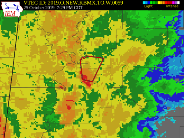
* Tornado Warning for…
North central Marengo County in southwestern Alabama…
Southwestern Hale County in west central Alabama…
* Until 800 PM CDT.
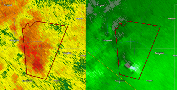
* At 727 PM CDT, a severe thunderstorm capable of producing a tornado
was located near Chickasaw State Park, or 7 miles northeast of
Linden, moving north at 35 mph.
HAZARD…Tornado.
SOURCE…Radar indicated rotation.
IMPACT…Flying debris will be dangerous to those caught without
shelter. Mobile homes will be damaged or destroyed.
Damage to roofs, windows, and vehicles will occur. Tree
damage is likely.
* Locations impacted include…
Demopolis, Arcola, Gallion and Old Spring Hill.
PRECAUTIONARY/PREPAREDNESS ACTIONS…
TAKE COVER NOW! Move to a basement or an interior room on the lowest
floor of a sturdy building. Avoid windows. If you are outdoors, in a
mobile home, or in a vehicle, move to the closest substantial shelter
and protect yourself from flying debris.
Tornadoes are extremely difficult to see and confirm at night. Do not
wait to see or hear the tornado. TAKE COVER NOW!
Category: Alabama's Weather, ALL POSTS, Severe Weather
About the Author (Author Profile)
Scott Martin is an operational meteorologist, professional graphic artist, musician, husband, and father. Not only is Scott a member of the National Weather Association, but he is also the Central Alabama Chapter of the NWA president. Scott is also the co-founder of Racecast Weather, which provides forecasts for many racing series across the USA. He also supplies forecasts for the BassMaster Elite Series events including the BassMaster Classic.Subscribe
If you enjoyed this article, subscribe to receive more just like it.


