

Midday Weather Discussion Video: Clouds Slowly Moving Out Of The Area
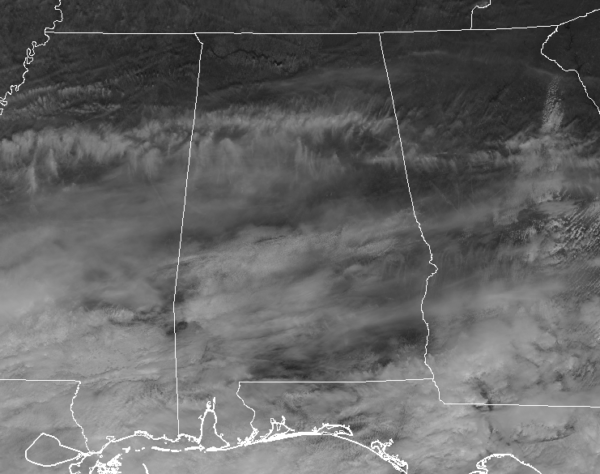
As we take a look at the latest visible satellite image as of 10:50 am, we can see a good bit of clouds continuing to stream across Central Alabama. All of these are moving mainly eastward with a little southward component thrown in. It will take a while for these clouds to clear out from northwest to southeast, but it will happen by midnight tonight.
Temperatures were in the lower 40s to the mid-50s across Central Alabama. The cool spot was Haleyville at 43 degrees. Birmingham was at 45 degrees. Tuscaloosa was at 48 degrees. Montgomery was at 54 degrees. And the warm spot was Troy at 55 degrees.
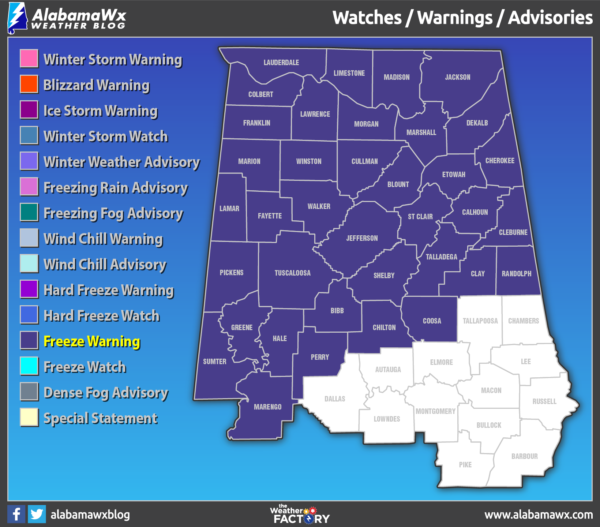
As we look at the hazards map, we have Freeze Warnings in effect for all counties in North Alabama and most of the counties in Central Alabama with the exception of the southern and southeastern counties. Warnings will go into effect tonight at 10:00 pm and should go through 8:00 am Saturday morning. Counties in the warnings could see temperatures as low as 25 degrees which could kill crops and other sensitive vegetation, and could damage unprotected pipes.
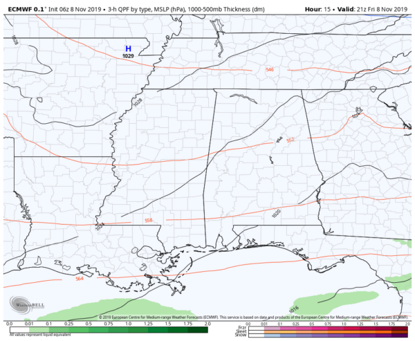
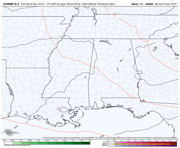
As we take a look at the 06z run of the European model valid today at 3:00 pm, we see that high pressure will be over the northeast corner of Arkansas and will be providing us with dry and very cool air from the north. Skies will continue to be on a slow clearing trend from northwest to southeast and afternoon highs will top out in the upper 40s to the upper 50s across the area.
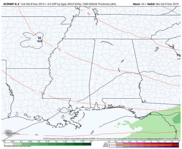
This image is valid at midnight tonight and it shows continued dry weather across the area. Skies will continue to clear out throughout the evening and should be clear as we reach midnight. We’ll continue to have colder and dry air move in from the north and overnight lows will be in the mid-20s to the upper 30s across the area from northwest to southeast.
We’ll have maximum sunshine across Central Alabama throughout the daylight hours on Saturday with moderating temperatures. While we start off very cold, we’ll warm nicely into the mid-50s to the lower 60s across the area from northwest to southeast. There will be very little wind so we should not have to worry about any wind chills across the area.
If you are heading to T-Town for the big football game at Bryant-Denny Stadium, it will be a nearly perfect day for football. Kickoff will be at 2:30 pm and temperatures will be in the upper 50s and will fall into the upper 40s by the end of the game. Skies will be clear and there will be hardly any wind at all.
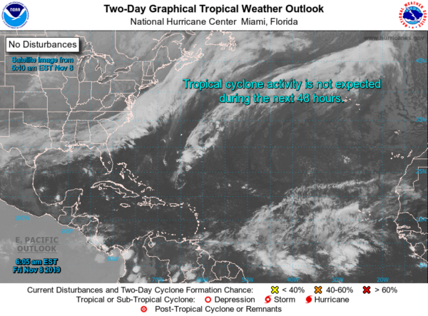
Taking a look at the tropics, we see no issues across the Atlantic Basin and no new tropical cyclones are expected to form over the next five days.
That is all for this first Midday Weather Discussion Video. Hope you can stay warm out there today and have a great day.
Category: Alabama's Weather, ALL POSTS
About the Author (Author Profile)
Scott Martin is an operational meteorologist, professional graphic artist, musician, husband, and father. Not only is Scott a member of the National Weather Association, but he is also the Central Alabama Chapter of the NWA president. Scott is also the co-founder of Racecast Weather, which provides forecasts for many racing series across the USA. He also supplies forecasts for the BassMaster Elite Series events including the BassMaster Classic.Subscribe
If you enjoyed this article, subscribe to receive more just like it.


