

Is There a Threat of Wintry Precipitation Late Monday Night, Early Tuesday Morning?
It’s hard to believe we are even talking about wintry precipitation given the hot late summer that we experienced, but here we are.
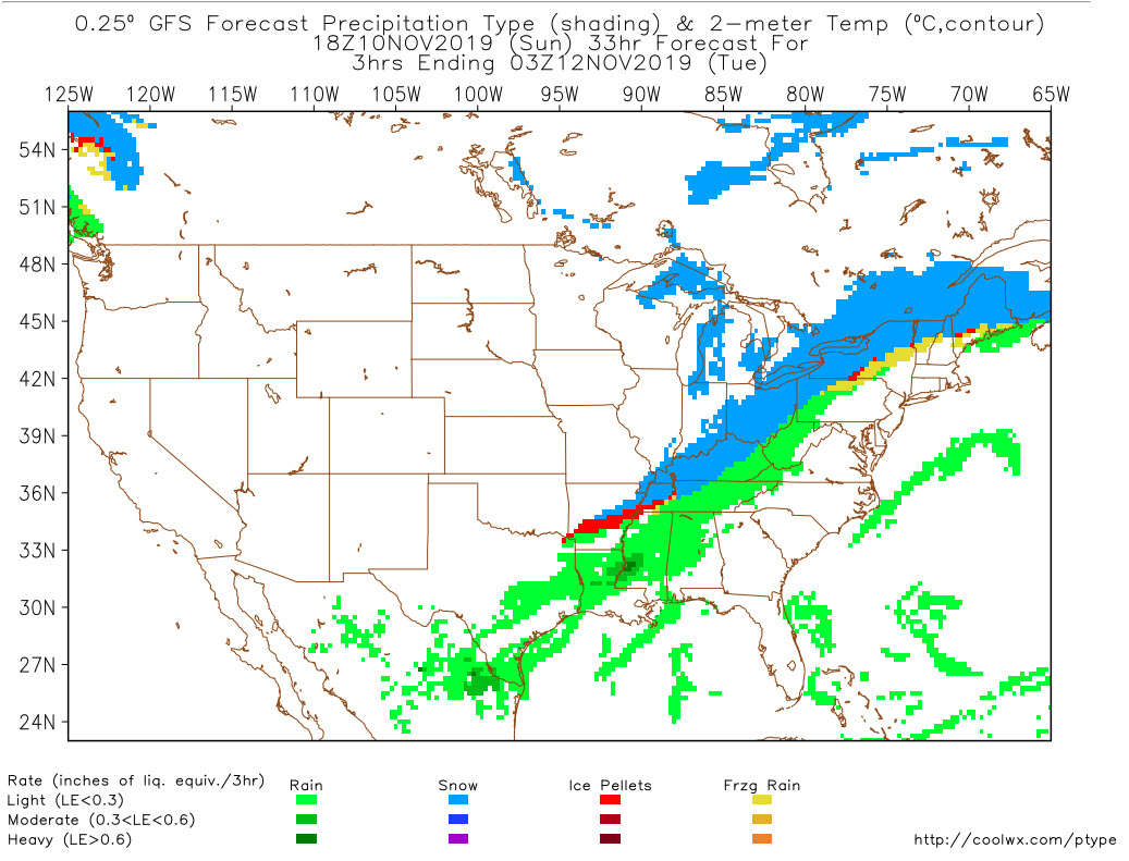
A powerful cold front will be pushing into Alabama late tomorrow night. It will reach the Northwest Corner of Alabama around 6 p.m. and I-59 by midnight.
Within 6-7 hours, temperatures will fall to freezing.
There will be enough precipitation behind the front to result in a brief period of sleet, perhaps mixed with freezing rain late Monday night and early Tuesday morning.
The main window will be between 3 a.m. and 9 a.m. The threat area is north of I-20, but the main threat will be over the Tennessee Valley counties of North Alabama.
No impacts are expected, including no travel problems. But just to be safe, check the latest updates here on Monday and Monday night, as welll as Tuesday morning.
Category: Alabama's Weather, ALL POSTS
About the Author (Author Profile)
Bill Murray is the President of The Weather Factory. He is the site's official weather historian and a weekend forecaster. He also anchors the site's severe weather coverage. Bill Murray is the proud holder of National Weather Association Digital Seal #0001 @wxhistorianSubscribe
If you enjoyed this article, subscribe to receive more just like it.


