

Rain Tonight; Into The Deep Freeze Tomorrow
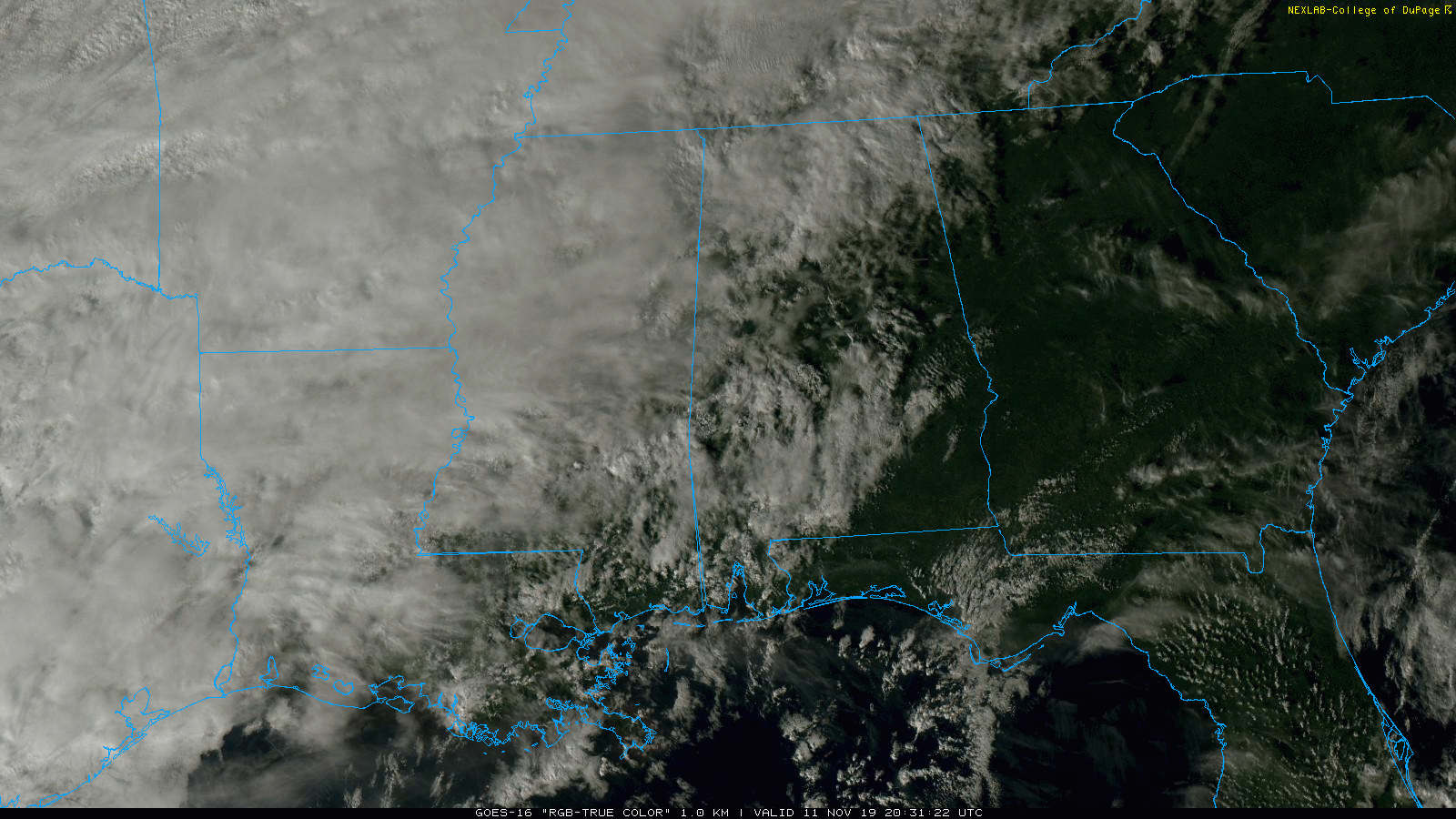
BIG COLD SHOT COMING: A cold front is nearing the northwest corner of Alabama this evening; rain has developed over the Tennessee Valley of North Alabama this afternoon, and we will have periods of rain statewide tonight as the front moves through. No risk of severe storms, no thunder, rain amounts should be around 1/2 inch or less for most places.
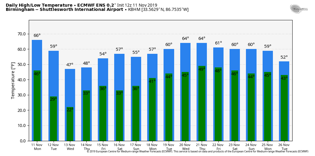
Birmingham has reached 72 degrees at 2:00 this afternoon… hopefully you have enjoyed this day since tomorrow will be 40 degrees colder.
Temperatures will drop into the upper 20s early tomorrow morning, and hover in the 32-38 degree range all day. A strong north wind of 12-22 mph will make it feel colder…. the wind chill index will stay below freezing all day.
NO NEED TO PANIC: As the rain ends tomorrow morning, cold air should become deep enough for a very brief period of light sleet (ice pellets) or freezing rain (rain in liquid form that falls with surface temperatures at or below freezing). With warm soil temperatures and the short lived window for freezing/frozen precipitation, we expect no impact. Forecast upper air soundings don’t favor it, but there could be a snow flake or two somewhere over North Alabama early tomorrow morning. Again, no impact is expected. The impact is from the very cold air that will settle into the state. The sky will begin to clear tomorrow afternoon.
RECORD LOWS: We are forecasting a low in the 18-24 degree range early Wednesday morning across North/Central Alabama. Birmingham’s record low for November 13 is 22, set in 1911, and that record is in danger. A freeze is likely all the way to the Florida Panhandle and the Gulf Coast.
REST OF THE WEEK: A warming trend begins Wednesday afternoon; the high will be near 50 degrees with a sunny sky. Most of Thursday and Friday will be dry, but we will mention a chance of rain Thursday night over the southern two-thirds of the state (generally south of I-20) as a wave passes through the northern Gulf of Mexico. The high Thursday will be in the mid 50s, followed by upper 50s Friday.
THE ALABAMA WEEKEND: With a sunny sky Saturday, we rise into the low 60s, and Sunday will be dry as well with a partly sunny sky. The high Sunday will be in the 60-64 degree range.
NEXT WEEK: For the moment most of the week looks dry and pleasant, with highs mostly in the 60s, not far from average values for mid to late November in Alabama. See the Weather Xtreme video for maps, graphics, and more details.
ON THIS DATE IN 2002: Clean up operations were underway after tornadoes and severe storms battered Alabama on November 10, 2002… responsible for twelve deaths. Some of the most significant damage was in Walker County; the Saragossa tornado, which killed eight, was on the ground for 73 miles, making it the fourth longest path length of any tornado in modern Alabama history at the time. The town of Carbon Hill was dealt a heavy blow. In June 2002, the town’s high school had burned to the ground. On this deadly night, an F3 tornado destroyed the town’s elementary school.
BEACH FORECAST: Click here to see the AlabamaWx Beach Forecast Center page.
WEATHER BRAINS: Don’t forget you can listen to our weekly 90 minute show anytime on your favorite podcast app. This is the show all about weather featuring many familiar voices, including our meteorologists here at ABC 33/40.
CONNECT: You can find me on all of the major social networks…
Facebook
Twitter
Instagram
Pinterest
Snapchat: spannwx
Look for the next Weather Xtreme video here by 7:00 a.m. tomorrow…
Category: Alabama's Weather, ALL POSTS, Weather Xtreme Videos
About the Author (Author Profile)
James Spann is one of the most recognized and trusted television meteorologists in the industry. He holds the AMS CCM designation and television seals from the AMS and NWA. He is a past winner of the Broadcast Meteorologist of the Year from both professional organizations.Subscribe
If you enjoyed this article, subscribe to receive more just like it.


