

Cloudy & Dry For Most At Midday; Strong To Severe Storms Possible Late Saturday & Into Sunday
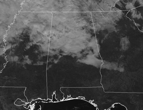
THE REST OF YOUR BLACK FRIDAY: Clouds continue to block out much of the sunshine for the northern half of Central Alabama at midday and will continue to spread southward throughout the remainder of your Friday. Temperatures are in the mid-50s to right at 70 degrees across the area and will eventually warm into the upper 50s to the lower 70s from northwest to southeast for the afternoon highs. No rain is expected through the rest of today and those temperatures will drop into the lower to mid-50s by the late local news time, and into the upper 40s to the lower 50s for the overnight lows.
IRON BOWL SATURDAY: Skies will be mostly cloudy through the daylight hours and there is a chance for a few showers over the northern half of Central Alabama during the late morning and into the afternoon. Where there may be a very slight risk of a shower passing over Jordan-Hare Stadium during the Iron Bowl, mainly all of the activity will hold off until well after the game is over. Afternoon highs will be in the mid-60s to the mid-70s across the area. The temperature will top out around 71 degrees in Auburn for the 2:30 pm kickoff, and fall into the upper 60s by the 4th quarter.
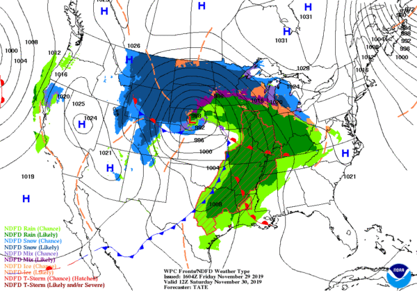
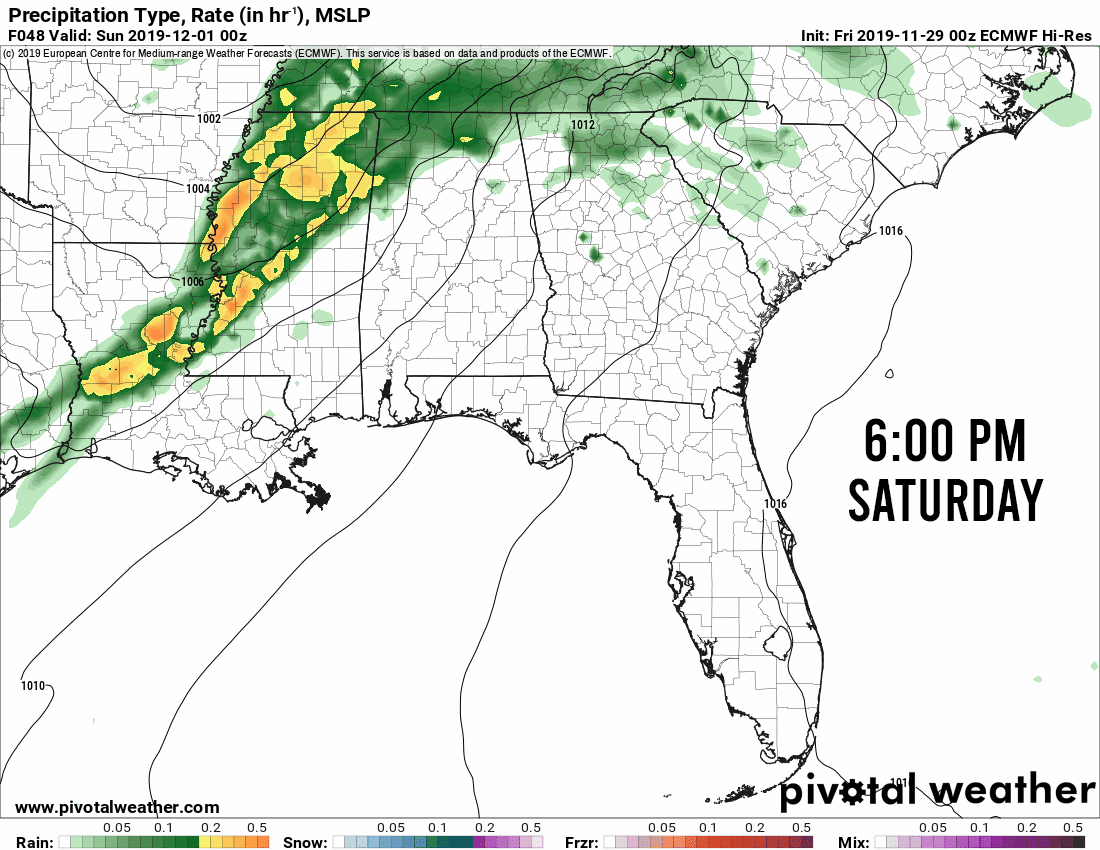
STRONG/SEVERE STORM THREAT LATE SATURDAY NIGHT INTO SUNDAY MORNING: A strong cold front will be approaching Central Alabama on Saturday, but warm air advection out ahead of that could potentially destabilize the atmosphere enough for strong to severe storms to affect the area with damaging winds and a few brief tornadoes possible.
NWS Birmingham has a Marginal Risk is up for much of Central Alabama on Saturday night through Sunday morning with the exception of the northeast quarter. To be more specific, the Marginal Risk is for locations west and south of a line from Cullman to Calera to LaFayette in Chambers County. At this point, the main threats look to be the possibility of damaging winds up to 60 MPH and a few brief tornadoes.
Timing for the strong to severe storms looks to be from 8:00 pm Saturday through 8:00 am Sunday from west to east. Let’s break that timing down even further for the threat locations…
8:00 pm to midnight for the western parts of the area (west of a line from Fairview in Cullman County to Vance in Tuscaloosa County to Linden in Marengo County).
10:00 pm to 3:00 am for the central parts of the area (west of a line from Kellyton in Coosa County to Hayneville in Lowndes County).
1:00 am to 8:00 am for the southeastern parts of the area (including Montgomery, Auburn, Troy, and Eufaula).
Damaging winds will be more of the main threat for the west and northwestern locations in the Marginal Risk, with tornadoes more of the main threat in the east and southeastern parts of the risk locations. Moist and unstable air will be advecting up ahead of a cold front after midnight which may fuel the atmosphere enough for a few brief tornadoes to be the main threat in the east and southeast. However, both threats are possible across all of the Marginal Risk areas.
Any watches that may be issued on Saturday night through the early morning hours on Sunday will more than likely be tornado watches.
These late-year events usually contain plenty of wind shear to support severe weather. We usually lack enough surface-based instability for a big severe outbreak. Sometimes it happens and we have an outbreak, but this event doesn’t look to be that way. Instability values look to be around 500 J/kg or less which is a low amount, but instability was around that level when a tornado touched down in Pike County and moved into Barbour County on Wednesday morning.
All of that to say… You need to be prepared for any risk level of severe weather during this time of the year as this is our secondary severe weather season. Remember to have your safety kits and your place of safety ready to go not only for tomorrow night but for every time we are under a severe risk. Have those batteries charged on your smartphones and be sure that your NOAA WeatherRadio and flashlights have fresh batteries.
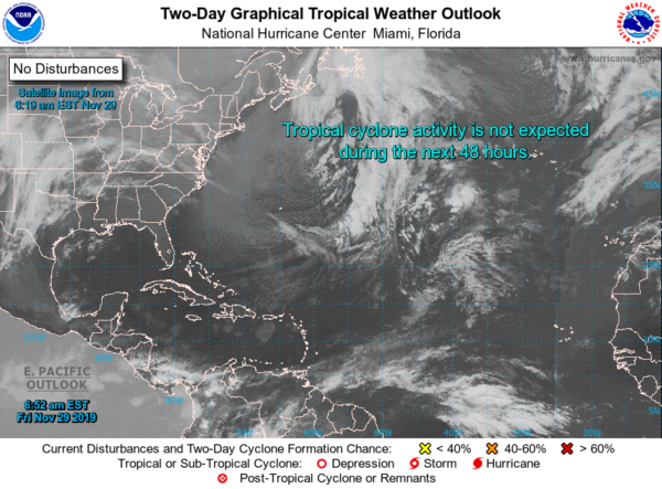
THE TROPICS: All is quiet across the Atlantic Basin and no tropical cyclones are expected to form. Tomorrow will bring the Atlantic Hurricane Season to an end for 2019. Unless any disturbances of concern pop up, tomorrow will be the last tropical update until June 1st, 2020.
Category: Alabama's Weather, ALL POSTS, Severe Weather, Tropical
About the Author (Author Profile)
Scott Martin is an operational meteorologist, professional graphic artist, musician, husband, and father. Not only is Scott a member of the National Weather Association, but he is also the Central Alabama Chapter of the NWA president. Scott is also the co-founder of Racecast Weather, which provides forecasts for many racing series across the USA. He also supplies forecasts for the BassMaster Elite Series events including the BassMaster Classic.Subscribe
If you enjoyed this article, subscribe to receive more just like it.


