

Hey Hale County, A Strong Storm Is Heading Your Way
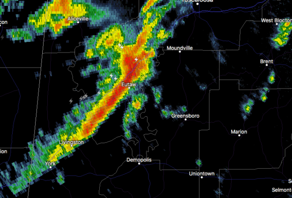
At 1104 PM CST, Doppler radar was tracking strong thunderstorms along
a line extending from Knoxville to near Tishabee. Movement was east
at 50 mph.
Winds in excess of 40 mph will be possible with these storms.
Locations impacted include…
Greensboro, Moundville, Akron, Newbern, Greensboro Municipal Airport,
Sawyerville, Wedgeworth, Evansville, Selden Lock And Dam, Moundville
Airport, Phipps, Mound State Park, Elliots Creek, Harper Hill,
Wateroak, Cedarville and Havana.
Category: Alabama's Weather, ALL POSTS, Severe Weather
About the Author (Author Profile)
Scott Martin is an operational meteorologist, professional graphic artist, musician, husband, and father. Not only is Scott a member of the National Weather Association, but he is also the Central Alabama Chapter of the NWA president. Scott is also the co-founder of Racecast Weather, which provides forecasts for many racing series across the USA. He also supplies forecasts for the BassMaster Elite Series events including the BassMaster Classic.Subscribe
If you enjoyed this article, subscribe to receive more just like it.


