

Pretty Nice Saturday Afternoon
After the foggy start to the day in some areas, we have been seeing tons of sunshine through the morning hours and now, into the afternoon hours across North/Central Alabama.
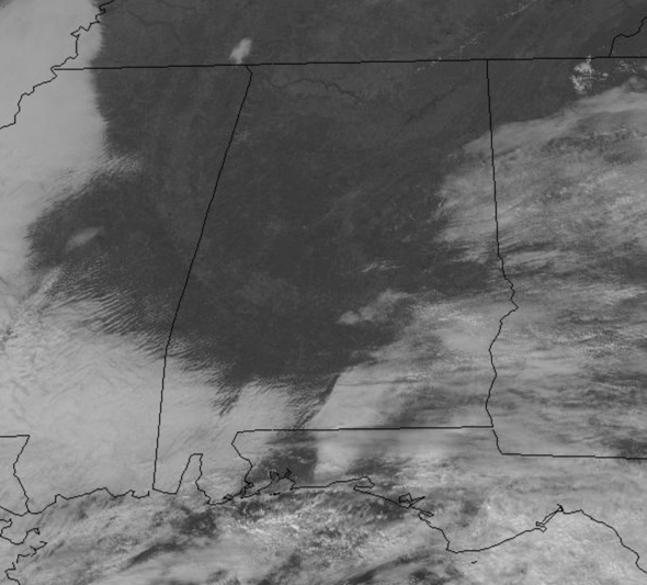
There are more clouds across southern and eastern portions of the state but for the most part, I think through the rest of the afternoon we will continue to see more sun than clouds.
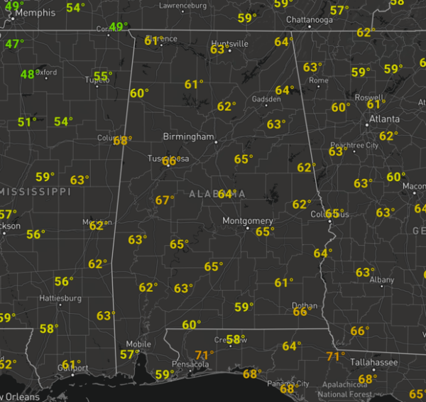
Temperatures aren’t too bad this afternoon either as mid 60s cover the state. Tonight, we should see a few more clouds with lows generally in the mid and upper 40s.
FOR TOMORROW: Our Sunday should feature a mix of sun and clouds, and we can’t completely rule out a few isolated showers across the area, but for the most part rain chances remain under 20% and most locations will be staying dry. Temperatures will once again climb back into the 60s tomorrow afternoon.
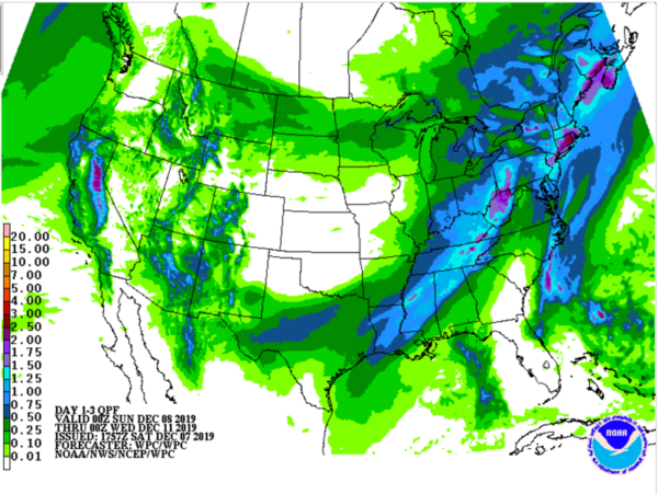
RAIN RETURNS: Not much change in the forecast as we start to the new work week. Monday will feature more clouds than sun, with some scattered showers across the state. It will be a very mild day as temperatures will head towards the upper 60s and perhaps low 70s in spots. Rain and perhaps some storms will become widespread Monday night and into Tuesday as a cold front passes through the state. Still doesn’t looks like severe storms will be an issue with this system, but rain amounts 1/2 to 1 inch are likely.
Behind the front, much colder air will roll into the state during the day Tuesday. We should start Tuesday in the 60s but fall through the 50s and 40s through the afternoon and evening. There continues to be chance for a few snow flakes across North Alabama on Tuesday as cold air rushes into the state, but for the most part, not sure we see any.
BEACH FORECAST CENTER: Get the latest weather and rip current forecasts for the beaches from Fort Morgan to Panama City on our Beach Forecast Center page. There, you can select the forecast of the region that you are interested in visiting.
WORLD TEMPERATURE EXTREMES: Over the last 24 hours, the highest observation outside the U.S. was 114.4F at Fitzroy Crossing Aero, Australia. The lowest observation was -58.4F at Verhojansk, Russia.
CONTIGUOUS TEMPERATURE EXTREMES: Over the last 24 hours, the highest observation was 85F at Falfurrias, TX. The lowest observation was -5F at Mount Washington, NH.
Category: Alabama's Weather, ALL POSTS
About the Author (Author Profile)
Macon, Georgia Television Chief Meteorologist, Birmingham native, and long time Contributor on AlabamaWX. Stormchaser. I did not choose Weather, it chose Me. College Football Fanatic. @Ryan_StinnetSubscribe
If you enjoyed this article, subscribe to receive more just like it.


