

Some Light Rain Possible Late Tonight; Severe Storms Saturday
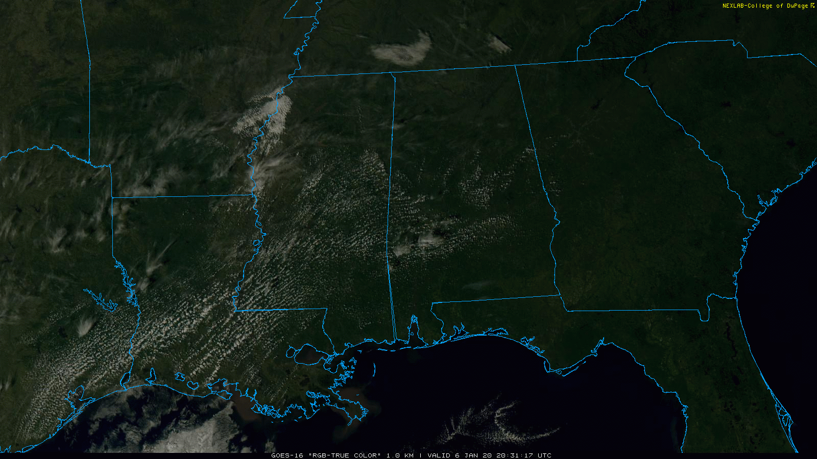
PLEASANT AFTERNOON: Temperatures are mostly in the 60s across Alabama this afternoon with a good supply of sunshine. A fast moving disturbance will bring some clouds into the state tonight, and some potential for scattered light rain from about midnight to 6:00 a.m. Moisture is very limited, and many communities probably won’t see enough rain to measure.
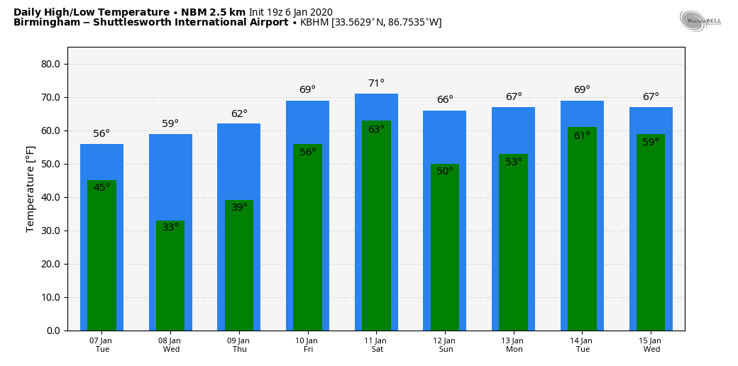
MID-WEEK: The weather will be rain-free tomorrow through Thursday. The high tomorrow will be in the mid 50s, followed by 60 degrees Wednesday, and upper 60s Thursday. The coldest morning will come early Wednesday when temperatures will be in the 28-34 degree range. Clouds thicken Thursday night as moisture surges northward from the Gulf of Mexico.
FRIDAY: Wet weather returns to the state Friday. The day will be mostly cloudy and very mild with a high in the 70-75 degree range (20 degrees above average for mid-January), and we will forecast periods of rain, with a few thunderstorms possible as well. While no severe weather is expected in Alabama Friday, severe storms are likely west of the state over parts of East Texas, Arkansas, Louisiana, and Southeast Oklahoma.
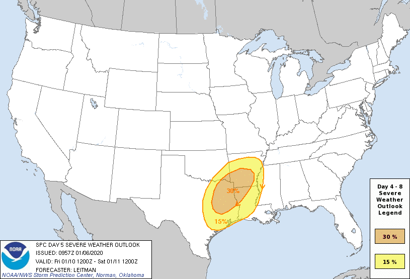
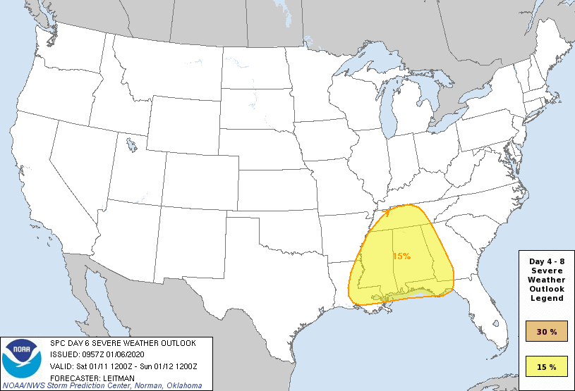
SEVERE THUNDERSTORM POTENTIAL: A dynamic weather system, featuring a negative tilt upper trough, deepening surface low, and strong wind fields, will bring the risk of strong to severe thunderstorms to Alabama Saturday. SPC has all of Alabama and Mississippi in a severe weather risk in their “Day 6” outlook…
No doubt the synoptic scale features favor severe thunderstorms, but we really won’t know much about the small, mesoscale features of this event until we are about 60 hours out. Bottom line is that there is no way of knowing the magnitude or timing of the event now, but just be aware that Saturday looks like a very active weather day, and be sure you have a way of hearing severe weather warnings and an action plan if you are placed in a tornado warning polygon.
Also understand we are expecting rain amounts of 2-4 inches over the northern half of the state Friday and Saturday, with 1-2 inches for the southern counties. This could lead to more flash flooding problems since the ground is saturated.
Dry air returns to the state Sunday; we are forecasting a good supply of sunshine with a high in the mid to upper 60s.
NEXT WEEK: Global data hints that some rain could return as early as Monday, followed by another rain event at the end of the week. Temperatures will remain above average; the upper air pattern won’t let the bitterly cold Arctic air drop southward from the higher latitudes for now. See the Weather Xtreme video for maps, graphics, and more details.
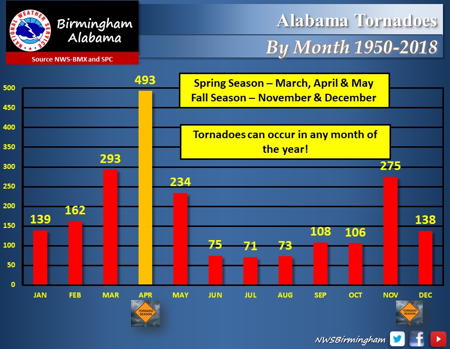
JANAURY SEVERE WEATHER? Alabama has experienced 139 tornadoes in January from 1950 through 2018… so having severe storms this time of the year is not all that unusual here.
ON THIS DATE IN 1996: The Great Blizzard was a severe nor’easter that paralyzed the East Coast on January 6 to the 8th. In Washington D.C., this storm is also known as the “Great Furlough Storm” because it occurred during the 1996 federal government shutdown. Snowfall amounts from this event includes: 47 inches in Big Meadows, Virginia; 30.7″ in Philadelphia; 27.8″ in Newark; 24.6″ at the Dulles International Airport; 24.2″ in Trenton; 24″ in Providence; 22.5″ in Baltimore; 18.2″ in Boston; 17.1″ in D.C.; and 9.6″ in Pittsburgh.
BEACH FORECAST: Click here to see the AlabamaWx Beach Forecast Center page.
WEATHER BRAINS: Don’t forget you can listen to our weekly 90 minute show anytime on your favorite podcast app. This is the show all about weather featuring many familiar voices, including our meteorologists here at ABC 33/40.
CONNECT: You can find me on all of the major social networks…
Facebook
Twitter
Instagram
Pinterest
Snapchat: spannwx
I enjoyed seeing a big group of home schoolers today at the Albert Scott Public Library in Alabaster… be looking for them on the Pepsi KIDCAM today at 5:00 on ABC 33/40 News! The next Weather Xtreme video will be posted here by 7:00 a.m. tomorrow…
Category: Alabama's Weather, ALL POSTS, Weather Xtreme Videos
About the Author (Author Profile)
James Spann is one of the most recognized and trusted television meteorologists in the industry. He holds the AMS CCM designation and television seals from the AMS and NWA. He is a past winner of the Broadcast Meteorologist of the Year from both professional organizations.Subscribe
If you enjoyed this article, subscribe to receive more just like it.


