

Showers Tomorrow; Severe Storms Saturday
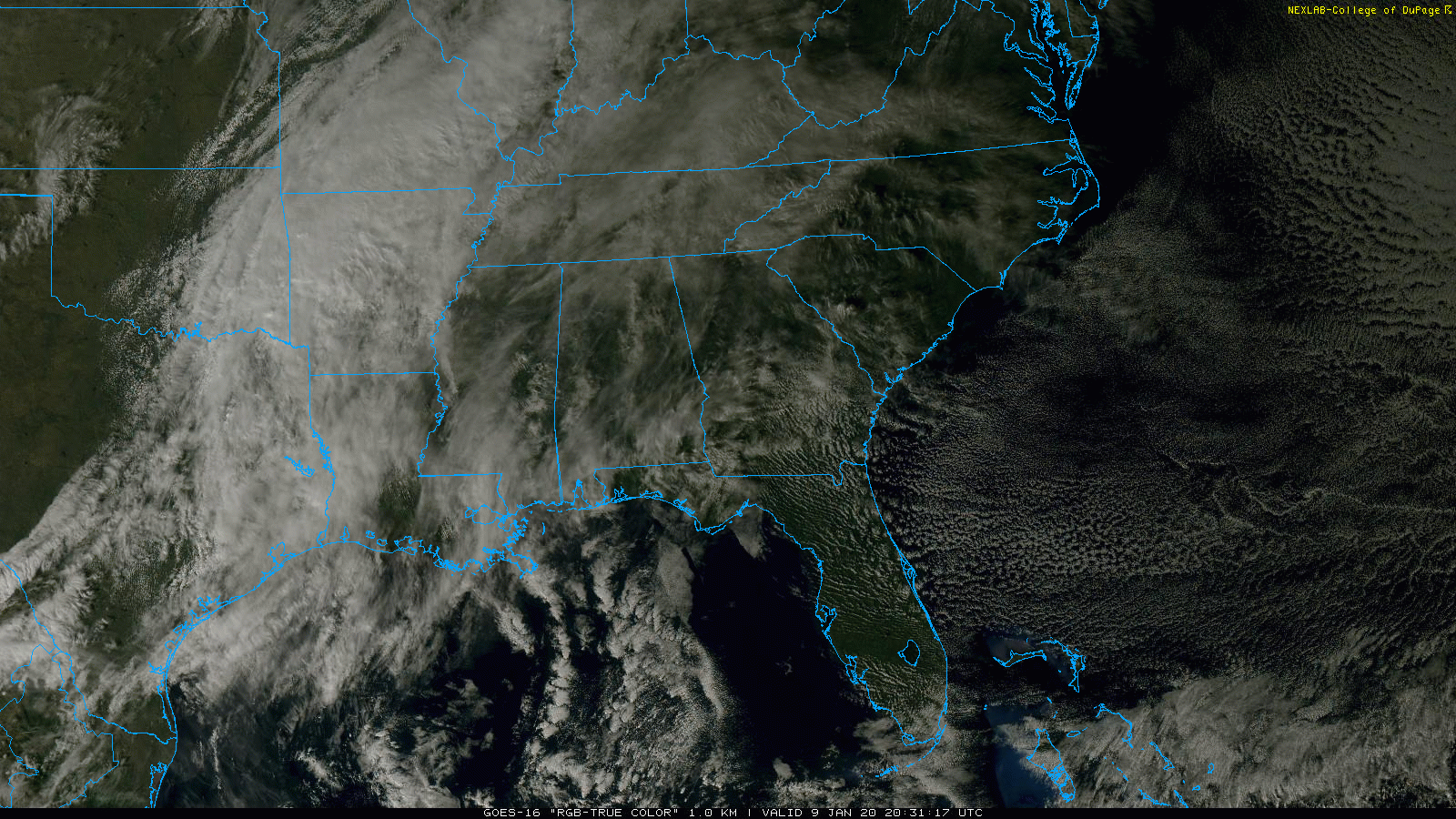
HIGH CLOUDS: High cirrus clouds have moved over Alabama this afternoon ahead of a complex storm system developing west of the state. Temperatures are mostly in the low to mid 60s, and the clouds become thicker and lower tonight.
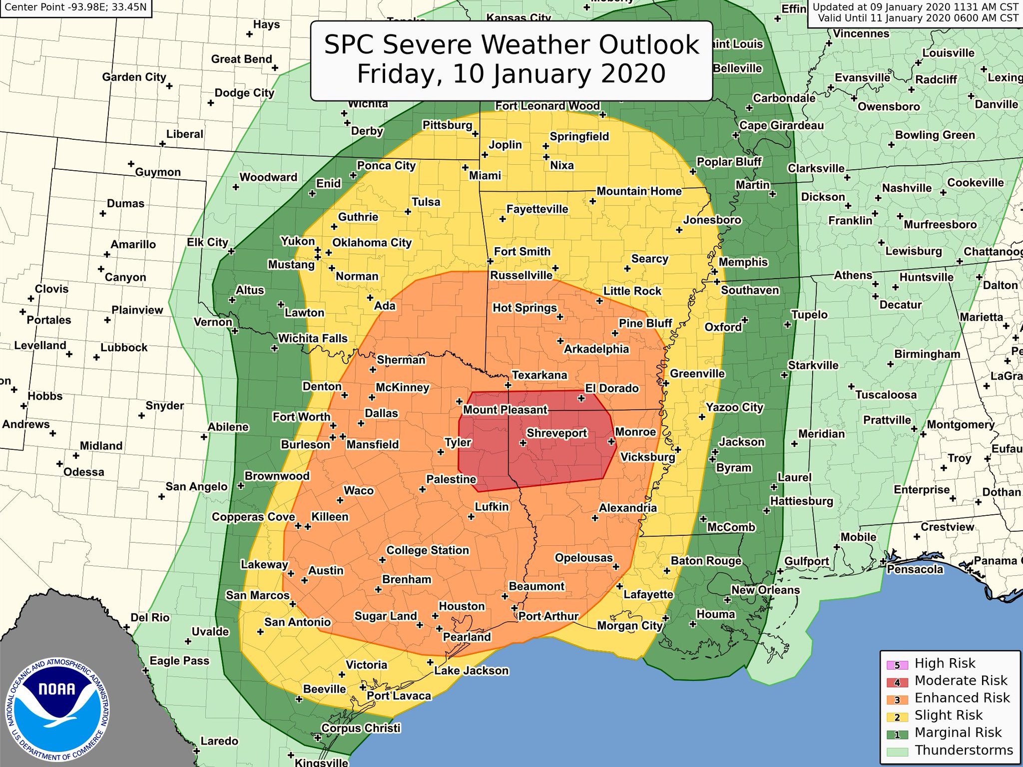
Tomorrow will be a breezy and mild day with a high around 70; showers are possible by afternoon. But the main action will be well to the west, where severe thunderstorms will break out over parts of Texas, Oklahoma, Louisiana, and Arkansas. SPC now has the I-20 corridor from Tyler, Texas to Shreveport and Monroe, LA in a “moderate risk” (level 4/5); a significant severe weather event is likely there.
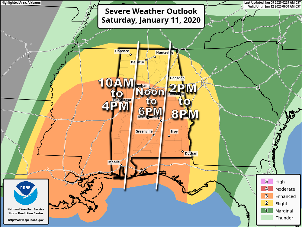
SEVERE STORMS IN ALABAMA SATURDAY: New data continues to show a potent severe weather setup for much of Alabama Saturday. The incoming system will feature strong wind fields; the low level jet (5,000 feet off the ground), will be in the 50-90 knot range, which will also make for high storm relative helicity values (veering of the wind with height in relation to storm motion). SPC has about the southern two-thirds of the state (south of a line from Vernon to Birmingham to Talladega to Opelika) in an “enhanced risk” (level 3/5), while the standard “slight risk” (level 2/5) extends north to the Tennessee state line.
Please don’t get too hung up in the risk categories or colors, just know all of Alabama has a risk of severe thunderstorms Saturday. With all of the media attention focused on Saturday… I know some people suffer from anxiety and worry. Just understand that even on a significant severe weather day, odds of any one spot being affected by a tornado are relatively small. Simply be prepared and we will get through the day together just fine.
TIMING: The main window for severe storms over the western side of the state will come from 9:00 a.m. until 4 p.m… for the central counties the window is from 12:00 noon to 6:00 p.m… and for East Alabama 2:00 p.m. until 8:00 p.m. This will be a generally daytime event.
THREATS: A line of storms will sweep through the state Saturday with potential for damaging winds and a few embedded tornadoes. Also, any discrete cells that form east of the line will be capable of producing a few tornadoes as well. Based on the forecast parameters, a few strong tornadoes (EF2 or higher) can’t be ruled out. Also, some hail is possible with the heavier thunderstorms. And, away from thunderstorms, pressure gradient winds will be fairly robust during the day Saturday; expect a south wind averaging 15-30 mph with gusts possible to 40 mph. A wind advisory has been issued for much of Alabama Saturday.
RAIN: Rain amounts tomorrow night and Saturday should be around 2 inches for much of Alabama; some flooding issues are possible. We note seven day rain totals (valid through Thursday of next week) are in the 4-5 inch range over North Alabama, with 3-4 inches for the southern counties as more rain is likely next week.
CALL TO ACTION: Everyone will need a good, reliable way of getting severe weather warnings Saturday if they are needed. Be sure WEA (“emergency alerts”) are enabled on your phone, and download the free ABC 33/40 weather app as well. Have a NOAA Weather Radio in your home and business. Never rely on an outdoor siren.
Identify the safe place in your home…in a site built home, it is a small room on the lowest floor, near the center of the home, and away from windows. Be sure everybody in the family knows where that safe place is, and in that room you need helmets for everyone in your family. We also recommend having a portable air horn for everyone, as well as hard soled shoes. If you live in a mobile home, you cannot stay there if you are in a tornado warning polygon. Know the location of the nearest shelter or site built structure that is available.
Is a tornado threat in January unusual? Not really… Alabama has experienced 139 tornadoes during the month of January since 1950. Tornadoes can happen during any month in our state, but the most active period is between November and May.
Do I need to cancel my event Saturday? Getting many questions about both indoor and outdoor events Saturday. All of them involve a different set of circumstances, and there is no way we can make that decision. Just keep an eye on these discussions; you will have the information you need to make an informed decision.
Sunday will be dry with a mix of sun and clouds; the high will be in the mid 60s.
NEXT WEEK: Moist air returns, and we will have a cloudy sky with periods of rain Monday through Wednesday. No severe storms are expected, and highs will be in the 60s as mild air continues to cover the state. Cooler and drier air returns Thursday and Friday with highs back in the 50s, at seasonal averages for Alabama. See the Weather Xtreme video for maps, graphics, and more details.
ON THIS DATE IN 2006: With cold air sweeping in from the Himalayas, New Delhi reports frost for the first time in 70 years with a low temperature of 0.2°C (32.3°F). The cold prompted officials to order all schools to close for three days.
BEACH FORECAST: Click here to see the AlabamaWx Beach Forecast Center page.
WEATHER BRAINS: Don’t forget you can listen to our weekly 90 minute show anytime on your favorite podcast app. This is the show all about weather featuring many familiar voices, including our meteorologists here at ABC 33/40.
CONNECT: You can find me on all of the major social networks…
Facebook
Twitter
Instagram
Pinterest
Snapchat: spannwx
Look for the next Weather Xtreme video here by 7:00 a.m. tomorrow…
Category: Alabama's Weather, ALL POSTS, Weather Xtreme Videos
About the Author (Author Profile)
James Spann is one of the most recognized and trusted television meteorologists in the industry. He holds the AMS CCM designation and television seals from the AMS and NWA. He is a past winner of the Broadcast Meteorologist of the Year from both professional organizations.Subscribe
If you enjoyed this article, subscribe to receive more just like it.


