

A Brief 7:00 AM Weather Update; Action About To Move Into Parts Of The Area
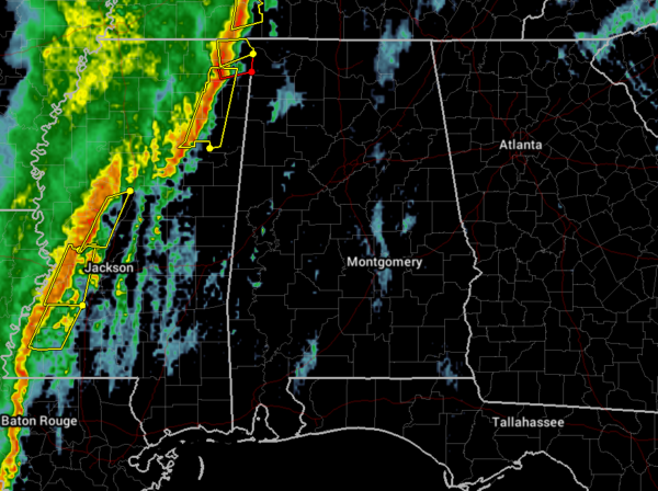
As of 7:00 am, the main line of strong to severe storms have become disjointed a little bit over the northeastern and north-central parts of Mississippi, with the northern parts beginning to move ahead of the southern parts of the line. Within the next 30 minutes or so, the line will be moving into the northwestern parts of North/Central Alabama.
Two separate tornado warnings are in effect for portions of northeastern Mississippi… one for portions of Tishomingo, Prentiss, and Alcorn counties until 7:45 am, and the other for portions of Tishomingo and Prentiss counties until 7:45 am.
Severe thunderstorm warnings are also in effect for the strongest portions of the line across northeastern Mississippi and back into west-central and southwestern Mississippi.
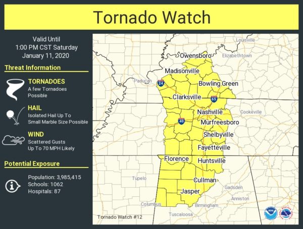
A Tornado Watch was just issued for the northwest quarter of the state until 1:00 pm this afternoon.
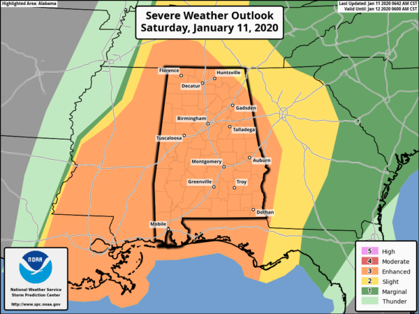
SPC has re-upgraded much of the Slight Risk locations to an Enhanced Risk with the exception of the extreme northeast corner of the state.
The latest SPC Mesoscale Analysis shows instability quickly rising over the next few hours over the west and southwestern parts of the state. The same can be said with the STP values, topping out at over 6.0 within the next few hours.
The action will be moving into the state soon. Stay with us throughout the day with updates.
Category: Alabama's Weather, ALL POSTS, Severe Weather
About the Author (Author Profile)
Scott Martin is an operational meteorologist, professional graphic artist, musician, husband, and father. Not only is Scott a member of the National Weather Association, but he is also the Central Alabama Chapter of the NWA president. Scott is also the co-founder of Racecast Weather, which provides forecasts for many racing series across the USA. He also supplies forecasts for the BassMaster Elite Series events including the BassMaster Classic.Subscribe
If you enjoyed this article, subscribe to receive more just like it.


