

Showers & T-Storms Over Parts Of The Area At Midday, Some Hail Possible Tonight
Conditions As Of 11:20 am
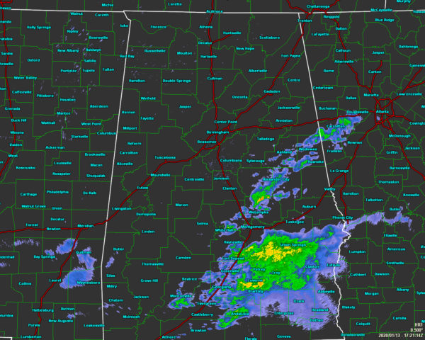
We have some shower and thunderstorm activity over the east and southeastern parts of the area that is currently moving to the northeast. Nothing strong and nothing too heavy at this point, but we do have a Marginal Risk for severe storms over the northern parts of the area for later this evening and tonight. Temperatures as of the 11:00 am roundup were in the lower to mid-60s across the area. Talladega and Anniston were tied as the cool spots at 60 degrees. Birmingham was at 64 degrees. The warm spot was Montgomery at 66 degrees.
Marginal Risk For Parts Of The Area Today & Tuesday
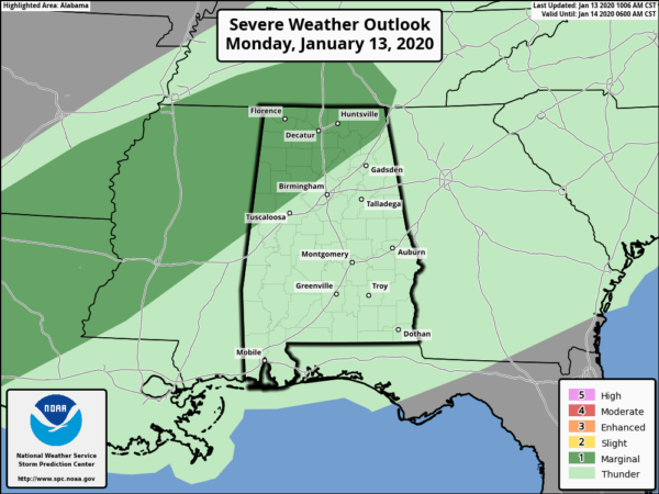
Isolated severe hail is possible from southeast Texas to the Tennessee Valley, primarily after midnight. Mid-level lapse rates will steepen across the risk locations which will make the environment more favorable for hail, but updrafts will struggle to intensify and that is the reason for only a Marginal Risk.
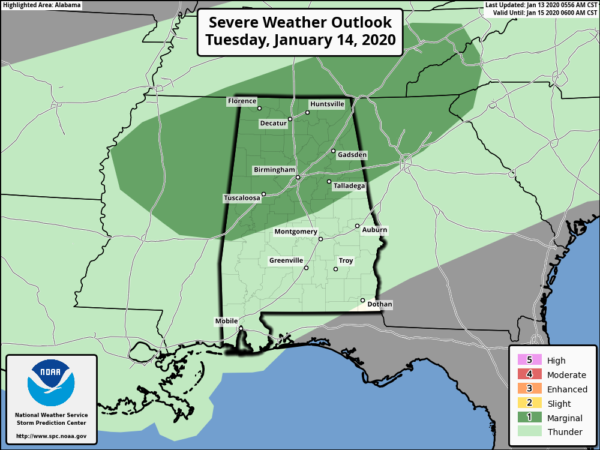
On Tuesday: thunderstorms are expected to develop on Tuesday across parts of the central Gulf Coast States, Tennessee Valley, and the southern Appalachian Mountains. Some of these storms could have a marginal hail threat. A few strong wind gusts may also occur in north-central Alabama where the models show potential for surface-based thunderstorms. A marginal severe threat could persist into the early evening before instability diminishes across the threat area.
Weather For The Rest Of Your Monday
We’ll continue to have widespread showers and a few scattered thunderstorms moving northward throughout the area for the rest of the daylight hours and into the evening. Skies will mainly be cloudy when it is not raining. Afternoon highs will be in the mid-60s to the mid-70s. For tonight, the better coverage of showers and thunderstorms will be over the northern two-thirds of the area. One or two of those storms may become hail producers and may possibly warrant a Severe Thunderstorm Warning for the potential of hail reaching one-inch in diameter (golf ball size). Lows will only drop into the upper 50s to the mid-60s across the area.
Not Much Change For Tuesday
We’ll continue to have scattered to numerous showers and thunderstorms across the area with the potential of one or two of those becoming strong with gusty winds and some hail. Skies will be cloudy when there is no rain falling. Afternoon highs will be in the lower to mid-70s for much of the area, slightly warmer in the extreme southeastern parts.
Category: Alabama's Weather, ALL POSTS, Severe Weather
About the Author (Author Profile)
Scott Martin is an operational meteorologist, professional graphic artist, musician, husband, and father. Not only is Scott a member of the National Weather Association, but he is also the Central Alabama Chapter of the NWA president. Scott is also the co-founder of Racecast Weather, which provides forecasts for many racing series across the USA. He also supplies forecasts for the BassMaster Elite Series events including the BassMaster Classic.Subscribe
If you enjoyed this article, subscribe to receive more just like it.


