

Hard Freeze Tonight; Rain Returns Late This Week
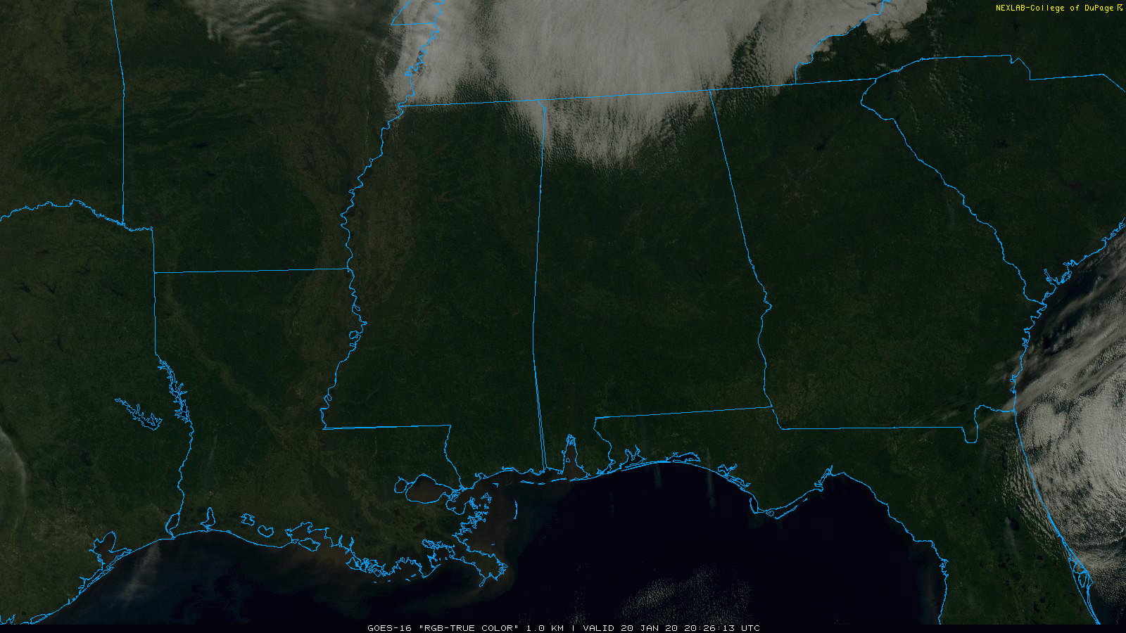
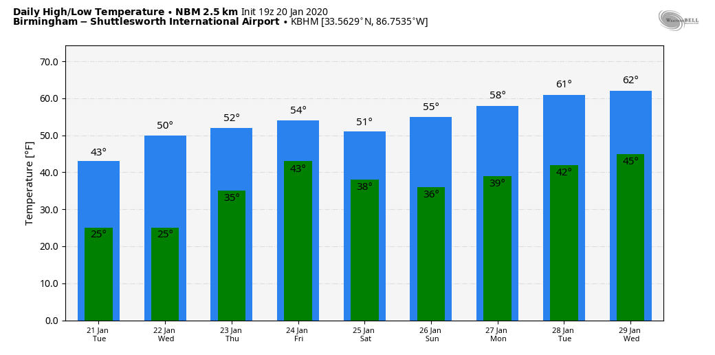
COLD JANUARY DAY: Clouds are lingering over far North Alabama this afternoon, where temperatures remain below freezing. At 2pm CT, Decatur reported 26 degrees, a north wind at 12 mph, and a wind chill index of 16. Even where the sun is shining, temperatures haven’t responded much. Birmingham was at 35 degrees at 2:00… the average high for Birmingham on January 20 is 54.
Tonight will be very cold, needless to say, with most places seeing a low in the 18-24 degree range; we note freezing temperatures are likely all the way down to the Gulf Coast. A disturbance aloft could squeeze out a few snow flurries after midnight tonight into early tomorrow morning, but there will be no impact. Tomorrow will be mostly sunny with high between 40 and 45 degrees over the northern half of the state.
Wednesday morning will be another cold one with lows well down in the 20s; upper teens are possible again for colder pockets. Then, we rise into the low 50s by afternoon as a slow warming trend begins. The air will be dry and Wednesday will be mostly sunny.
THURSDAY/FRIDAY: Clouds return to the state Thursday, and we will forecast a good chance of rain late Thursday afternoon, Thursday night, and into the day Friday. The new model data suggests the main window for rain will come from 4:00 p.m. Thursday through 4:00 p.m. Friday. Rain amounts should be in the 1/2 to 1 inch range, and there is no risk of severe storms. And, probably no thunder with a stable airmass in place. The high Thursday will be close to 50 degrees, followed by mid 50s Friday.
THE ALABAMA WEEKEND: For now the weekend looks dry with seasonal temperatures for late January. Look for a partly sunny sky Saturday and Sunday with afternoon highs in the low 50s. A light freeze is likely early Sunday morning.
NEXT WEEK: The weather will be dry during the first half of the week, but rain should return in the Thursday-Friday time frame (January 30-31)… See the Weather Xtreme video for maps, graphics, and more details.
EAST TENNESSEE SHAKER: A magnitude 3.6 quake was centered north of Knoxville at 2:12p ET this afternoon; it was felt across much of East Tennessee and parts of far North Georgia. No damage was reported.
ON THIS DATE IN 1940: Alabama was in the midst of the state’s most severe, long lasting cold wave. The two weeks beginning with the Arctic invasion that arrived on the night of January 18, 1940 still rate as the coldest 14 day period in Magic City history with an average temperature of 22.5F. When it comes to prolonged cold waves, Whether you look at 10, 14, 21, or 30 day periods, you won’t find a colder time in Birmingham than January-February 1940.
ON THIS DATE IN 1985: The low at Birmingham was -4F, the third coldest temperature on record for the Magic City. Coldest on record is -10F on February 13, 1899.
BEACH FORECAST: Click here to see the AlabamaWx Beach Forecast Center page.
WEATHER BRAINS: Don’t forget you can listen to our weekly 90 minute show anytime on your favorite podcast app. This is the show all about weather featuring many familiar voices, including our meteorologists here at ABC 33/40.
CONNECT: You can find me on all of the major social networks…
Facebook
Twitter
Instagram
Pinterest
Snapchat: spannwx
Look for the next Weather Xtreme video here by 7:00 a.m. tomorrow…
Category: Alabama's Weather, ALL POSTS, Weather Xtreme Videos
About the Author (Author Profile)
James Spann is one of the most recognized and trusted television meteorologists in the industry. He holds the AMS CCM designation and television seals from the AMS and NWA. He is a past winner of the Broadcast Meteorologist of the Year from both professional organizations.Subscribe
If you enjoyed this article, subscribe to receive more just like it.


