


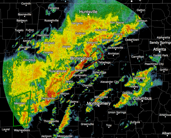
As of 2:14 am, it looks like the severe threat has come to an end for locations west of I-65 in the northern parts of the area and also for locations west of I-20/59 from Birmingham to the southwest.
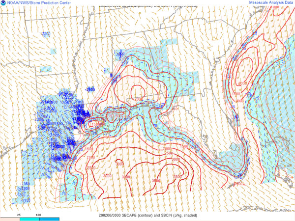
An unstable airmass continues over the south and southeastern portions of Central Alabama as instability values are well more than enough to support stronger to severe thunderstorms, ranging from 500 J/kg to over 1500 J/kg. Wind shear continues to be strong at this point reaching as high as 60 knots, which is well more than enough to be supportive of supercells and severe storms.
We’ll continue to see the threat of a few tornadoes and damaging wind gusts up to and exceeding 60 MPH, especially with the recent tornado warnings for Jefferson, Shelby, and St. Clair counties. A new tornado watch is likely to be issued for the southeastern parts of the area. The threat looks to continue through the rest of the pre-dawn hours and possibly as late as 10:00 am in the extreme southeast.
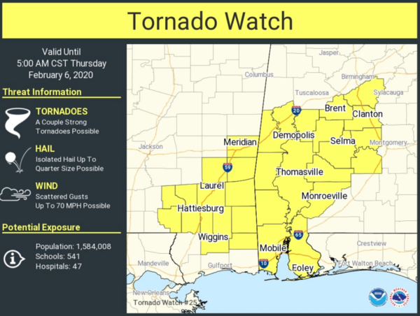
A Tornado Watch continues for Autauga, Bibb, Chilton, Dallas, Greene, Hale, Lowndes, Marengo, Perry, Shelby, and Sumter counties until 5:00 am.


