

Some Travel Issues Possible Over The Next Couple Of Hours In Northeast Alabama
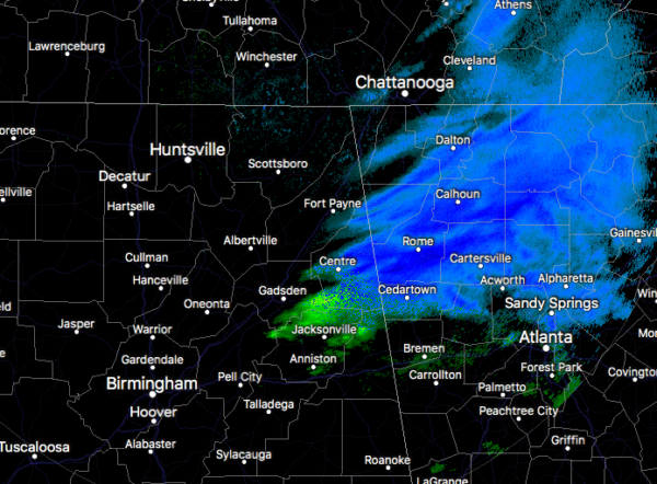
As of 9:50 am, the snow has almost made it all of the ways into northwestern Georgia, but snow showers continue for eastern Dekalb County and much of Cherokee County. Precipitation that is falling for the rest of North/Central Alabama is good old-fashioned rain.
All of the major reporting stations are now above freezing. Fort Payne is the cold spot at 33 degrees. The rest of North/Central Alabama is now in the mid-30s to the upper 40s across the area from northeast to the southwest. As a matter of fact, Montgomery has already hit 50 degrees.
The Winter Weather Advisory has just been canceled for Calhoun, Cherokee, Cleburne, and Etowah counties. As of now, it continues for Dekalb and Jackson counties.
Once the skies clear, any snow on the roadways and on the ground should quickly melt and you’ll be back to looking at grass and pavement by this evening.
We just received a report in on NWS Chat that Hwy 117 in Flat Top (Jackson County) from the top of the mountain to the four-way stop has become very slick. Once again, please delay your trip on the roadways in that part of the area until this afternoon if possible. Those Travel issues in Cherokee County continue as well. So far, those are the only reports.
Here are some Local Storm Reports from NWS Chat on snow totals so far…
Local Storm Report by NWS BMX: 1 W Cedar Bluff [Cherokee Co, AL] public reports SNOW of E0.1 INCH at 09:00 AM CST — snow covering grassy surfaces near the cedar bluff post office via photo posted to social media. time and depth approximate.
Local Storm Report by NWS BMX: Black Creek [Etowah Co, AL] public reports SNOW of E0.1 INCH at 08:30 AM CST — snow covering the ground via photo posted to social media in the black creek area of etowah county. time and depth approximate.
Local Storm Report by NWS BMX: 1 E Sand Rock [Cherokee Co, AL] public reports SNOW of E1.0 INCH at 09:30 AM CST — 1 inch of snow estimated covering the ground in the sand rock area via social media post. time approximate.
No LSRs have been reported for the NWS Huntsville county warning area.
Here are some more Tweets sent in from the “Spann Army” from the snow-covered locations in North Alabama…
Blanche, Cherokee County @spann @NWSBirmingham pic.twitter.com/WlzS5nYKYH
— Jay Prater (@JayPrater40) February 8, 2020
@spann My parents house in Bryant, AL #sandmountain #snowday pic.twitter.com/0kKyZsXqdf
— Cody Kirk (@codykirk22) February 8, 2020
@spann A Sand Mtn “farmhouse snowman” – Dutton, AL pic.twitter.com/WFrF4cCsZ6
— Jamie Darwin (@JamieDarwin1) February 8, 2020
@spann a little over an inch in Pisgah, AL pic.twitter.com/2QwIo9d2Fg
— Doug Haynes (@freshnj15) February 8, 2020
Category: Alabama's Weather, ALL POSTS, Winter Weather
About the Author (Author Profile)
Scott Martin is an operational meteorologist, professional graphic artist, musician, husband, and father. Not only is Scott a member of the National Weather Association, but he is also the Central Alabama Chapter of the NWA president. Scott is also the co-founder of Racecast Weather, which provides forecasts for many racing series across the USA. He also supplies forecasts for the BassMaster Elite Series events including the BassMaster Classic.Subscribe
If you enjoyed this article, subscribe to receive more just like it.


