


The National Weather Service in Birmingham has issued a
* Flash Flood Warning for…
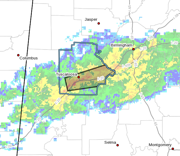
Southern Tuscaloosa County in west central Alabama…
* Until 915 AM CST.
* At 612 AM CST, Doppler radar indicated heavy rain falling across
the warned area. Up to one inch of rain has already fallen. Flash
flooding is ongoing or expected to begin shortly.
HAZARD…Flash flooding caused by heavy rain.
SOURCE…Radar indicated.
IMPACT…Flooding of small creeks and streams, urban areas,
highways, streets and underpasses as well as other
drainage and low lying areas.
* Some locations that will experience flooding include…
Tuscaloosa, Northport, Holt, Lake View, Brookwood, Coaling, Vance,
Tannehill Ironworks State Park, Abernant, McFarland Mall, Shelton
State Community College, Tuscaloosa Amphitheater, Bryant Denny
Stadium, Tuscaloosa Regional Airport, Lake Wildwood, University
Mall, Deerlick Creek Campgrounds, Mercedes Benz Of Alabama, North
Bibb and Englewood.
PRECAUTIONARY/PREPAREDNESS ACTIONS…
Turn around, don’t drown when encountering flooded roads. Most flood
deaths occur in vehicles.


