

Moderate To Heavy Rain Across Much Of The Area, Snow Reported In North Alabama
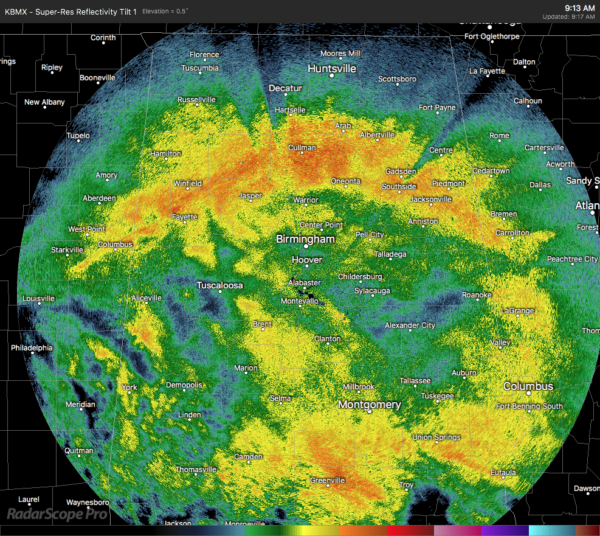
As of 9:13 am, we see moderate to heavy rain falling over the northern parts of Central Alabama along with the southern portions of North Alabama, mainly from Winfield and Fayette to Cullman to Piedmont and Jacksonville. Moderate to heavy rain is falling over the southern parts of Central Alabama as well, especially south of the I-85 corridor east of I-65.
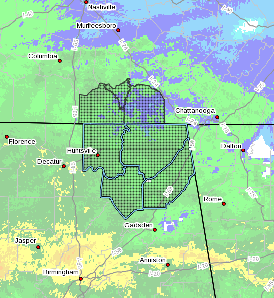
NWS Huntsville continues a Significant Weather Advisory for Madison, Marshall, Jackson, and Dekalb counties for the potential of accumulating snowfall until 3:00 pm this afternoon. With the lower parts of the atmosphere expected to cool, conditions look to become more favorable for the rain to transition to a wintry mix or all snow starting sometime between now and 11:00 am. Once it starts, it is expected to continue into the afternoon hours until the precipitation moves out of the area.
At this point, only a few flakes were reported earlier this morning up at Monte Sano according to NWS Chat. Minor snow accumulations may occur at locations with an elevation of 1,500 feet or higher with the potential of 1 to 2 inches of snow atop the Cumberland Plateau. No major travel issues are expected as any accumulations should stay confined to grassy areas and elevated surfaces, but we’ll have to watch for the potential of a few slick spots developing.
We just got a report in of heavier snow falling in Florence with visibility being reduced to around 1/2 mile. Temperatures are still above freezing, but dusting is occurring on rooftops, decks, and vehicles. Roadways are just wet at this point.
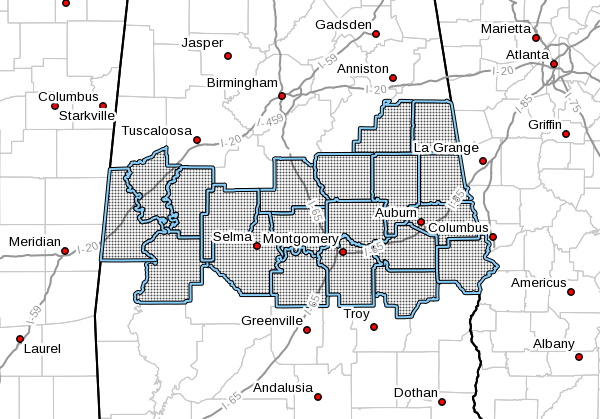
For the rest of the area, just expect rain from now through the afternoon hours, with heavier amounts expected mainly in the southern parts of the area. A Flash Flood Watch continues until 6:00 pm tonight for Autauga, Bullock, Chambers, Chilton, Clay, Coosa, Dallas, Elmore, Greene, Hale, Lee, Lowndes, Macon, Marengo, Montgomery, Perry, Randolph, Russell, Sumter, and Tallapoosa counties.
With rainfall rates around 1/2 inch per hour, there is a threat of some flash flooding issues developing over areas with saturated soils. As the rain moves from west to east, we could see training of the heavier rain bands over the southern parts of the area that could bring rainfall totals for the day over 1.50 inches. This could produce a flash flood threat, especially where rivers and creeks are in or near flood stage.
Category: Alabama's Weather, ALL POSTS, Winter Weather
About the Author (Author Profile)
Scott Martin is an operational meteorologist, professional graphic artist, musician, husband, and father. Not only is Scott a member of the National Weather Association, but he is also the Central Alabama Chapter of the NWA president. Scott is also the co-founder of Racecast Weather, which provides forecasts for many racing series across the USA. He also supplies forecasts for the BassMaster Elite Series events including the BassMaster Classic.Subscribe
If you enjoyed this article, subscribe to receive more just like it.


