

Mainly Cloudy, Cooler Saturday Afternoon
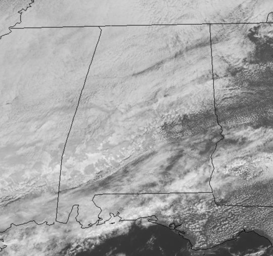
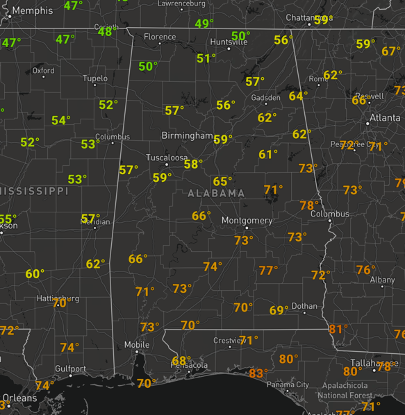
The cold front moved through the state overnight and is now sitting along the Gulf Coast today. There were a few lingering showers in Alabama this morning, but for the most part as we roll into the afternoon hours, the showers are confined to areas near the front. We are dealing with more clouds than sun, and it is cooler today as temperatures remain in the 50s and 60s.
Heading into tonight, it will be a rather cool night with upper 40s and lower 50s. Clouds will be increasing and rain should begin to spread north from the Gulf as the front to the south lifts back north as a warm front. By tomorrow morning, rain will be increasing across the Southeast.
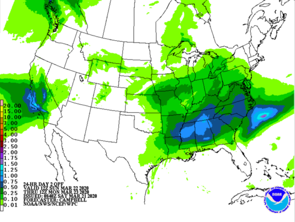
SHOWERY SUNDAY: It is going to be a wet go of it a times tomorrow as a widespread, soaking rain event means is ahead as we are going to deal periods of light to moderate rain in many locations tomorrow. Thunderstorms are not expected, and there is no threat of severe weather tomorrow with a rather stable air mass in place as clouds and rain will hold temps in the 60s tomorrow. Rain amounts should be around an inch as well, so flooding is not a concern either.
FOR MONDAY: Rain showers will continue through at least the first half of our Monday but a weak front will push through the state by midday and we should see the rain come to an end by the afternoon. Highs on Monday should be in the lower 70s.
TUESDAY STORMS: An upper-trough will eject out of the Plains on Tuesday and send another front boundary towards Alabama. Ahead of the feature, southerly flow will increase, warming us well into the upper 70s on Tuesday. Some showers are possible, but rain and storms should become widespread by late in the day and actually some strong to severe storms will be possible with this system across the Mid-South. The SPC does have an area of North Mississippi and Northwest Alabama in a risk for severe storms Tuesday afternoon and night.
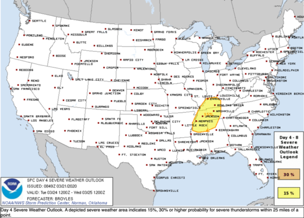
For now, this risk area is for locations north and west of the Birmingham area. So something we are going to be watching in the coming days. But for most of Alabama, expect rain and storms overnight Tuesday.
BEACH FORECAST CENTER: Get the latest weather and rip current forecasts for the beaches from Fort Morgan to Panama City on our Beach Forecast Center page. There, you can select the forecast of the region that you are interested in visiting.
WORLD TEMPERATURE EXTREMES: Over the last 24 hours, the highest observation outside the U.S. was 109.4F at Birni-N’Konni, Niger. The lowest observation was -84.3F at Amundsen-Scott South Pole Station, Antarctica.
CONTIGUOUS TEMPERATURE EXTREMES: Over the last 24 hours, the highest observation was 91F at Miles City, FL. The lowest observation was -15F at numerous locations across Minnesota.
WEATHER ON THIS DATE IN 1952: Severe thunderstorms spawned thirty-one tornadoes across Arkansas, Tennessee, Missouri, Mississippi, Alabama and Kentucky. The tornadoes killed 343 persons and caused 15 million dollars damage. Arkansas and Tennessee each reported thirteen tornadoes. The towns of Judsonia AR and Henderson TN were nearly wiped off the map in what proved to be the worst tornado outbreak of record for Arkansas. A tornado, one and a half miles wide at times, left a church the only undamaged building at Judsonia.
Category: ALL POSTS
About the Author (Author Profile)
Macon, Georgia Television Chief Meteorologist, Birmingham native, and long time Contributor on AlabamaWX. Stormchaser. I did not choose Weather, it chose Me. College Football Fanatic. @Ryan_StinnetSubscribe
If you enjoyed this article, subscribe to receive more just like it.


