

Nice Afternoon, Storms Arrive Later Tonight
It is another very nice and warm spring day across Alabama. We are seeing a mix of sun and clouds as we roll into the afternoon hours and we are dry across Alabama.
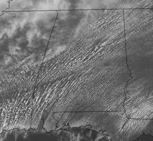
Temperatures are heading well into the 80s again this afternoon, flirting with record highs in portions of the state and for the rest of the daytime hours, it will remain dry.
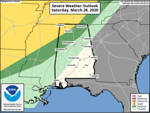
Now tonight, we are going to have a band of showers and storms moving into the state ahead of a cold front and some of these will be strong and potentially severe across northwestern portions of the state. Now this will be late tonight, 10PM at the earliest and then continue through the early morning hours. The SPC maintains a “slight risk” (level 2/5) of severe thunderstorms for the northwest corner of the state, with a “marginal risk” (level 1/5) as far south as Northport, Oneonta, and Fort Payne.
Storms could produce strong gusty winds and some hail over Northwest Alabama late tonight, but will be weakening as they move southeast through state as the better dynamics remain well north of the state and we lose instability with the loss of daytime heating. By the time they reach Tuscaloosa/Birmingham/Anniston/Gadsden we will be dealing with mostly rain with perhaps some embedded storms, but we are not expecting any severe storms. Rainfall amounts should be less than one-half inch for much of the area.
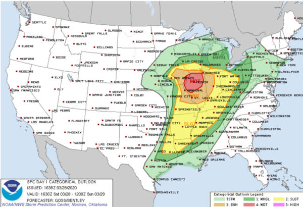
SEVERE WEATHER OUTBREAK: Not here thankfully, but this is the same system which could produce those stronger storms into Alabama later tonight. To our northwest, a significant severe-weather outbreak is expected for portions of the Midwest this afternoon and evening. A few long-tracked, significant tornadoes are possible, along with large, damaging hail and severe gusts. The SPC has much of northern Illinois highlighted in a “moderate risk” (level 4/5), with the lower risk categories extending out from there. Certainly a very dangerous and volatile situation in these areas.
COOLER SUNDAY: We are likely to start tomorrow off with lingering showers pushing southeast ahead of the front, but the activity will be dissipating and most of the rain will done by early afternoon. We should see a clearing sky from northwest to southeast through the afternoon. Highs tomorrow will be in the 70s.
DRY MONDAY: We will be in between systems on Monday, and the day itself will feature more clouds than sun, with slightly cooler temps as easterly flow will be in place across the state. Highs may struggle to reach the 70s across much of Central Alabama. On Monday, our next storm system will emerge out of the Desert Southwest and will cause the front to the south to begin to lift back north as warm front.
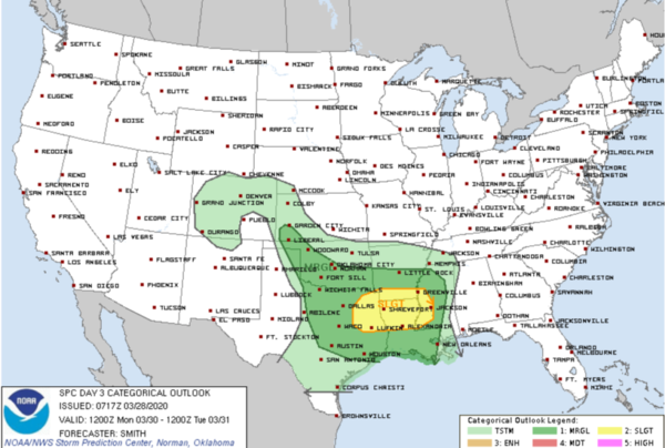
To our west, the SPC has much of the area from Texas to Mississippi highlighted in risk for severe weather, but no part of Alabama is included. Monday night, the front will begin lifting north across Alabama bringing a warm, unstable air mass back north into the state.
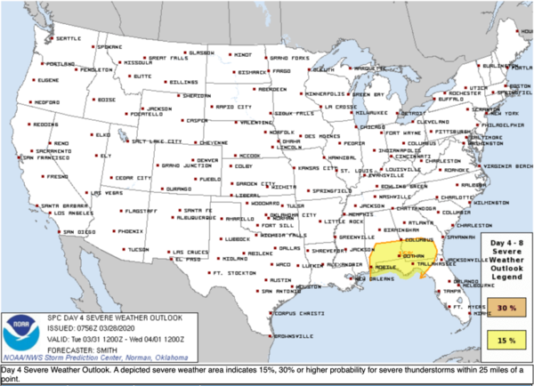
RAIN/STORMS TUESDAY: Early on Tuesday, showers and storms should be approaching Alabama as the low tracks east through the Southeast. For now, the models continue a track right across Central Alabama, which would keep the greatest threat of strong to severe storms across southern portions of the state. For now, in their Day 4 Outlook, the SPC has areas along and south of a line from Demopolis to Selma to Montgomery to Auburn highlighted in a risk for severe weather.
Of course, this could change in the coming days depending on the track of the low, and how far north the warm front makes into the state. So with this current model output, we will forecast rain and storms for much of North/Central Alabama by late morning and lasting through the afternoon hours until the associated cold front pushes through the state. We will keep the threat for severe storms across the southern portions of the state, where damaging winds, hail, and some tornadoes may be possible.
VERY SPRINGY REST OF WEEK: For Wednesday through Friday, a ridge builds in from the northwest and it will bring a cooler, drier air mass into the Southeast. We will have several days with seasonal temps across Alabama. Highs will range from the 60s and 70s each afternoon with more sun than clouds. Nights, will have a bit of chill in the air with 40s expected. Late Friday, we could have some showers move back into the state.
BEACH FORECAST CENTER: Get the latest weather and rip current forecasts for the beaches from Fort Morgan to Panama City on our Beach Forecast Center page. There, you can select the forecast of the region that you are interested in visiting.
WORLD TEMPERATURE EXTREMES: Over the last 24 hours, the highest observation outside the U.S. was 109.8F at Diffa, Niger. The lowest observation was -94.5F at Concordia, Antarctica.
CONTIGUOUS TEMPERATURE EXTREMES: Over the last 24 hours, the highest observation was 106F at Zapata, TX. The lowest observation was -7F at Peter Sinks, UT.
WEATHER ON THIS DATE IN 1987: A blizzard raged from southern Nebraska to central Iowa. Snowfall totals ranged up to 17 inches at Blue Hill NE. Winds gusted to 68 mph at Carroll IA. High winds produced snow drifts twenty feet high in western Iowa, and produced wind chill readings as cold as 30 degrees below zero in Nebraska. The snowfall total of 9.4 inches at Omaha NE was a record for the date.
Category: Alabama's Weather, ALL POSTS
About the Author (Author Profile)
Macon, Georgia Television Chief Meteorologist, Birmingham native, and long time Contributor on AlabamaWX. Stormchaser. I did not choose Weather, it chose Me. College Football Fanatic. @Ryan_StinnetSubscribe
If you enjoyed this article, subscribe to receive more just like it.


