

Another Beautiful & Warm Midday Across Central Alabama; Rain Returns Tomorrow
AT MIDDAY
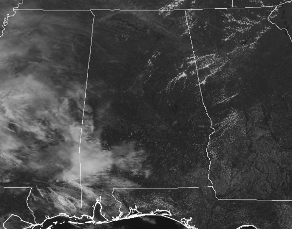
We have plenty of sunshine across Central Alabama as we have reached the midday hours on this nice and warm Monday. We do see some clouds starting to creep into the southwestern portions of the area and those will continue to move into the area throughout the rest of the day. Temperatures are in the upper 70s to the lower 80s across the area. Birmingham was at 81 degrees, tied with several locations as the warm spot. Cullman and Pell City were tied as the cool spots at 77 degrees.
REST OF TODAY
We’ll continue to have mostly sunny skies across Central Alabama throughout much of the afternoon hours before more clouds start to move in during the late afternoon and into the evening hours. We’ll stay dry for the most part throughout the night and overnight hours, but a few isolated showers may be possible over the extreme northern and northwestern parts of the area after midnight. Afternoon highs will get up into the lower to mid-80s across the area, with overnight lows dropping only into the lower to mid-60s.

TUESDAY
We’ll have increasing clouds along with the chance of showers and a few thunderstorms across Central Alabama throughout the day on Tuesday, with the better rain chances being over the western and southwestern parts of the area during the day. Once we lose the heating of the day, those rain chances will drop somewhat, but a small chance will remain through the late night and overnight hours.
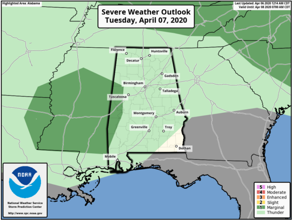
We may see a strong storm or two over the extreme west and southwestern parts of the area during the afternoon to early evening, and the SPC has placed those locations in a Marginal Risk for severe weather. Gusty winds will be the main threat with any storm that becomes strong. Afternoon highs will reach the mid-70s to the lower 80s.
ON THIS DAY IN WEATHER HISTORY
1936 – A tornado outbreak in the Deep South resulted in a total of 446 deaths and eighteen million dollars damage. It was a “Tale of Two Cities”. During the evening of the 5th a tornado hit Tupelo MS killing 216 persons, injuring 700 others, and causing three million dollars damage. The next morning the paths of two tornadoes met about 8:30 AM and cut a swath four blocks wide through Gainesville GA killing 203 persons, injuring 934, and causing thirteen million dollars damage. Eight to ten feet of debris filled the streets following the storm. At least 70 persons died in the Cooper Pants Factory, the greatest tornado toll of record for a single building.
Category: Alabama's Weather, ALL POSTS, Severe Weather
About the Author (Author Profile)
Scott Martin is an operational meteorologist, professional graphic artist, musician, husband, and father. Not only is Scott a member of the National Weather Association, but he is also the Central Alabama Chapter of the NWA president. Scott is also the co-founder of Racecast Weather, which provides forecasts for many racing series across the USA. He also supplies forecasts for the BassMaster Elite Series events including the BassMaster Classic.Subscribe
If you enjoyed this article, subscribe to receive more just like it.


