

CALL TO ACTION: Significant Severe Weather Threat Continues Overnight
Just a quick note to remind everyone that a significant severe weather event is expected still overnight and early Thursday morning for much of Alabama. Review your plan now.
CALL TO ACTION
You MUST have multiple ways to receive warnings overnight. Have your WeatherRadio programmed and on with fresh batteries. Have WEA alerts enabled on your phone. Don’t have your phone in Do Not Disturb mode. Have any weather apps set and running. Have your items including helmets, hard-soled shoes, and portable air horns.
If you live in a mobile or manufactured home, know where you are going to go, and leave yourself plenty of time to get to a shelter in plenty of time.
According to the Alabama Department of Public Health, your first priority has to be to protect yourself from a potential tornado. If a warning is issued for your area, you are more likely to be impacted by a tornado than the virus. If you plan on going to a community shelter, check now to make sure it is going to be open.
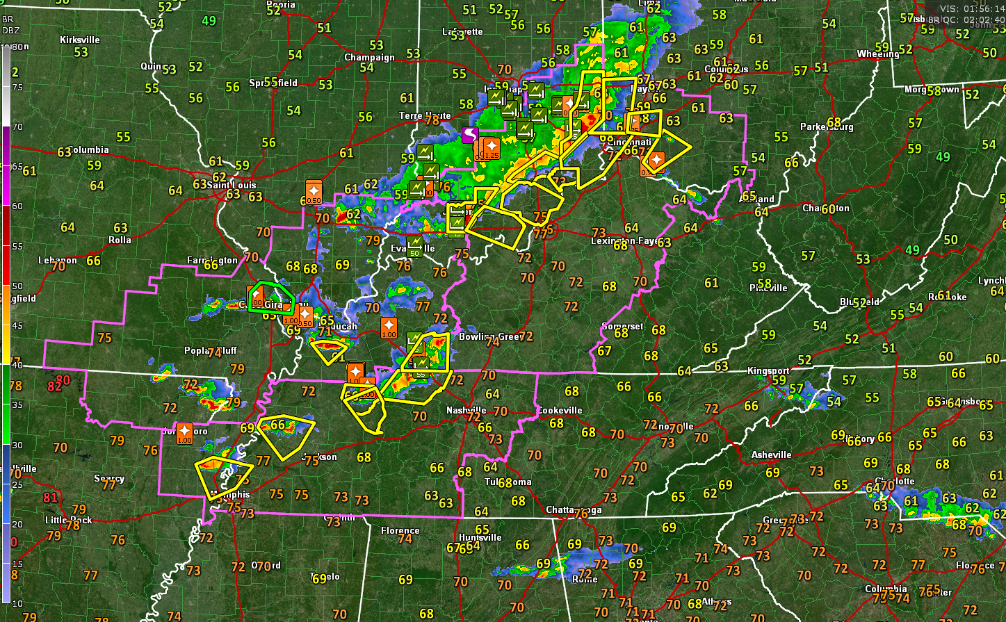
WEATHER UPDATE AT 9:08 PM
Dangerous storms are occurring tonight from western Ohio through southern Indiana/Illinois into Southeastern Missouri and northeastern Arkansas. Tornado watches extend from Ohio through Kentucky, Illinois, Indiana, into western Tennessee, Arkansas, and Missouri.
A tornado warning is in effect for a storm that will be passing south of Blytheville, Arkansas, north of Memphis.
A widespread damaging wind event is moving through the Ohio Valley tonight from southern Illinois, southern Indiana and entering northern Kentucky into western Ohio.
A squall line with damaging winds, large hail, and even tornadoes will move into North Alabama around 1-3 a.m., reaching the I-20 Corridor between 3-6 a.m.
The thing that makes this event very serious is that mid-level temperatures in the atmosphere are very cold, which will result in moderate instabilities being maintained all the to south of I-20. Strong bulk shear values around 60 knots will maintain the storms. Storm relative helicity values will be significant, around 140-180 m2/s2, so there will be a tornado threat with any supercells or bowing segments that form.
Projected Significant Tornado Values will be running 2-3 across North and Central Alabama, supporting that idea.
The squall line will push into South Central Alabama during the morning and perhaps all the way into South Alabama.
We will have frequent updates throughout the night and morning.
Category: Alabama's Weather, ALL POSTS, Severe Weather
About the Author (Author Profile)
Bill Murray is the President of The Weather Factory. He is the site's official weather historian and a weekend forecaster. He also anchors the site's severe weather coverage. Bill Murray is the proud holder of National Weather Association Digital Seal #0001 @wxhistorianSubscribe
If you enjoyed this article, subscribe to receive more just like it.


