


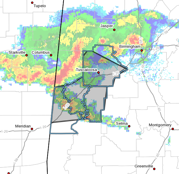
The National Weather Service in Birmingham has issued a
* Severe Thunderstorm Warning for…
Tuscaloosa County in west central Alabama…
Greene County in west central Alabama…
Hale County in west central Alabama…
Sumter County in west central Alabama…
* Until 630 AM CDT.
* At 534 AM CDT, severe thunderstorms were located along a line
extending from 6 miles west of Samantha to near Benevola to near
Panola, moving southeast at 55 mph.
HAZARD…60 mph wind gusts and quarter size hail.
SOURCE…Radar indicated.
IMPACT…Hail damage to vehicles is expected. Expect wind damage
to roofs, siding, and trees.
* Locations impacted include…
Tuscaloosa, Northport, Demopolis, Livingston, Eutaw, York,
Greensboro, Holt, Moundville, Lake View, Brookwood, Coaling, Vance,
Coker, Forkland, Akron, Boligee, Union, Gainesville and Epes.
PRECAUTIONARY/PREPAREDNESS ACTIONS…
For your protection move to an interior room on the lowest floor of a
building.


