

Significant Severe Weather Threat Sunday
NICE AFTERNOON: With sunshine in full supply, temperatures are mostly in the mid 70s this afternoon, right at seasonal averages for mid-April in Alabama. Tonight will be fair and cool with a low between 40 and 45 degrees for most places.
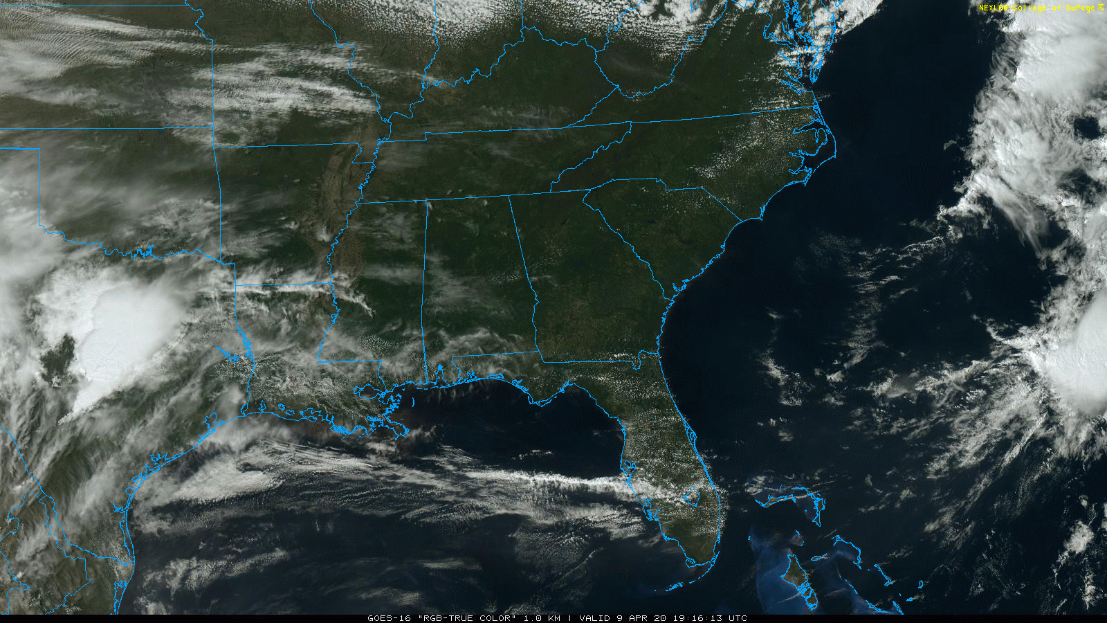
TOMORROW/SATURDAY: Dry weather continues. Tomorrow will be mostly sunny and cooler; the high will be in the mid 60s. Then, with clear sky and light wind, colder spots will dip into the 30s early Saturday morning with potential for some scattered light frost. Then, during the day Saturday, the sky will remain mostly sunny with a high in the 70-73 degree range. Clouds will roll in Saturday night.
EASTER SUNDAY SEVERE WEATHER THREAT: Weather parameters are falling into place for potential for a signifiant severe weather threat for the Deep South, including Alabama, on Sunday. An ejecting short wave trough is forecast to take on a neutral to somewhat negative tilt by Sunday afternoon as it moves quickly east-northeastward across the Southeast states. Rich low-level moisture will be drawn inland from the Gulf of Mexico in advance of a deepening surface low that will move from the mid-Mississippi Valley into the Ohio Valley by Monday morning.
We expect a very favorable environment for organized convection, including the potential for long-track supercells and a corresponding strong tornado risk. Very strong low/mid level flow fields will also support widespread damaging wind potential. For now it looks like the main window for severe storms will come from noon to midnight across the state; we will be much more specific on timing tomorrow.
SPC has defined an enhanced risk of severe storms Sunday for the southern half of the state; that will be, most likely, expanded northward on their new outlook issued late tonight.
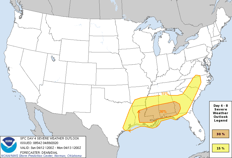
Sunday’s situation is complex when it comes to messaging; we don’t want to create more anxiety (there is enough of that in the world during these times)… but at the same time we have to clearly communicate that Sunday could be a signifiant severe weather day. Don’t be anxious, but prepared.
*Have a reliable way of getting warnings. A NOAA Weather Radio is the baseline; be sure Wireless Emergency Alerts (WEA) on your phone are enabled, and have the free ABC 33/40 app on your phone as well.
*Know your tornado action plan, and in that safe place have helmets, portable air horns, and hard sole shoes for everyone.
*If you live in a mobile home, know where you are going, and the quickest way of getting there.
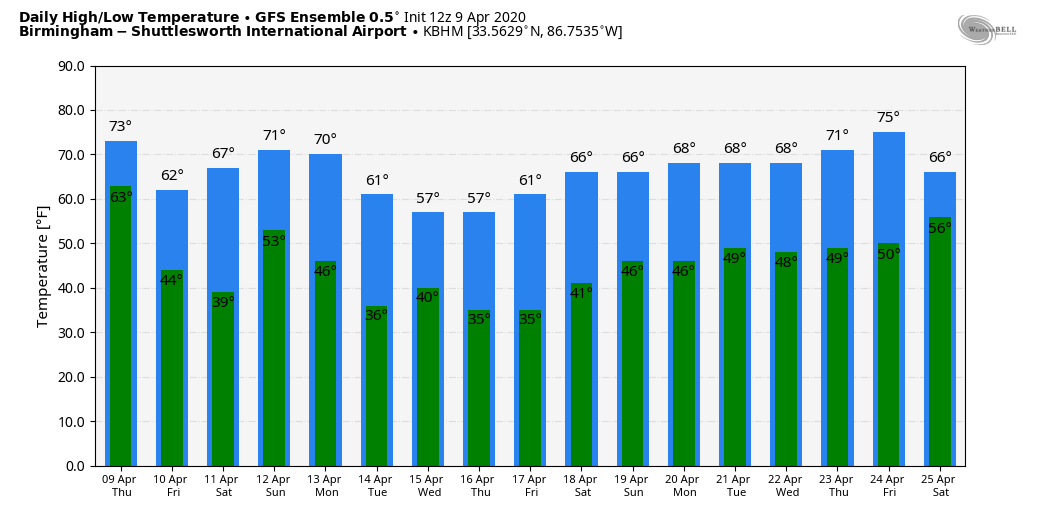
NEXT WEEK: The week looks mostly dry, but temperatures should be well below average. I expect multiple mornings with potential for a late season freeze or frost; growers will need to monitor temperature forecasts closely. See the Weather Xtreme video for maps, graphics, and more details.
ON THIS DATE IN 1947: An estimated F5 tornado struck Woodward, Oklahoma during the late evening killing 95 persons and causing six million dollars damage. The tornado, one to two miles in width, and traveling at a speed of 50 mph, killed a total of 167 persons along its 221-mile path from Texas into Kansas, injured 980 others, and caused nearly ten million dollars damage.
BEACH FORECAST: Click here to see the AlabamaWx Beach Forecast Center page.
WEATHER BRAINS: Don’t forget you can listen to our weekly 90 minute show anytime on your favorite podcast app. This is the show all about weather featuring many familiar voices, including our meteorologists here at ABC 33/40.
CONNECT: You can find me on all of the major social networks…
Facebook
Twitter
Instagram
Pinterest
Snapchat: spannwx
Look for the next Weather Xtreme video here by 7:00 a.m. tomorrow….
Category: Alabama's Weather, ALL POSTS, Weather Xtreme Videos
About the Author (Author Profile)
James Spann is one of the most recognized and trusted television meteorologists in the industry. He holds the AMS CCM designation and television seals from the AMS and NWA. He is a past winner of the Broadcast Meteorologist of the Year from both professional organizations.Subscribe
If you enjoyed this article, subscribe to receive more just like it.


