

CANCELED – Severe T-Storm Warning For Barbour & Bullock Counties Until 12:15 AM
The National Weather Service in Birmingham has issued a
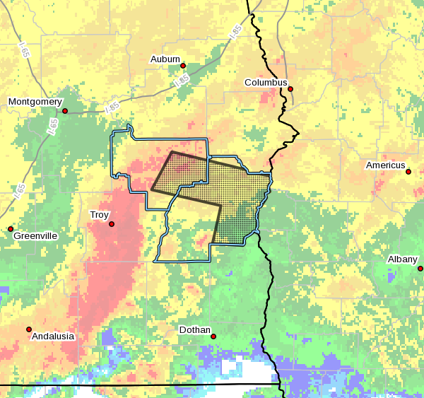
* Severe Thunderstorm Warning for…
Southeastern Bullock County in southeastern Alabama…
Northeastern Barbour County in southeastern Alabama…
* Until 1215 AM CDT.
* At 1115 PM CDT, severe thunderstorms were located along a line
extending from near Aberfoil to near Ariton, moving east at 65 mph.
HAZARD…70 mph wind gusts.
SOURCE…Radar indicated.
IMPACT…Expect considerable tree damage. Damage is likely to
mobile homes, roofs, and outbuildings.
* Locations impacted include…
Eufaula, Midway, Pickett, Hawkinsville, Aberfoil, Spring Hill,
Gaino, Comer, Barbour County Public Lake Dam, Osco, Richards
Crossroads, White Oak, Lakepoint Resort State Park, Batesville,
Lugo, Baker Hill, Three Notch and Mount Andrew.
PRECAUTIONARY/PREPAREDNESS ACTIONS…
A Tornado Watch remains in effect until 600 AM CDT for southeastern
Alabama.
For your protection move to an interior room on the lowest floor of a
building.
This is a DANGEROUS SITUATION. These storms are producing widespread
wind damage0. SEEK SHELTER NOW inside a sturdy structure and stay
away from windows!
Category: Alabama's Weather, ALL POSTS, Severe Weather
About the Author (Author Profile)
Scott Martin is an operational meteorologist, professional graphic artist, musician, husband, and father. Not only is Scott a member of the National Weather Association, but he is also the Central Alabama Chapter of the NWA president. Scott is also the co-founder of Racecast Weather, which provides forecasts for many racing series across the USA. He also supplies forecasts for the BassMaster Elite Series events including the BassMaster Classic.Subscribe
If you enjoyed this article, subscribe to receive more just like it.


