

Some Sun, Some Clouds, & Warm at Midday; Arthur Could Form as Early as Tonight
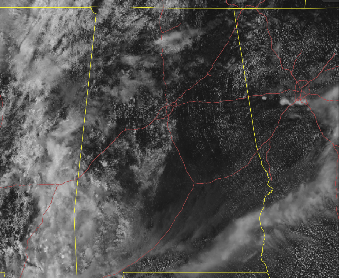
As of 12:00 pm on this Friday afternoon, we have a mix of sun and clouds across the area… more clouds are on the west side of Central Alabama with more sun over the east side. Nothing on radar at this point, but isolated to scattered showers and thunderstorms will be possible over the western third of the area.
Temperatures as of the 12:00 pm round-up were in the mid-70s to the lower 80s. Birmingham was at 81 degrees. Montgomery was the warm spot at 83 degrees. Haleyville was the cool spot at 75 degrees.
For the rest of the daylight hours, we’ll continue to have a mix of sun and clouds with convective clouds increasing a little with the heating of the day. Isolated to scattered showers and thunderstorms will be possible over the western parts of the area mainly west of a line from Jasper to Brent to Selma. Afternoon highs will be in the mid-80s to the right at or just over 90 degrees.
Some of those clouds and a few showers will continue to linger around during the evening hours, but skies will mostly clear out and showers will end by the late local news. Overnight lows will be in the lower to mid-60s.
Mainly the same story for your Saturday… More sun than clouds for most with a few more clouds for the extreme western parts of the area. A few isolated showers and storms will be possible over those extreme western locations, but overall chances will be very small. Afternoon highs will be in the mid-80s to the lower 90s.
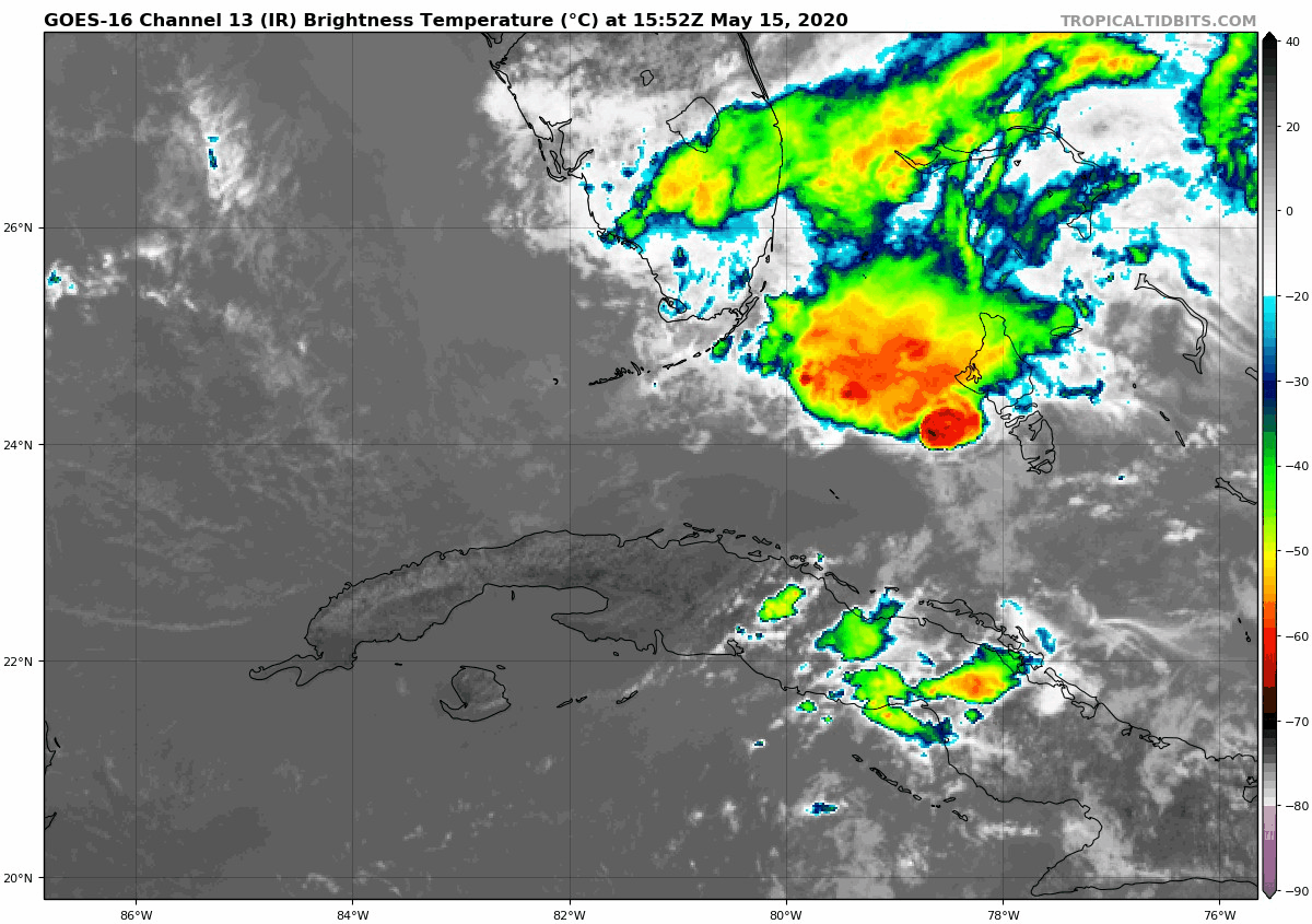
Tropical Storm Arthur is expected to form over the weekend, perhaps as early as late tonight, as conditions are starting to become more favorable for development. It is expected to move in a general northeastward direction eventually away from the Atlantic coastline of the Southeast US. Rough seas and gusty winds can be expected for the next couple of days in the Florida Keys, the southeastern parts of the Florida Peninsula, and in the Bahamas. Aircraft was scheduled to investigate the low today, but it has been postponed until Saturday. The next tropical update will be out around 2:00 pm this afternoon.
Category: Alabama's Weather, ALL POSTS, Tropical
About the Author (Author Profile)
Scott Martin is an operational meteorologist, professional graphic artist, musician, husband, and father. Not only is Scott a member of the National Weather Association, but he is also the Central Alabama Chapter of the NWA president. Scott is also the co-founder of Racecast Weather, which provides forecasts for many racing series across the USA. He also supplies forecasts for the BassMaster Elite Series events including the BassMaster Classic.Subscribe
If you enjoyed this article, subscribe to receive more just like it.


