

The Latest on Tropical Storm Arthur
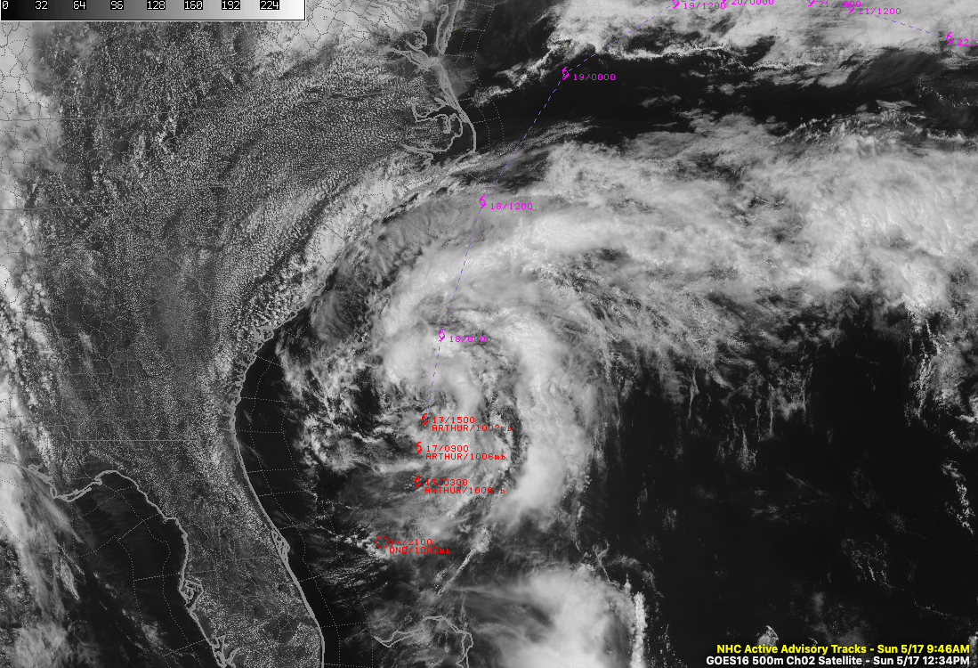
The center of Tropical Storm Arthur is 125 miles east of Jacksonville, Florida at this hour.
Top winds are 45 mph. The system is better organized on satellite presentations, but it still does not have substantial convection near the center. The storm is expected to slowly intensify over the next 24 hours and is forecast to have top winds of 60 mph as it brushes by North Carolina on Monday.
The center is forecast to pass within 100 miles of Cape Hatteras Monday during the late morning hours. Some of the models bring it directly over Hatteras, while some deflect it a little further off shore.
The central pressure is 1002 millibars.
Tropical storm warnings are in effect for the Outer Banks of North Carolina from Surf City to Duck, including the Albemarle and Pamlico Sounds. Winds of 40-50 mph with gusts to 65 mph are now expected at Hatteras. That wind threat has increased from previous forecasts. Storm surge of up to 2 feet is possible.
Dangerous wave action and rip currents will also affect the coastlines of the southeastern United States and Mid-Atlantic.
The storm will then serve to the northeast, east northeast, and even southeast over the next few days before wandering around the Atlantic, possibly until the end of the month, as a weak low pressure system.
About the Author (Author Profile)
Bill Murray is the President of The Weather Factory. He is the site's official weather historian and a weekend forecaster. He also anchors the site's severe weather coverage. Bill Murray is the proud holder of National Weather Association Digital Seal #0001 @wxhistorianSubscribe
If you enjoyed this article, subscribe to receive more just like it.


