

EXPIRED: Severe T-Storm Warning for Shelby Co. Until 5:30 pm
The National Weather Service in Birmingham has issued a
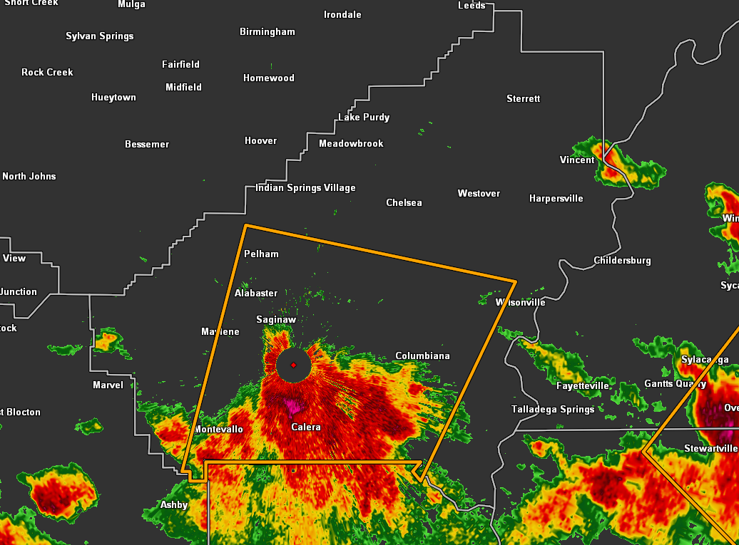
* Severe Thunderstorm Warning for…
Southern Shelby County in central Alabama…
* Until 530 PM CDT.
* At 453 PM CDT, a severe thunderstorm was located over Montevallo,
moving northeast at 20 mph.
HAZARD…Quarter size hail.
SOURCE…Radar indicated.
IMPACT…Damage to vehicles is expected.
* Locations impacted include…
Alabaster, Pelham, Helena, Calera, Montevallo, Columbiana,
Wilsonville, Wilton, American Village, University Of Montevallo,
Maylene, Shelby County Airport, Oak Mountain State Park, Shelby,
Ballantrae, Camp Branch, Saddle Lake Farms, Siluria, Alabaster
Veterans Park and Bounds Lake.
PRECAUTIONARY/PREPAREDNESS ACTIONS…
For your protection move to an interior room on the lowest floor of a
building.
Category: Alabama's Weather, ALL POSTS, Severe Weather
About the Author (Author Profile)
Scott Martin is an operational meteorologist, professional graphic artist, musician, husband, and father. Not only is Scott a member of the National Weather Association, but he is also the Central Alabama Chapter of the NWA president. Scott is also the co-founder of Racecast Weather, which provides forecasts for many racing series across the USA. He also supplies forecasts for the BassMaster Elite Series events including the BassMaster Classic.Subscribe
If you enjoyed this article, subscribe to receive more just like it.


