

Strong Storms Affecting Portions of Jefferson Co.
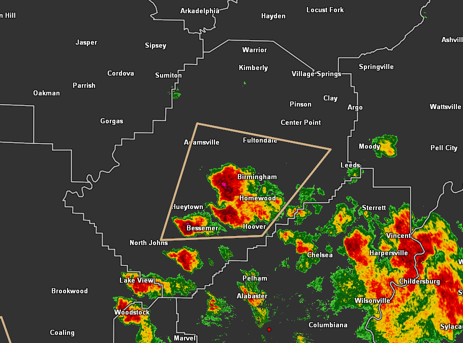
…SIGNIFICANT WEATHER ADVISORY FOR CENTRAL JEFFERSON COUNTY UNTIL
615 PM CDT…
At 545 PM CDT, Doppler radar was tracking a strong thunderstorm over
western Birmingham, moving northeast at 15 mph.
Pea size hail and winds in excess of 40 mph will be possible with
this storm.
Locations impacted include…
Birmingham, Hoover, Vestavia Hills, Bessemer, Homewood, Mountain
Brook, Hueytown, Irondale, Fairfield, Fultondale, Pleasant Grove,
Tarrant, Midfield, Adamsville, Brighton, Lipscomb, Graysville, Sylvan
Springs, Brookside and Mulga.
Category: Alabama's Weather, ALL POSTS, Severe Weather
About the Author (Author Profile)
Scott Martin is an operational meteorologist, professional graphic artist, musician, husband, and father. Not only is Scott a member of the National Weather Association, but he is also the Central Alabama Chapter of the NWA president. Scott is also the co-founder of Racecast Weather, which provides forecasts for many racing series across the USA. He also supplies forecasts for the BassMaster Elite Series events including the BassMaster Classic.Subscribe
If you enjoyed this article, subscribe to receive more just like it.


