

Rain & Strong Storms Continue as We Move into the Late Evening Hours
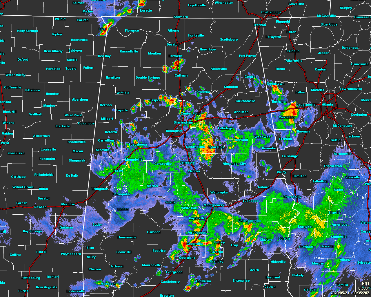
As of 7:38 pm, we continue to have strong storms affecting a good portion of the southern half of Central Alabama along with some strong storms moving into the extreme northwestern parts of North Alabama. The stronger storms remain capable of producing copious amounts of lightning, heavy rainfall, gusty winds, and small hail.
While the overall severe weather threat remains Marginal at best, we may see a storm or two go severe due to downburst winds from collapsing storms or for large hail reaching 1-inch in diameter (quarter size).
The activity across Central Alabama is generally moving to the east-northeast, but the storms in the northwestern parts of North Alabama are moving to the east-southeast.

A Flood Advisory was just issued until 9:30 pm tonight for portions of Blount, Jefferson, St. Clair, Shelby, Calhoun, and Talladega counties. Radar was indicating heavy rain due to thunderstorms which may cause urban and small stream flooding. Overflowing poor drainage areas will cause minor flooding in the advisory area. Between 1 and 2 inches of rain has fallen.
We’ll continue with scattered to numerous showers and thunderstorms at least through the late local news with everything tapering off after midnight.
Category: Alabama's Weather, ALL POSTS, Severe Weather
About the Author (Author Profile)
Scott Martin is an operational meteorologist, professional graphic artist, musician, husband, and father. Not only is Scott a member of the National Weather Association, but he is also the Central Alabama Chapter of the NWA president. Scott is also the co-founder of Racecast Weather, which provides forecasts for many racing series across the USA. He also supplies forecasts for the BassMaster Elite Series events including the BassMaster Classic.Subscribe
If you enjoyed this article, subscribe to receive more just like it.


