

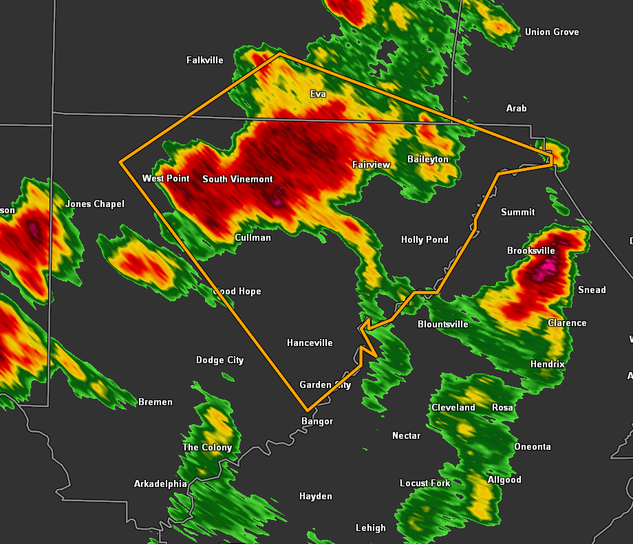
EXPIRED: Severe T-Storm Warning for Cullman & Morgan Co. Until 8:45 pm
The National Weather Service in Huntsville Alabama has issued a
* Severe Thunderstorm Warning for…
Northeastern Cullman County in north central Alabama…
South central Morgan County in north central Alabama…
* Until 845 PM CDT.
* At 817 PM CDT, a severe thunderstorm was located near Cullman,
moving southeast at 15 mph.
HAZARD…60 mph wind gusts.
SOURCE…Radar indicated.
IMPACT…Expect damage to roofs, siding, and trees.
* Locations impacted include…
Cullman, Hanceville, Good Hope, Holly Pond, Baldwin, Vinemont,
Baileyton, West Point, Eva and Garden City.
PRECAUTIONARY/PREPAREDNESS ACTIONS…
Torrential rainfall is occurring with this storm, and may lead to
flash flooding. Do not drive your vehicle through flooded roadways.
Category: Alabama's Weather, ALL POSTS, Severe Weather
About the Author (Author Profile)
Scott Martin is an operational meteorologist, professional graphic artist, musician, husband, and father. Not only is Scott a member of the National Weather Association, but he is also the Central Alabama Chapter of the NWA president. Scott is also the co-founder of Racecast Weather, which provides forecasts for many racing series across the USA. He also supplies forecasts for the BassMaster Elite Series events including the BassMaster Classic.Subscribe
If you enjoyed this article, subscribe to receive more just like it.


