

CANCELED: Severe T-Storm Warning for Madison Co. Until 9:45 pm
The National Weather Service in Huntsville Alabama has issued a
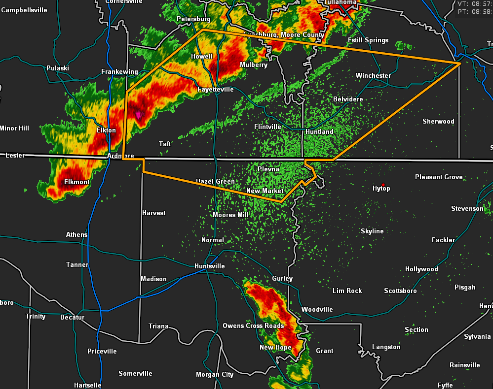
* Severe Thunderstorm Warning for…
Northern Madison County in north central Alabama…
Southeastern Moore County in Middle Tennessee…
Lincoln County in Middle Tennessee…
Southern Franklin County in Middle Tennessee…
* Until 945 PM CDT.
* At 859 PM CDT, severe thunderstorms were located along a line
extending from 7 miles west of Lynchburg to Ardmore, moving east at
40 mph.
HAZARD…60 mph wind gusts.
SOURCE…Radar indicated.
IMPACT…Expect damage to roofs, siding, and trees.
* Locations impacted include…
Winchester, Fayetteville, Lynchburg, Hazel Green, Decherd, Cowan,
Ardmore, Huntland, Tims Ford Lake and Sewanee.
PRECAUTIONARY/PREPAREDNESS ACTIONS…
For your protection move to an interior room on the lowest floor of a
building.
Hail up to the size of nickels and damaging winds and continuous
cloud to ground lightning is occurring with these storms. Move
indoors immediately.
Category: Alabama's Weather, ALL POSTS, Severe Weather
About the Author (Author Profile)
Scott Martin is an operational meteorologist, professional graphic artist, musician, husband, and father. Not only is Scott a member of the National Weather Association, but he is also the Central Alabama Chapter of the NWA president. Scott is also the co-founder of Racecast Weather, which provides forecasts for many racing series across the USA. He also supplies forecasts for the BassMaster Elite Series events including the BassMaster Classic.Subscribe
If you enjoyed this article, subscribe to receive more just like it.


