

A Few Scattered Storms Today; A Dry Weekend Ahead
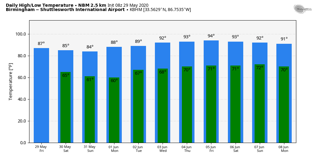
WARM, HUMID DAY: We note a few scattered showers on radar early this morning over Northwest Alabama… we will maintain a chance of scattered showers and thunderstorms across the state today as a surface front approaches. We are not expecting any severe storms, and some places won’t see any rain due to the scattered nature of the showers. Otherwise, we will see a mix of sun and clouds today with a high in the mid-80s.
THE ALABAMA WEEKEND: Unusually dry air for late May will roll into the northern two-thirds of the state tomorrow; the sky will be mostly sunny with a high in the mid-80s. Any showers tomorrow should be confined to the far southern counties of the state. Sunday promises to be a delightful day with sunshine in full supply and lower humidity levels. We start the day in the 57-67 degree range, followed by a high in the low to mid-80s.
NEXT WEEK: Monday morning will be refreshing with lows in the 50s in many areas; the sky will stay sunny with a high in the 80s. Then, expect slowly rising heat and humidity levels for the rest of the week… we could see 90-degree heat by Thursday and Friday. The weather will be generally dry, although a few isolated showers are possible over the latter half of the week. See the Weather Xtreme video for maps, graphics, and more details.
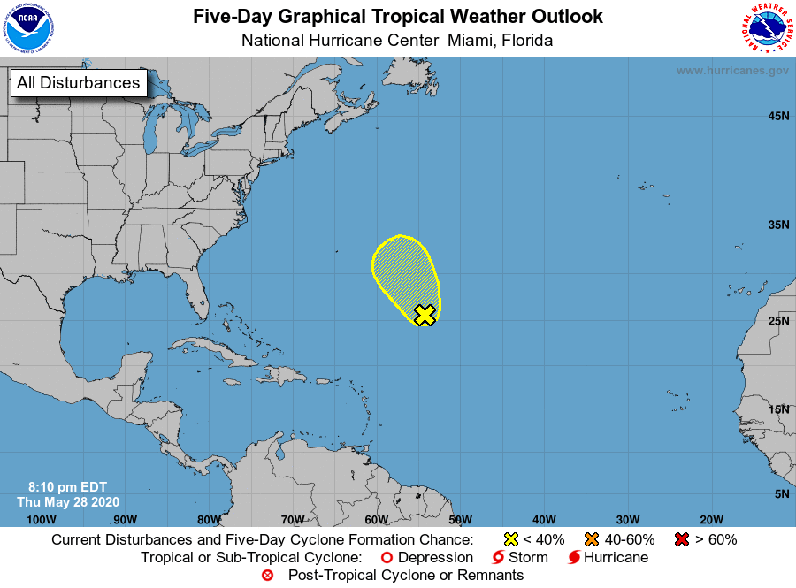
TROPICS: A surface trough and associated upper-level disturbance are producing disorganized shower activity and gusty winds over the central Atlantic Ocean several hundred miles east-southeast of Bermuda. Gradual development of this system is possible, and it could acquire some subtropical characteristics on Friday and Saturday as it moves generally northward. Development is not expected after that time due to unfavorable environmental conditions.
We also note that global models show potential for a tropical low to form over the western Gulf of Mexico in the 6-10 day range; way too early to know if a depression or storm will form in the region… just something to watch for now.
ON THIS DATE IN 1982: Two significant tornadoes ripped through southern Illinois. The most severe was an F4 that touched down northeast of Carbondale, Illinois then moved to Marion. The twister had multiple vortices within the main funnel. Extensive damage occurred at the Marion Airport. A total of 10 people were killed, and 181 were injured. 648 homes and 200 cars were damaged or destroyed, with total damages around $100 million.
BEACH FORECAST: Click here to see the AlabamaWx Beach Forecast Center page.
WEATHER BRAINS: Don’t forget you can listen to our weekly 90 minute show anytime on your favorite podcast app. This is the show all about weather featuring many familiar voices, including our meteorologists here at ABC 33/40.
CONNECT: You can find me on all of the major social networks…
Facebook
Twitter
Instagram
Pinterest
Snapchat: spannwx
Look for the next Weather Xtreme video here by 4:00 this afternoon… enjoy the day!
Category: Alabama's Weather, ALL POSTS, Weather Xtreme Videos
About the Author (Author Profile)
James Spann is one of the most recognized and trusted television meteorologists in the industry. He holds the AMS CCM designation and television seals from the AMS and NWA. He is a past winner of the Broadcast Meteorologist of the Year from both professional organizations.Subscribe
If you enjoyed this article, subscribe to receive more just like it.


