

Mostly Sunny & Very Warm at Midday; No Rain At This Time
WHAT’S HAPPENING AT MIDDAY
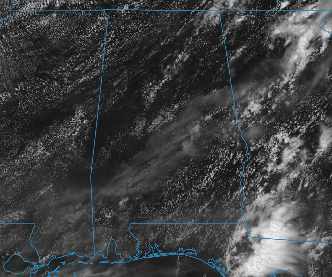
We have a decent amount of sunshine across the area as of 12:30 pm with only a few clouds dotting the skies overhead. We are dry at this point with nothing showing up on radar. Temperatures as of the noon round-up were in the upper 70s to the mid-80s across Central Alabama. Haleyville was the cool spot at 77 degrees. Montgomery and Troy were tied as the warm spots at 85 degrees. Birmingham was at 81 degrees.
SCATTERED SHOWERS & STORMS POSSIBLE LATER TODAY
Skies will be mostly sunny to partly cloudy throughout the rest of the afternoon and early evening hours, but we’ll also have a decent chance of scattered showers and thunderstorms with most of the coverage occurring over the southern parts of the area. Highs will reach the lower 80s in the northwest to the mid to upper 80s in the southeast. Any shower or thunderstorm activity will come to an end later tonight and we’ll be dry for the overnight hours. Lows will be in the upper 50s to the upper 60s.
THE CENTRAL ALABAMA WEEKEND
The upper low causing all of the unsettled weather will be far enough away that our weather will become dry for the most part and a touch cooler for the end of Meteorological Spring. We’ll have a good bit of sunshine on Saturday but a few showers and thunderstorms will be possible south of a line from Demopolis to Clanton to Roanoke. Highs will be in the lower 80s to near 90 degrees from northwest to southeast.
Sunday will feature near-maximum sunshine and dry weather with highs reaching the lower to mid-80s for most. Temperatures may be slightly warmer south of the I-85 corridor in the southeastern parts of the area.
A DRY START TO METEOROLOGICAL SUMMER
Monday looks to be a dry day with lower humidity values. Highs will be in the mid to upper 80s. Humidity levels start to creep back up and we’ll have a small chance of afternoon showers and storms on Tuesday. Highs will be in the upper 80s to the lower 90s. Those hot temperatures will stick around for Wednesday and Thursday with only a small chance of a scattered afternoon shower or storm to try to break the heat. Wednesday’s highs will be in the lower 90s with Thursday’s highs reaching the lower to mid-90s.
THE TROPICS
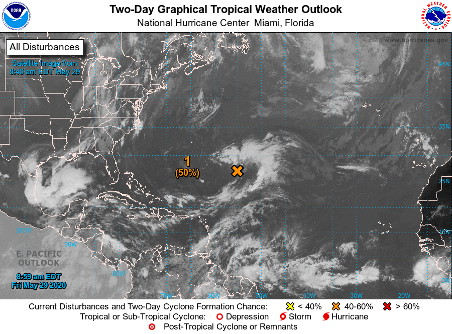
The disturbance out in the Atlantic Ocean has now been classified as Invest 92L and may actually organize into a subtropical depression later tonight or on Saturday. Conditions after Saturday will become unfavorable for development as it moves generally to the north. It has been given a 50/50 chance of becoming a depression.
ON THIS DAY IN WEATHER HISTORY
1953 – A tornado, 600 yards wide at times, killed two persons on its 20-mile path from southwest of Fort Rice ND into Emmons County. Nearly every building in Fort Rice was damaged. The Catholic church was leveled, with some pews jammed four feet into the ground.
1990 – Afternoon and evening thunderstorms produced severe weather from north-central Colorado to the northern half of Texas. Severe thunderstorms spawned four tornadoes, and there were seventy reports of large hail or damaging winds. Midday thunderstorms produced wind gusts to 90 mph at Hobart, OK, and produced up to three and a half inches of rain in eastern Colorado in four hours.
BEACH FORECAST
Get the latest weather and rip current forecasts for the beaches from Bay St. Louis, MS, to Panama City Beach, FL, on our Beach Forecast Center page. There, you can select the forecast of the region that you are interested in.
ADVERTISE ON THE BLOG!
We had another fantastic year in 2019 with just over 17 million page views! That brings our total for the last 2 years close to 37 million page views! Don’t miss out! We can customize a creative, flexible, and affordable package that will suit your organization’s needs. Contact Bill Murray at (205) 687-0782.
E-FORECAST
Get the Alabama Wx Weather Blog’s Seven-Day Forecast delivered directly to your inbox by email twice daily. It is the most detailed weather forecast available in Central Alabama. Subscribe here… It’s free!
CONNECT WITH THE BLOG ON SOCIAL MEDIA
You can find the AlabamaWx Weather Blog on the major social media networks:
Facebook
Twitter
Instagram
Category: Alabama's Weather, ALL POSTS, Tropical
About the Author (Author Profile)
Scott Martin is an operational meteorologist, professional graphic artist, musician, husband, and father. Not only is Scott a member of the National Weather Association, but he is also the Central Alabama Chapter of the NWA president. Scott is also the co-founder of Racecast Weather, which provides forecasts for many racing series across the USA. He also supplies forecasts for the BassMaster Elite Series events including the BassMaster Classic.Subscribe
If you enjoyed this article, subscribe to receive more just like it.


