

Weather Xtreme: Mainly Dry Today & Staying Dry Through Much of Next Week
A Significant Weather Advisory in effect through 8:00 am for Colbert, Cullman, DeKalb, Franklin, Jackson, Lauderdale, Lawrence, Limestone, Madison, Marshall, and Morgan counties in North Alabama for patchy dense fog.
For today, we’ll start off with a cold front moving through the extreme southeastern portions of the area, and that will provide just enough energy for a few scattered showers and storms to form. We’ll have partly to mostly sunny skies across the area with only a small chance of a few scattered afternoon showers and thunderstorms in the southern parts of the area mainly south of a line from Demopolis to Clanton to Alexander City. Highs will range in the lower 80s in the northwest to the upper 80s in the southeast.
High pressure will be to our north on Sunday which will be feeding us drier, continental air in from the west and northwest. Dewpoints will be down in the mid to upper 50s across much of the area and that will make our day feel more comfortable. We’ll have near-maximum sunshine across the area. Afternoon highs will top out in the 80s across the area.
Unfortunately, we’ll start to see those dewpoints start to rise on Monday and it will feel a little more humid and sticky. Skies will feature plenty of sunshine and very little in the way of clouds. Afternoon highs look to top out in the mid-80s to the lower 90s across the area.
On Tuesday, the high will be centered just off of the North Carolina coast which will allow for more moisture to move into the area, and dewpoints will be in the mid to upper 60s. Skies will be mostly sunny across the area throughout the day. Afternoon highs will be in the upper 80s to the lower 90s.
Even though it will be a beautiful day on Wednesday, the combination of hot temperatures and higher dewpoints will make it feel uncomfortable. We’ll have plenty of sun with only a few clouds. Highs will top out in the lower 90s across the area.
On Thursday, a center of low pressure will be located back to our west over the northern parts of Texas that will allow for more moisture to be pushed into our neck of the woods. We look to stay mainly dry with mostly sunny skies, but an isolated shower can’t be ruled out for the northern parts of the area during the afternoon. It will be hot and humid with highs in the lower to mid-90s.
Nearly the same story on Friday… We’ll have more sun than clouds with only a very small chance of an isolated shower or two during the afternoon. Highs look to top out in the lower to mid-90s across the area.
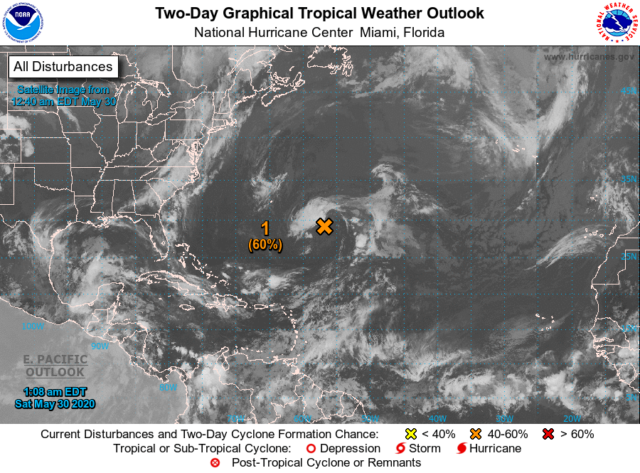
For the tropics, we have a broad low out over the open waters of the Central Atlantic that has a 60% chance of becoming a subtropical depression later today. It will be no threat to the US Mainland as it will move generally tot he north. Conditions will become unfavorable for further development after today.
Category: Alabama's Weather, ALL POSTS, Weather Xtreme Videos
About the Author (Author Profile)
Scott Martin is an operational meteorologist, professional graphic artist, musician, husband, and father. Not only is Scott a member of the National Weather Association, but he is also the Central Alabama Chapter of the NWA president. Scott is also the co-founder of Racecast Weather, which provides forecasts for many racing series across the USA. He also supplies forecasts for the BassMaster Elite Series events including the BassMaster Classic.Subscribe
If you enjoyed this article, subscribe to receive more just like it.


