

First Day of the Season & TD3 Forms Over the Bay of Campeche

It is just the first day of the Atlantic Hurricane Season and we already have our third tropical depression in the Atlantic basin for 2020. Here is the latest from the National Hurricane Center:
SUMMARY OF 400 PM CDT…2100 UTC…INFORMATION
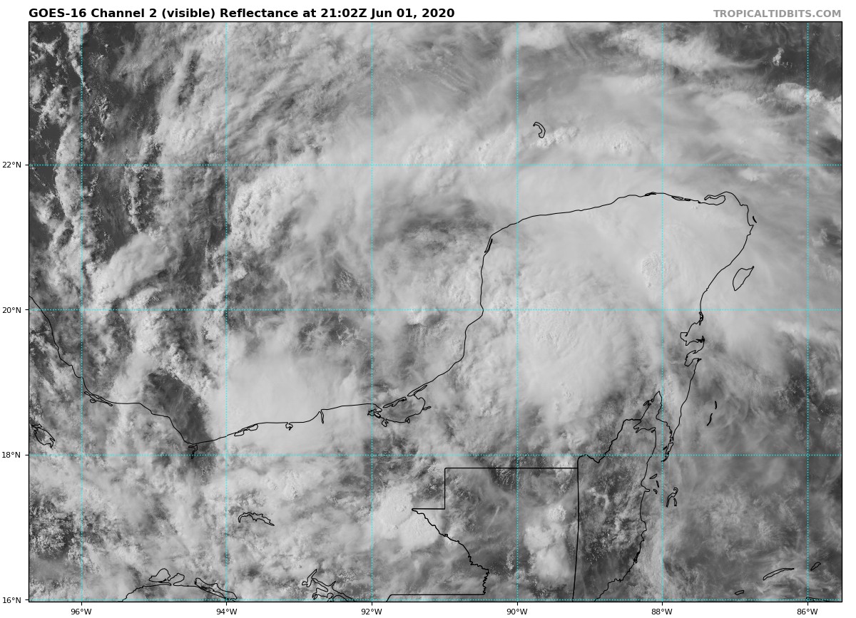
LOCATION…19.6N 91.2W
ABOUT 50 MI…80 KM WSW OF CAMPECHE MEXICO
ABOUT 230 MI…370 KM ENE OF COATZACOALCOS MEXICO
MAXIMUM SUSTAINED WINDS…30 MPH…45 KM/H
PRESENT MOVEMENT…WNW OR 290 DEGREES AT 7 MPH…11 KM/H
MINIMUM CENTRAL PRESSURE…1007 MB…29.74 INCHES
SUMMARY OF WATCHES AND WARNINGS IN EFFECT
A Tropical Storm Warning is in effect for…
* Campeche to Puerto de Veracruz
DISCUSSION AND OUTLOOK
At 400 PM CDT (2100 UTC), the center of Tropical Depression Three was located near latitude 19.6 North, longitude 91.2 West. The depression is moving toward the west-northwest near 7 mph (11 km/h). This motion at a slower forward speed is expected tonight. The depression is forecast to turn west-southwestward or southward at a slower forward speed on Tuesday and meander over the southern Bay of Campeche through late Wednesday. On the forecast track, the center of the cyclone is forecast to be near the coast of the southern Bay of Campeche Tuesday night through Thursday.
Maximum sustained winds are near 30 mph (45 km/h) with higher gusts. Gradual strengthening is expected during the next couple of days and the depression is forecast to become a tropical storm tonight or Tuesday.
The estimated minimum central pressure is 1007 MB (29.74 inches).
HAZARDS AFFECTING LAND
RAINFALL … Tropical Depression Three is expected to produce rain accumulations of 10 to 15 inches over parts of the Mexican states of Tabasco and Veracruz and adjacent portions of Guatemala. This system is also expected to produce rain accumulations of 5 to 10 inches over parts of El Salvador and Honduras. Isolated maximum rainfall amounts of 20 inches are possible in the Mexican states of Tabasco, Veracruz, Oaxaca, and portions of Guatemala. This rainfall may produce life-threatening flash floods and mudslides.
WIND … Tropical storm conditions are expected to first reach the coast within the warning area Tuesday night.
KEY MESSAGES
1. The depression is expected to bring heavy rainfall to portions of southern Mexico, Guatemala, Honduras, and El Salvador, which could cause life-threatening flash flooding and mudslides.
2. Tropical storm conditions are expected along the coast of Mexico where a tropical storm warning is in effect.
3. The system is forecast to begin moving northward across the Gulf of Mexico later this week. However, it is too soon to specify the location and timing of any potential impacts along the U.S. Gulf Coast. Interests in these areas should monitor the progress of this system through the week and ensure they have their hurricane plan in place as we begin the season.
About the Author (Author Profile)
Scott Martin is an operational meteorologist, professional graphic artist, musician, husband, and father. Not only is Scott a member of the National Weather Association, but he is also the Central Alabama Chapter of the NWA president. Scott is also the co-founder of Racecast Weather, which provides forecasts for many racing series across the USA. He also supplies forecasts for the BassMaster Elite Series events including the BassMaster Classic.Subscribe
If you enjoyed this article, subscribe to receive more just like it.


