Alabama 811 | Know What's Below.

Another Strong Storm Affecting Jefferson & Shelby Counties

| June 5, 2020 @ 1:40 pm

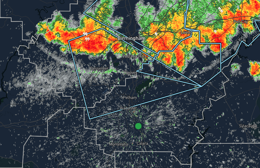
…SIGNIFICANT WEATHER ADVISORY FOR CENTRAL SHELBY AND SOUTHEASTERN
JEFFERSON COUNTIES UNTIL 230 PM CDT…

At 138 PM CDT, Doppler radar was tracking a strong thunderstorm over
Brighton, or over Hueytown, moving southeast at 20 mph.

Pea size hail and winds in excess of 40 mph will be possible with
this storm.

Locations impacted include…
Southwestern Birmingham, Hoover, Vestavia Hills, Alabaster, Bessemer,
Homewood, Pelham, Mountain Brook, Helena, Hueytown, Fairfield,
Chelsea, Pleasant Grove, Midfield, Adamsville, Brighton, Indian
Springs Village, Lipscomb, Sylvan Springs and Westover.

Category: Alabama's Weather, ALL POSTS, Severe Weather

About the Author ()

Scott Martin is an operational meteorologist, professional graphic artist, musician, husband, and father. Not only is Scott a member of the National Weather Association, but he is also the Central Alabama Chapter of the NWA president. Scott is also the co-founder of Racecast Weather, which provides forecasts for many racing series across the USA. He also supplies forecasts for the BassMaster Elite Series events including the BassMaster Classic.

Comments are closed.