

Saturday Morning Update On Tropical Storm Cristobal
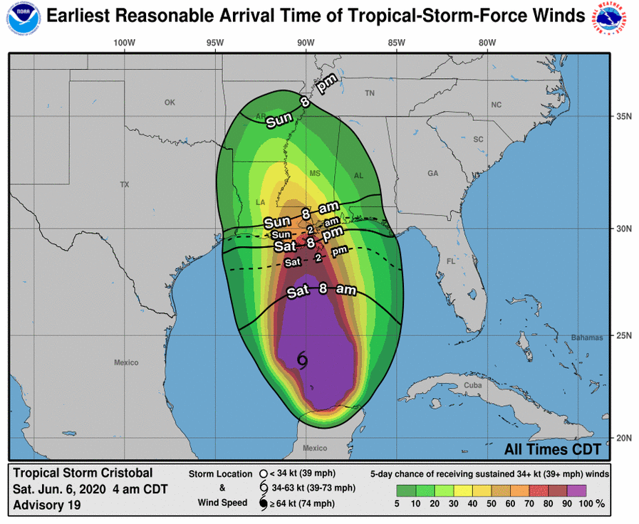
CURRENT POSITION: This morning at 7:00a CT the center of Tropical Storm Cristobal was located near latitude 23.9 North, longitude 90.2 West. Cristobal is moving toward the north near 12 mph (19 km/h), and this general motion is expected to continue for the next couple of days. On the forecast track, the center of Cristobal will move northward over the central Gulf of Mexico today and will be near the northern Gulf of Mexico coast on Sunday. Cristobal’s center is then forecast to move inland across Louisiana late tomorrow and Monday morning and across Arkansas Monday afternoon and Monday night.
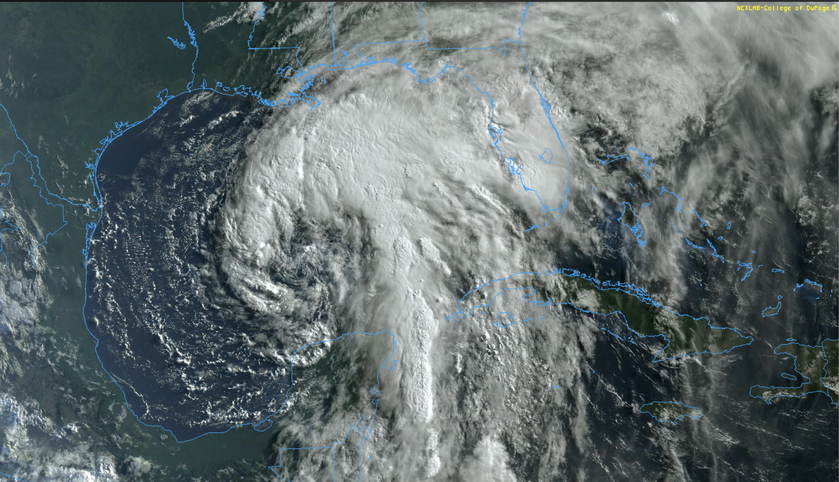
Maximum sustained winds are near 50 mph (85 km/h) with higher gusts. Some additional slow strengthening is forecast until landfall occurs on the northern Gulf coast. Weakening will begin once Cristobal moves inland late Sunday and Monday. The minimum central pressure estimated from Air Force Hurricane Hunter aircraft observations is 992 mb (29.29 inches).
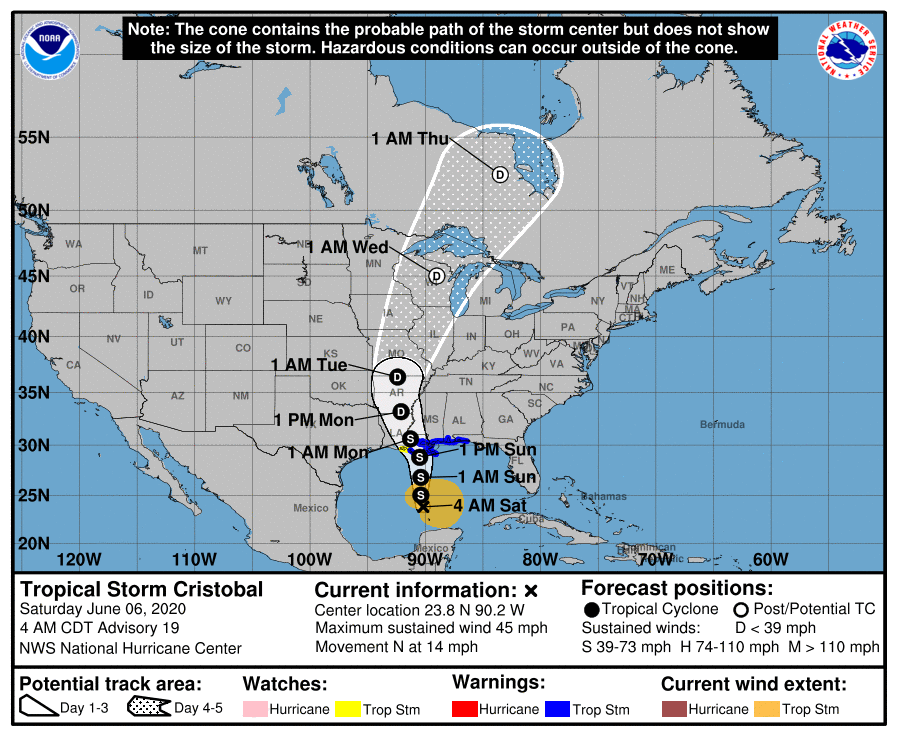
Cristobal is not expected to be a hurricane at the time of landfall due to mid-level dry air, and moderate shear across the Gulf of Mexico. We should also note that Cristobal is likely to remain a broad and asymmetric storm when it makes landfall. Don’t focus on the exact forecast path as the associated winds, storm surge, and rainfall will extend well to the east of the center.
SOUTHEAST LOUISIANA/COASTAL MISSISSIPPI: There is a danger of life-threatening storm surge outside of the Hurricane and Storm Damage Risk Reduction System from the Mouth of the Mississippi River to Ocean Springs, Mississippi, and a Storm Surge Warning is in effect for those areas. Life-threatening storm surge remains possible along the Florida Big Bend and in other portions of southern and southeastern Louisiana where a Storm Surge Watch is in effect. Residents in these locations should follow advice given by local emergency officials.
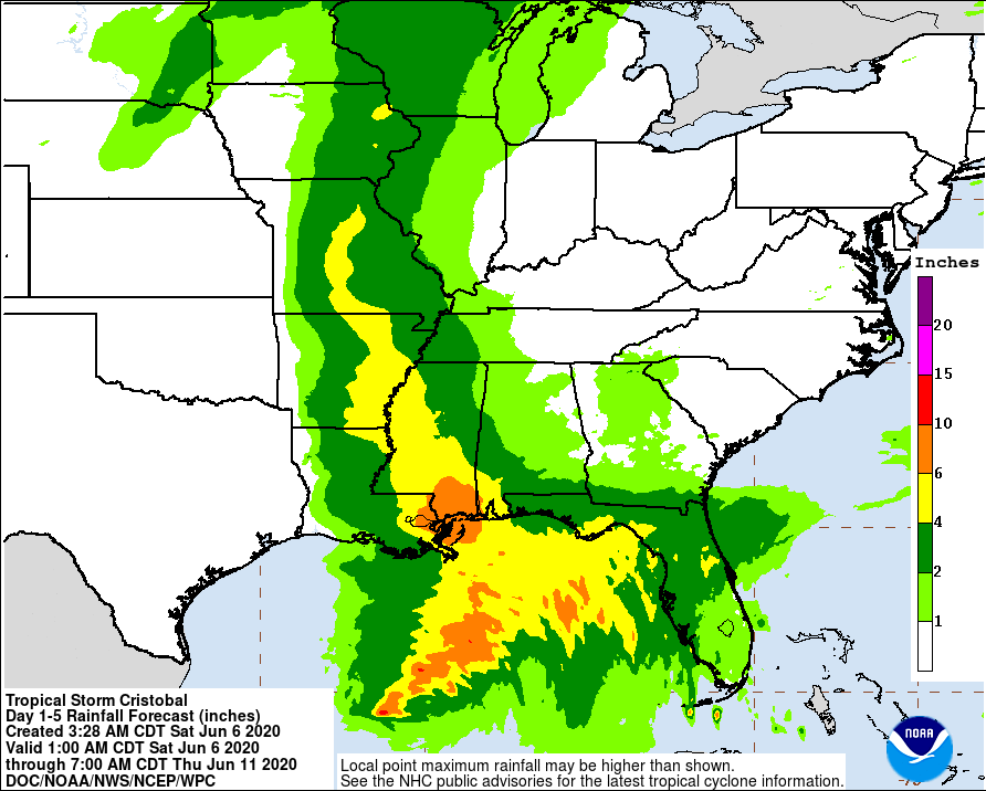
Freshwater flooding is also likely; rain amounts of 6 to 10 inches are possible across parts of Southeast Louisiana and far South Mississippi.
ALABAMA/NORTHWEST FLORIDA: This part of the discussion applies to the region from Dauphin Island and Gulf Shores east to Panama City Beach.
Rain from the initial feeder band will spread into the coast later this morning. and periods of rain are likely this afternoon and tonight. Tomorrow will be windy with occasional tropical showers, but it won’t rain all day, and you might even see some filtered sunshine at times. Here are the biggest issues for the Alabama and Northwest Florida coasts:
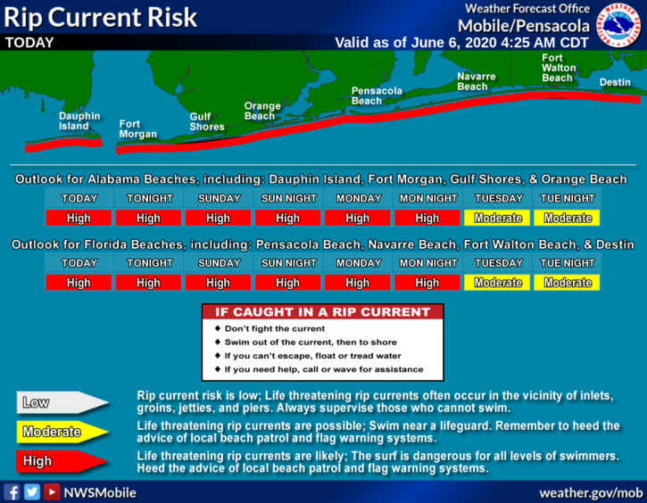
*RIP CURRENTS: The threat of dangerous rip currents will continue through Monday, and red flags continue to fly. Don’t get in the water. Conditions will improve Tuesday.
*FLOODING: Rain amounts of 2-6 inches are possible over the next 48 hours; a flash flood watch is in effect for Mobile, Baldwin, and Washington counties in Alabama, and for Escambia, Santa Rosa, and Okaloosa counties in Florida. Heavier rain totals are likely over far Southwest Alabama, with lighter amounts to the east.
*WIND: Sustained winds of 20-30 mph are likely tomorrow and tomorrow night, with possible gusts to 45 mph. The higher wind velocities will be to the west over coastal Mississippi and Southeast Louisiana.
*TORNADOES: A few brief tornadoes or waterspouts are possible tomorrow and tomorrow night, especially south of I-10.
The weather will improve on the Gulf Coast Monday, and most of next week will feature routine June weather with 7-9 hours of sunshine daily along with the usual risk of a passing shower or storm from time to time.
INLAND ALABAMA: The weather over the northern half of Alabama will be relatively dry today and tomorrow with only isolated showers; the sky will be partly sunny with highs around 90. Showers and storms become more likely by Tuesday and Wednesday of next week as deeper moisture is pulled northward ahead of an approaching surface front.
Category: Alabama's Weather, Tropical
About the Author (Author Profile)
James Spann is one of the most recognized and trusted television meteorologists in the industry. He holds the AMS CCM designation and television seals from the AMS and NWA. He is a past winner of the Broadcast Meteorologist of the Year from both professional organizations.Subscribe
If you enjoyed this article, subscribe to receive more just like it.


