


An upper-level trough is strengthening over the Midwest this morning. Strong surface high pressure remains well to our east, and southwesterly flow is strengthening between it and low pressure to the west.
Temperatures are warming into the 80s now. With dewpoints in the upper 60s to near 70F, instabilities are increasing, especially south of I-20. They will be increasing area-wide through the afternoon.
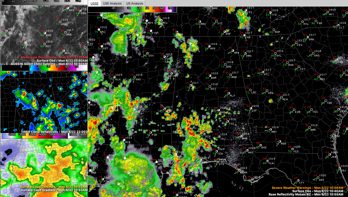
Showers and storms are increasing over Southwest Alabama, This activity will push northeastward across Central Alabama this afternoon, in areas generally south of I-59.
Storms are also increasing over eastern Louisiana and western Mississippi. This activity will move across the rest of West Central and North Alabama also this afternoon.
Some of the storms will be strong to severe in isolated cases, producing damaging wind gusts. They will also produce deadly lightning, heavy rain, and even some small hail.
It looks like another round will push across North and North Central Alabama late tonight, but those don’t appear that they will be as strong.
More showers and storms will occur tomorrow as the trough gets closer. The storms could be strong to severe again tomorrow.


