

Strong Storms Lifting Across Central Alabama
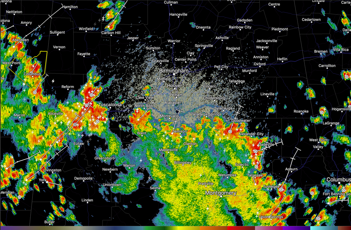
Strong thunderstorms are lined up this afternoon from Pickens and Tuscaloosa Counties in the west across Bibb, Chilton, and Coosa Counties, on through Tallapoosa, Macon, and Bullock Counties.
The entire band is lifting north-northeastward.
Storms are entering the Tuscaloosa area right now with dangerous lightning, torrential rain, and winds gusts to 40 mph. There may be some small hail out by Elrod in western Tuscaloosa County.
Storms approaching the Birmingham area from Bibb County to the southwest have weakened. An outflow boundary is moving north from those cells.
The storms in East Alabama between Rockford and Goodwater are strong as well, along with the one approaching Dadeville. The storm approaching Dadeville might have some small hail in it.
The storms are capable of producing damaging wind gusts this afternoon as well that could bring down a few trees, so give them the respect they deserve as they approach your location, even if there is no warning.
There is a severe thunderstorm warning for the Columbus MS area.
Category: Alabama's Weather, ALL POSTS
About the Author (Author Profile)
Bill Murray is the President of The Weather Factory. He is the site's official weather historian and a weekend forecaster. He also anchors the site's severe weather coverage. Bill Murray is the proud holder of National Weather Association Digital Seal #0001 @wxhistorianSubscribe
If you enjoyed this article, subscribe to receive more just like it.


