

Unsettled Weather Continues Through Mid-Week
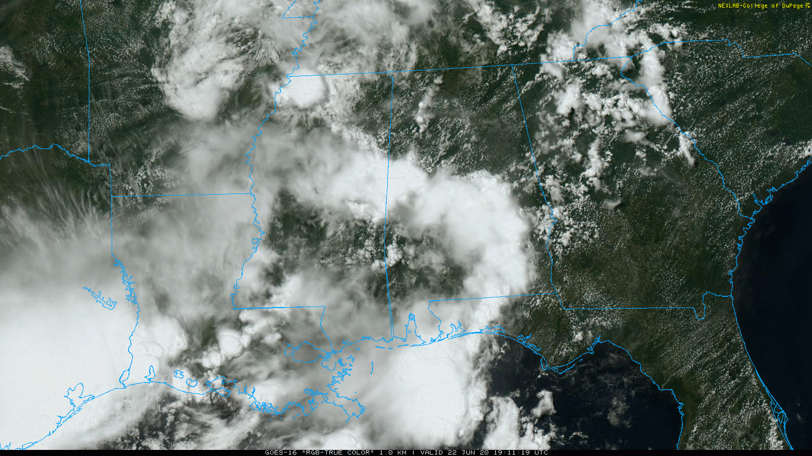
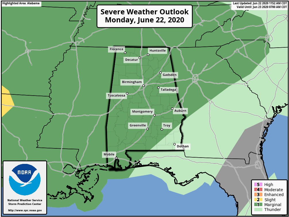
RADAR CHECK: Showers and thunderstorms are fairly widespread across Alabama at mid-afternoon; so far the storms have generally remained below severe limits, but the heavier storms are producing gusty winds and lots of lightning. SPC maintains a “marginal risk” (level 1/5) of severe storms across much of Alabama through early tonight.
Showers will slowly fade away tonight.
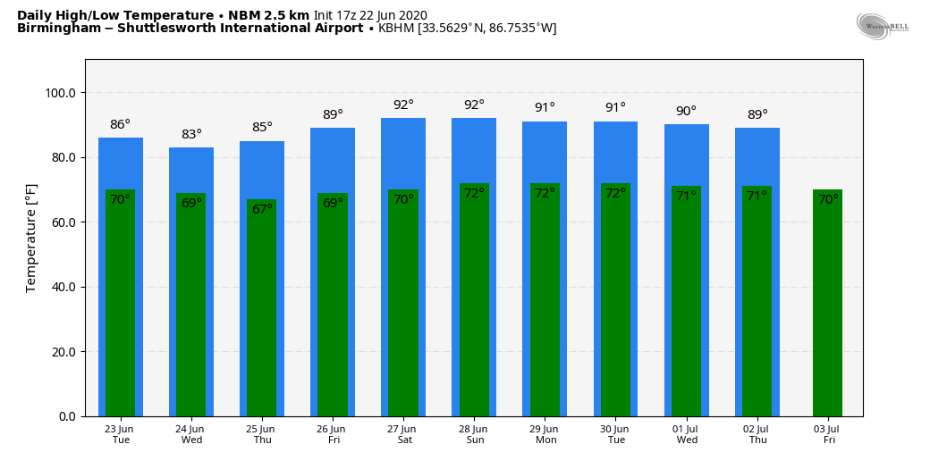
REST OF THE WEEK: An upper trough, in combination with a deep layer of tropical moisture, will keep our weather unsettled through Thursday. Look for scattered to numerous showers and thunderstorms, mostly from 1:00 until 9:00 p.m. Like today, a few strong storms will be possible with gusty winds and small hail. The sky will be occasionally cloudy with highs mostly in the low to mid 80s. Showers are still possible Friday, but they should be a little fewer in number, and the high will be in the upper 80s.
THE ALABAMA WEEKEND: Look for a partly sunny sky Saturday and Sunday with the typical chance of random, scattered, mostly afternoon and evening showers and thunderstorms. Highs over the weekend will be close to 90 degrees.
NEXT WEEK: We will stay with the classic summer forecast for much of the week. Highs 87-91; a few pop-up, splash and dash showers and thunderstorms around each day. See the Weather Xtreme video for maps, graphics, and more details.
TROPICS:Shower and thunderstorm activity associated with a well-defined low pressure system located about 350 miles southeast of Cape Cod, Massachusetts, has continued to get better organized today, and a subtropical depression appears to be forming. If these trends continue, advisories will be initiated on this system at 500 PM AST this afternoon. This system is expected to move eastward and northeastward away from the United States during the next couple of days.
AFRICAN DUST: The SAL (Saharan Air Layer), with origins over the deserts of Africa, is pushing through the Caribbean this morning, and should reach parts of the southern U.S. later this week. This dry, dusty air is transported in high levels of the atmosphere, generally between 5,000 and 20,000 feet, and the main effect is creating very vivid sky scenes at sunrise and sunset due to the scattering of sunlight. The dry air also mitigates any tropical storm formation. There can be a reduction in air quality, but most of the dust is several thousand feet off the ground and is not an issue for most people. And, this is NOT unusual in summer.
ON THIS DATE IN 2007: The first officially documented F5 tornado in Canada struck the town of Elie, Manitoba population 500 people. Video of the storm showed a heavy van being whirled through the air. The storm also tossed an almost entire house several hundred yards through the air before it disintegrated. The tornado traveled across the landscape for about 35 minutes covering 3.4 miles and leaving a damage path 984 feet wide. Wind speeds in the tornado were later estimated at 260-316 mph. Fortunately, no fatalities or serious injuries were reported.
BEACH FORECAST: Click here to see the AlabamaWx Beach Forecast Center page.
WEATHER BRAINS: Don’t forget you can listen to our weekly 90 minute show anytime on your favorite podcast app. This is the show all about weather featuring many familiar voices, including our meteorologists here at ABC 33/40.
CONNECT: You can find me on all of the major social networks…
Facebook
Twitter
Instagram
Pinterest
Snapchat: spannwx
Look for the next Weather Xtreme video here by 7:00 a.m. tomorrow…
Category: Alabama's Weather, ALL POSTS, Weather Xtreme Videos
About the Author (Author Profile)
James Spann is one of the most recognized and trusted television meteorologists in the industry. He holds the AMS CCM designation and television seals from the AMS and NWA. He is a past winner of the Broadcast Meteorologist of the Year from both professional organizations.Subscribe
If you enjoyed this article, subscribe to receive more just like it.


