

Midday Nowcast: More Rain and Storms
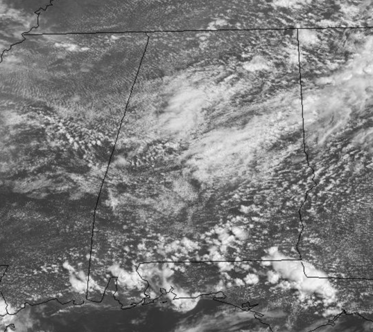
Morning rain and storms have pushed out of the area, but more are on the way today as a rather unstable air mass remains in place across Alabama. As we approach the midday hours, we are seeing a mix of sun and clouds, with temps well into the 80s.
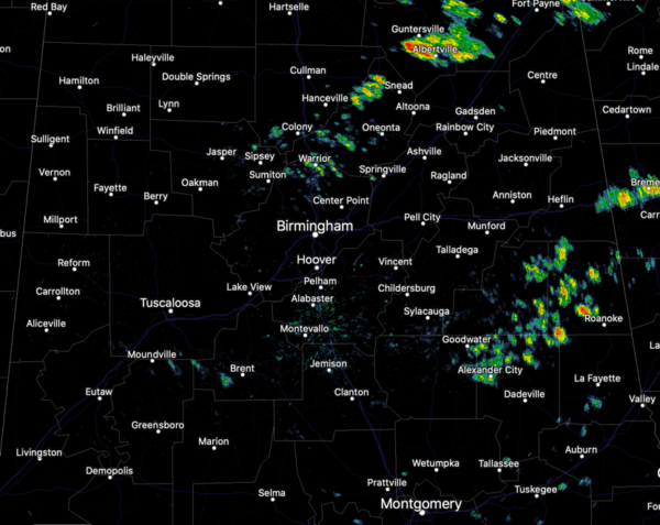
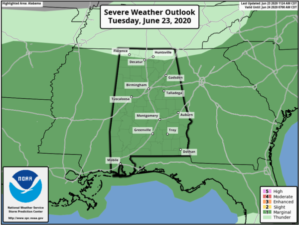
We are starting to see and we are going to see scattered to numerous showers and thunderstorms develop this afternoon, and again some stronger storms are likely as the SPC maintains a “marginal risk” (level 1/5) of severe thunderstorms the rest of today.
Some storms this afternoon could produce small hail and strong, gusty winds, and briefly reach severe limits, like we have seen the past couple of days, and of course intense rainfall and tremendous amounts of lightning will be possible as well.
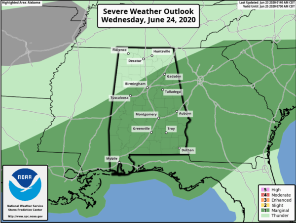
TOMORROW/THURSDAY: Little change in the forecast these two days as scattered to numerous showers and thunderstorms will occur across the Alabama. Also, each day some storms will pack a punch and we are likely going to see the level 1/5 “marginal risk” across Alabama each day as well, including this risk area for Wednesday.
Rain will be possible at anytime with such a moisture-rich air mass in place, but we will see the greatest coverage of rain and storms during the afternoon and evening hours. When it is not raining, we should see a mix of sun and clouds, very muggy conditions, and highs in the 80s. Of course, rainfall distribution will be very uneven this week, with rainfall amounts possibly ranging from one-half inch to perhaps over three inches at any give location.
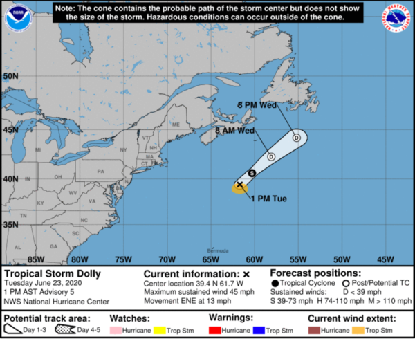
WE NOW HAVE DOLLY: At 100 PM AST, the center of Tropical Storm Dolly was located near latitude 39.4 North, longitude 61.7 West. Dolly is moving toward the east-northeast near 13 mph. A turn toward the northeast with an increase in forward speed is expected tonight and on Wednesday.
Satellite-derived wind data indicate that maximum sustained winds have increased to near 45 mph with higher gusts.Weakening is forecast during the next day or two as Dolly moves over colder waters, and the system is expected to become post-tropical on Wednesday. The low should then dissipate by early Thursday.Tropical-storm-force winds extend outward up to 70 miles to the south of the center. The estimated minimum central pressure is 1002 mb (29.59 inches).
Elsewhere the basin is clear, except for all the Saharan dust. The Saharan Air Layer (SAL) continues to move through the Caribbean, and the dry, dusty air should reach the southern U.S. by Thursday or Friday. Remember, this is not unusual, and helps to mitigate tropical storm formation. It also brings potential for vivid sunrise and sunset scenes due to the scattering of sunlight. There can be some reduction in air quality, but it won’t impact most people.
BEACH FORECAST CENTER: Get the latest weather and rip current forecasts for the beaches from Fort Morgan to Panama City on our Beach Forecast Center page. There, you can select the forecast of the region that you are interested in visiting.
WORLD TEMPERATURE EXTREMES: Over the last 24 hours, the highest observation outside the U.S. was 120.2F at Zabol, Iran. The lowest observation was -91.3F at University Dome, Antarctica.
CONTIGUOUS TEMPERATURE EXTREMES: Over the last 24 hours, the highest observation was 119F Death Valley, CA. The lowest observation was 29F at Albany, WY.
WEATHER ON THIS DATE IN 1957: A few miles west of Fort Stockton TX, softball size hail injured 21 persons unable to find shelter, mostly farm laborers. Some livestock were killed.
Category: Alabama's Weather, ALL POSTS
About the Author (Author Profile)
Macon, Georgia Television Chief Meteorologist, Birmingham native, and long time Contributor on AlabamaWX. Stormchaser. I did not choose Weather, it chose Me. College Football Fanatic. @Ryan_StinnetSubscribe
If you enjoyed this article, subscribe to receive more just like it.


