

Strong Storms Dropping Southeast Over Northwest Alabama
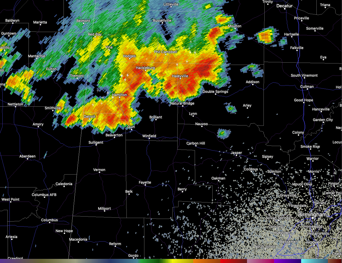
A cluster of strong storms is located over southern Franklin, southern Lawrence, Marion, northwest Winston, and northern Lamar Counties at this hour.
The heaviest rainfall is west of Hackleburg at this time, with very heavy rain from west of Moulton to Haleyville to Hackleburg and Hodges to Hamilton and Detroit.
Winds could gust to 40 mph in the strongest storms along with heavy rain and lightning. Small hail does not appear likely but is possible.
The storms will be in Guin shortly, and Winfield by 2:25. They will reach Brilliant by 2:35 and Carbon Hill by 3.
If the storms hold together, they could reach the Birmingham Metro just after 4 p.m.
The airmass ahead of the storms does have moderately high instability but wind shear is low so the storms will have a hard time staying organized. Still, storms could briefly become severe this afternoon.
Category: Alabama's Weather, ALL POSTS, Severe Weather
About the Author (Author Profile)
Bill Murray is the President of The Weather Factory. He is the site's official weather historian and a weekend forecaster. He also anchors the site's severe weather coverage. Bill Murray is the proud holder of National Weather Association Digital Seal #0001 @wxhistorianSubscribe
If you enjoyed this article, subscribe to receive more just like it.


