

7:35 p.m. Radar Update and What to Expect Overnight
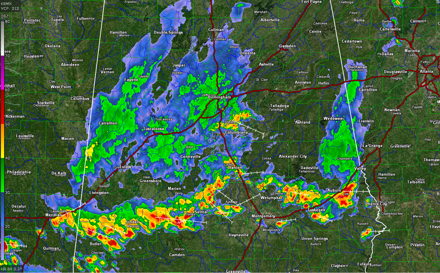
A line of storms is arrayed across Centtrall Alabama tonight from Auburn on to Tuskegee then to the east of Wetuumpka to Clanton to the north of Selma to LLinden and to near Meridian MS.
Other storms are moving southeastward through Shelby County.
Light to moderate rain covers much of West-central Alabama.
The activity is expected to diminish this evening, but more showers and storms are expected to develop over Mississippi later tonight and move over Northwest and North Central Alabama after midnight. The storms will not be strong, but will have some lightning and heavy rain.
More storms will develop on Wednesday and some of them could be strong to briefly severe with damaging wind gusts possible.
Category: Alabama's Weather, ALL POSTS
About the Author (Author Profile)
Bill Murray is the President of The Weather Factory. He is the site's official weather historian and a weekend forecaster. He also anchors the site's severe weather coverage. Bill Murray is the proud holder of National Weather Association Digital Seal #0001 @wxhistorianSubscribe
If you enjoyed this article, subscribe to receive more just like it.


