

Watch Possible for South/South Central Alabama
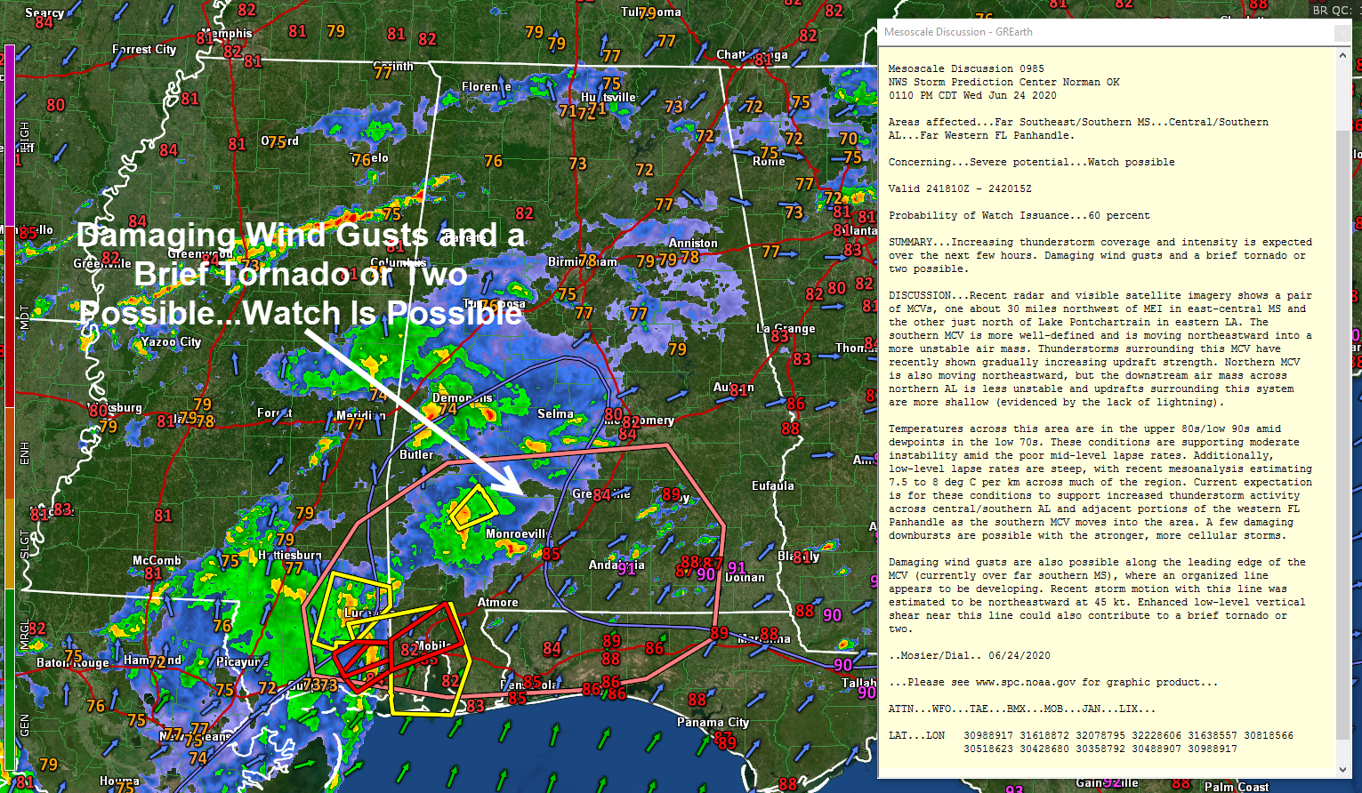
Two mesoscale convective vortices (MCVs) are moving through southern Mississippi and southeastern Louisiana this afternoon and causing thunderstorms.
The northern one is passing north of Meridian MS and will be pushing up I-59 towards Birmingham. Showers and storms are accompanying it but they are not severe at this time and only have limited lighting. The good news is that the airmass across North Central Alabama is less unstable than it is to the south, so not much severe weather is expected, although a couple of the storms couple become briefly severe with a few damaging wind gusts to 60 mph and some hail.
To the south, the MCV moving out of the New Orleans area will encounter much more unstable air ass it moves northeastward into South and South Central Alabama. Add in decent winds aloft at 700 MB or about 10,000 feet and we are getting some decent wind shear to support the storms. The MCV imparts its own low-level spin which can result in some spin-up tornadoes. Parts of the Mobbie area are under a tornado warning right now.
There is a severe thunderstorm warning for parts of Clarke County as well. Winds gusts could reach 60 mph across areas of South and South Central Alabama this afternoon and evening.
To the north, a front boundary is lying across the northern part of Alabama and storms have fired up along it from Marion County back into North Central Mississippi. A few damaging winds gusts and some quarter-sized hail could fall here as well, although these storms will weaken before sunset.
Category: Alabama's Weather, ALL POSTS, Severe Weather
About the Author (Author Profile)
Bill Murray is the President of The Weather Factory. He is the site's official weather historian and a weekend forecaster. He also anchors the site's severe weather coverage. Bill Murray is the proud holder of National Weather Association Digital Seal #0001 @wxhistorianSubscribe
If you enjoyed this article, subscribe to receive more just like it.


