

Sun And Scattered Storms Over The Weekend
RADAR CHECK: Light to moderate rain is falling over parts of North and West Alabama this afternoon…the eastern and southern counties of the state are mostly dry. Temperatures remain below average with many places only in the 70s at mid-afternoon; the average high for Birmingham on June 26 is 90. Showers will taper off later tonight after sunset.
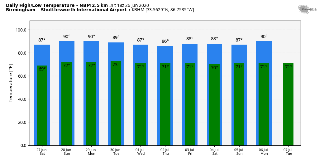
THE ALABAMA WEEKEND: We are forecasting a mix of sun and clouds tomorrow and Sunday with highs back in the 85 to 90 degree range. We will have the typical risk of random, scattered, mostly afternoon and evening showers and thunderstorms both days, generally between 1:00 and 9:00 p.m. Odds of any one spot getting wet are in the 30/40 percent range. No way of knowing in advance exactly when and where they form… you just have to watch radar trends. Rain distribution will be very uneven.
Where storms develop tomorrow afternoon, they could be fairly strong, and SPC maintains a “marginal risk” (level 1/5) of severe thunderstorms for much of the state.
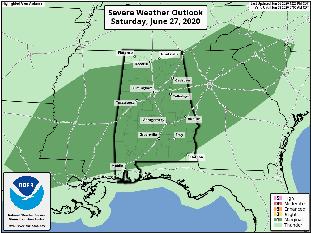
Heavier thunderstorms tomorrow will be capable of producing strong winds and small hail.
NEXT WEEK: The overall pattern won’t change much; pretty routine weather for late June and early July. Partly sunny days with “scattered, mostly afternoon and evening showers and thunderstorms” on a daily basis. Highs between 88 and 92 most afternoons. See the Weather Xtreme video for maps, graphics, and more details.
TROPICS: Tropical storm formation is not expected across the Atlantic basin through next week due to very dry air over the region.
SAL: The Saharan Air Layer is over Alabama and the Deep South for a few days, as forecast. This happens most summers, and is not unusual. Be on the alert for very vivid sunrises and sunsets over the weekend. We do note the Jefferson County Department of Health has issued a “code orange” air quality alert for the Birmingham metro tomorrow, meaning air quality is expected to be “unhealthy for sensitive groups”.
Members of “sensitive groups” may experience health effects due to the SAL over Alabama…. people with heat and lung ailments, etc. The general public is less likely to be affected.
ON THIS DATE IN 1957: Hurricane Audrey was in the western Gulf of Mexico; a category three storm. Landfall would come the following day, June 27, between the mouth of the Sabine River and Cameron, Louisiana,. It would go on to cause unprecedented destruction across the region. Prior to making landfall, Audrey severely disrupted offshore drilling operations in the Gulf of Mexico. Damages from offshore oil facilities alone was estimated at $16 million. Damage from the surge alone extended 25 miles inland. The rough seas killed nine people offshore after capsizing the boat they were in. Further inland in Louisiana, the storm spawned two tornadoes, causing additional damage. Audrey also dropped heavy rainfall, peaking at 10.63? near Basile. In Louisiana and Texas, where Audrey first impacted, the damage toll was $128 million. The total death toll was 416.
BEACH FORECAST: Click here to see the AlabamaWx Beach Forecast Center page.
WEATHER BRAINS: Don’t forget you can listen to our weekly 90 minute show anytime on your favorite podcast app. This is the show all about weather featuring many familiar voices, including our meteorologists here at ABC 33/40.
CONNECT: You can find me on all of the major social networks…
Facebook
Twitter
Instagram
Pinterest
Snapchat: spannwx
Look for my next Weather Xtreme video here by 7:00 a.m. Monday… enjoy the weekend!
Category: Alabama's Weather, ALL POSTS, Weather Xtreme Videos
About the Author (Author Profile)
James Spann is one of the most recognized and trusted television meteorologists in the industry. He holds the AMS CCM designation and television seals from the AMS and NWA. He is a past winner of the Broadcast Meteorologist of the Year from both professional organizations.Subscribe
If you enjoyed this article, subscribe to receive more just like it.


