

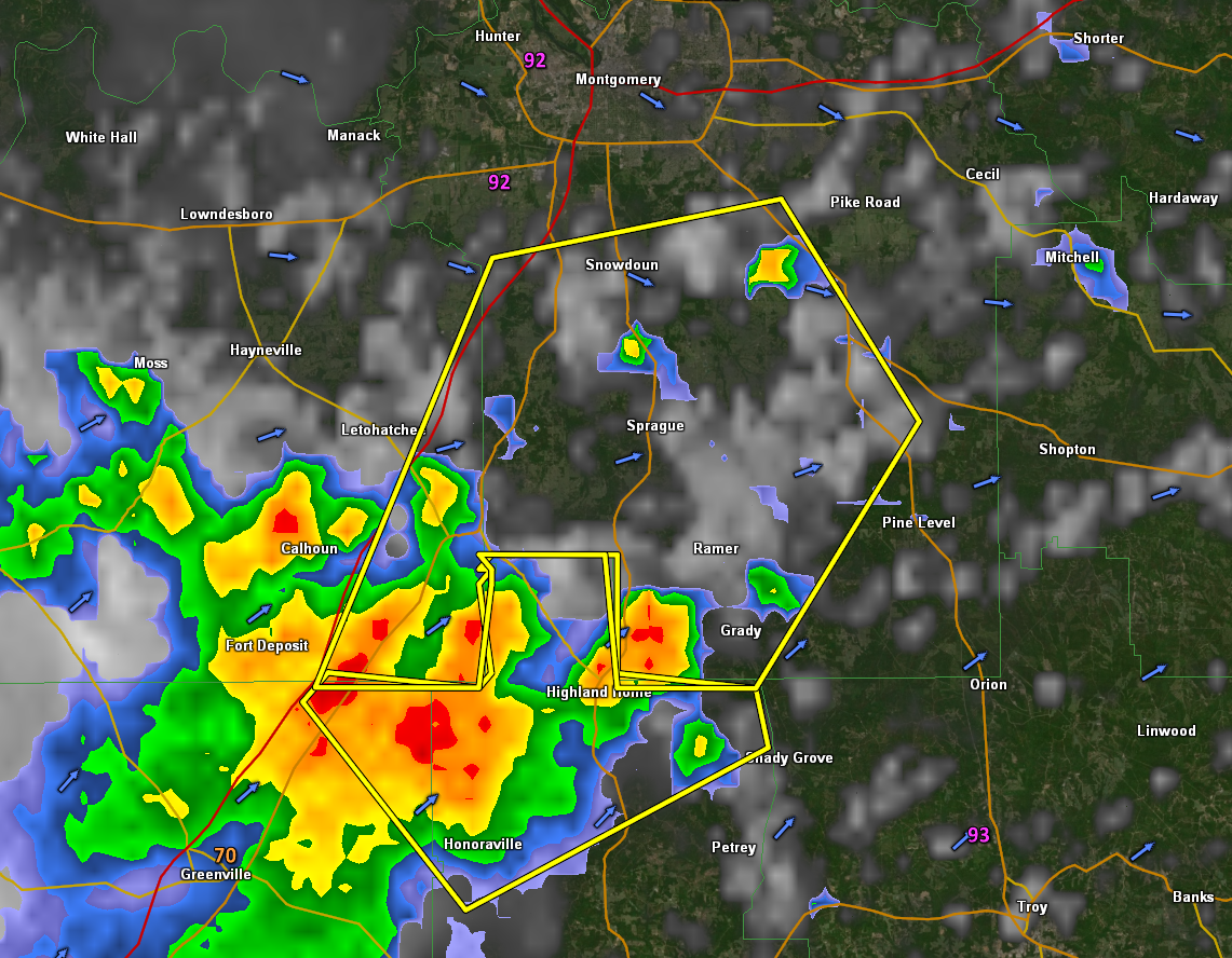
Severe Thunderstorm Warning for Parts of Lowndes/Montgomery Counties Until 530 p.m.
The National Weather Service in Birmingham has issued a
* Severe Thunderstorm Warning for…
Southeastern Lowndes County in south central Alabama…
Southwestern Montgomery County in south central Alabama…
* Until 530 PM CDT.
* At 440 PM CDT, a severe thunderstorm was located over Sellers, or 8
miles west of Meadville, moving northeast at 35 mph.
HAZARD…60 mph wind gusts and penny size hail.
SOURCE…Radar indicated.
IMPACT…Expect damage to roofs, siding, and trees.
* Locations impacted include…
Fort Deposit, Meadville, Pike Road, Strata, Dublin, Naftel,
Snowdoun, Logan, Sprague, Grady, Sellers, Davenport, Ramer, Lapine,
Pintlala and Carters Hill.
Category: Alabama's Weather, ALL POSTS, Severe Weather
About the Author (Author Profile)
Bill Murray is the President of The Weather Factory. He is the site's official weather historian and a weekend forecaster. He also anchors the site's severe weather coverage. Bill Murray is the proud holder of National Weather Association Digital Seal #0001 @wxhistorianSubscribe
If you enjoyed this article, subscribe to receive more just like it.


